- Dunvegan, Alberta
-
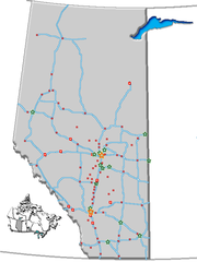
Location of Dunvegan in Alberta Dunvegan is an unincorporated community within the Municipal District of Fairview No. 136 in northern Alberta, Canada. It is located 26 kilometres (16 mi) south of the town of Fairview on the northern bank of the Peace River at the mouth of the Dunvegan Creek.
Highway 2 crosses the Peace River at Dunvegan on Alberta's only vehicle suspension bridge.[1] Dunvegan was named by Archibald Norman Macleod in 1805 after Dunvegan Castle in Scotland.[2] The Dunvegan Formation was in turn named for this community.
History
The area was inhabited by the Beaver (Dunneza) First Nation, and the first European explorers arrived in the 18th century.[2]
One of Alberta's earliest fur trade posts was Fort Dunvegan, built in 1878 by the Hudson's Bay Company. The St. Charles Church was built by oblate missionaries in the same period, and is preserved along with the 1879 built factory house.[3] In 1985, the Knights of Columbus erected a statue of the Virgin Mary (Our Lady of Peace) on a nearby location overlooking the Peace River valley.
The fort is designated as a historic site by Parks Canada.[4] Dunvegan Provincial Park was established on the same location in 1992.[1]
References
- ^ a b Alberta Tourism, Parks, Recreation and Culture. "Dunvegan Provincial Park". http://gateway.cd.gov.ab.ca/siteinformation.aspx?id=40. Retrieved 2008-02-10.
- ^ a b Discover the Peace Country. "Dunvegan Provincial Park". http://www.discoverthepeacecountry.com/htmlpages/dunvegan.html. Retrieved 2008-02-10.
- ^ Alberta Tourism, Parks, Recreation and Culture. "Historic Dunvegan". http://www.tprc.alberta.ca/museums/historicsiteslisting/dunvegan/default.aspx. Retrieved 2008-02-10.
- ^ Parks Canada (June 2007). "Historic Dunvegan". http://www.pc.gc.ca/docs/r/ab/sites/dunvegan_e.asp. Retrieved 2008-02-10.

Hines Creek Fairview 
Moonshine Lake Provincial Park 
 Dunvegan

Spirit River Rycroft Wanham  Subdivisions of Alberta
Subdivisions Regions · Census divisions · Municipal districts (counties) · Specialized municipalities · School districts · Regional health authoritiesCommunities Cities · Towns · Villages · Summer villages · Hamlets · Indian reserves · Métis settlements · Ghost towns · Designated placesCities and Urban
Service AreasAirdrie · Brooks · Calgary · Camrose · Cold Lake · Edmonton (capital) · Fort McMurray · Fort Saskatchewan · Grande Prairie · Lacombe · Leduc · Lethbridge · Lloydminster · Medicine Hat · Red Deer · Sherwood Park · Spruce Grove · St. Albert · Wetaskiwin Category ·
  Portal ·
  WikiProject
Coordinates: 55°55′16″N 118°36′09″W / 55.92111°N 118.6025°W
Categories:- Fairview No. 136, Alberta
- Hudson's Bay Company trading posts
- Northern Alberta geography stubs
Wikimedia Foundation. 2010.

