- Rowena, Oregon
Infobox Settlement
official_name = Rowena, Oregon
settlement_type = CDP
nickname =
motto =
imagesize =
image_caption =
image_
imagesize =
image_caption =
image_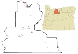
mapsize = 250px
map_caption = Location of Rowena, Oregon
mapsize1 =
map_caption1 =subdivision_type = Country
subdivision_name =United States
subdivision_type1 = State
subdivision_name1 =Oregon
subdivision_type2 = County
subdivision_name2 = Wascogovernment_footnotes =
government_type =
leader_title =
leader_name =
leader_title1 =
leader_name1 =
established_title =
established_date =unit_pref = Imperial
area_footnotes =area_magnitude =
area_total_km2 = 4.8
area_land_km2 = 4.8
area_water_km2 = 0.0
area_total_sq_mi = 1.9
area_land_sq_mi = 1.9
area_water_sq_mi = 0.0population_as_of = 2000
population_footnotes =
population_total = 148
population_density_km2 = 30.8
population_density_sq_mi = 79.7timezone = Pacific (PST)
utc_offset = -8
timezone_DST = PDT
utc_offset_DST = -7
elevation_footnotes =
elevation_m = 41
elevation_ft = 135
latd = 45 |latm = 40 |lats = 6 |latNS = N
longd = 121 |longm = 16 |longs = 34 |longEW = Wpostal_code_type =
ZIP code
postal_code = 97058
area_code = 541
blank_name = FIPS code
blank_info = 41-63950GR|2
blank1_name = GNIS feature ID
blank1_info = 1136714GR|3
website =
footnotes =Rowena is an unincorporated community in Wasco County,
Oregon ,United States . For statistical purposes, theUnited States Census Bureau has defined Rowena as acensus-designated place (CDP). The census definition of the area may not precisely correspond to local understanding of the area with the same name. The population was 148 at the 2000 census.Rowena is located west of
The Dalles on theColumbia River , where the river passes through the natural feature Rowena Gap. Interstate 84 (Columbia River Highway) and U.S. Route 30 (Historic Columbia River Highway ) pass through the community. Route 30 near Rowena is notable for theRowena Loops . [ [http://photos.salemhistory.org/cdm4/item_viewer.php?CISOROOT=/orarc&CISOPTR=196&REC=2 Historic photo of the Rowena loops on U.S. 30 from Salem Public Library] ]According to "
Oregon Geographic Names ", the exact origin of the name "Rowena" is disputed. Two sources say Rowena was named for H.S. Rowe, arailroad company official, in the early 1880s. Another source says it was named for a girl, Rowena, who had been living in the area at the time the community was founded. It is also possible that the name comes indirectly from Rowena, "Ivanhoe "'s lady, in thenovel by Sir Walter Scott.There was once a
ferry operating between Rowena andLyle, Washington across the Columbia. [ [http://community.gorge.net/lyle/song_of_the_rivers.htm The Song of the Rivers ] ]The Nature Conservancy has a nature preserve on theplateau near Rowena, TheTom McCall Preserve, that is known for its spring wildflowers. The preserve is owned and managed in cooperation withMayer State Park .Geography
Rowena is located at coor dms|45|40|6|N|121|16|34|W|city (45.668198, -121.276201)GR|1.
According to the
United States Census Bureau , the CDP has a total area of 1.9square mile s (4.8km² ), all of it land.Demographics
As of the
census GR|2 of 2000, there were 148 people, 63 households, and 40 families residing in the CDP. Thepopulation density was 79.7 people per square mile (30.7/km²). There were 89 housing units at an average density of 47.9/sq mi (18.5/km²). The racial makeup of the CDP was 98.65% White, 0.68% Asian and 0.68% Pacific Islander.There were 63 households out of which 31.7% had children under the age of 18 living with them, 49.2% were married couples living together, 9.5% had a female householder with no husband present, and 36.5% were non-families. 31.7% of all households were made up of individuals and 11.1% had someone living alone who was 65 years of age or older. The average household size was 2.33 and the average family size was 2.93.
In the CDP the population was spread out with 30.4% under the age of 18, 5.4% from 18 to 24, 34.5% from 25 to 44, 18.9% from 45 to 64, and 10.8% who were 65 years of age or older. The median age was 35 years. For every 100 females there were 85.0 males. For every 100 females age 18 and over, there were 98.1 males.
The median income for a household in the CDP was $41,080, and the median income for a family was $42,417. Males had a median income of $40,938 versus $26,111 for females. The
per capita income for the CDP was $15,457. There were 16.3% of families and 13.6% of the population living below thepoverty line , including 10.0% of under eighteens and none of those over 64.References
External links
* [http://www.nature.org/wherewework/northamerica/states/oregon/preserves/art6809.html Tom McCall Preserve at Rowena]
* [http://www.oregonstateparks.org/park_161.php Mayer State Park]
Wikimedia Foundation. 2010.