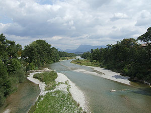
- Crest, Drôme
-
Crest

Administration Country France Region Rhône-Alpes Department Drôme Arrondissement Die Canton Crest-Nord and Crest-Sud Intercommunality Val de Drôme Mayor Hervé Mariton
(2008–2014)Statistics Elevation 166–463 m (545–1,519 ft) Land area1 23.38 km2 (9.03 sq mi) Population2 7,793 (2008) - Density 333 /km2 (860 /sq mi) INSEE/Postal code 26108/ 26400 1 French Land Register data, which excludes lakes, ponds, glaciers > 1 km² (0.386 sq mi or 247 acres) and river estuaries. 2 Population without double counting: residents of multiple communes (e.g., students and military personnel) only counted once. Coordinates: 44°43′45″N 5°01′22″E / 44.7291666667°N 5.02277777778°E
Crest is a commune in the Drôme department in southeastern France.
Contents
Population
Historical population of Crest, Drôme 1793 1800 1806 1821 1831 1836 1841 1846 1851 1856 4500 4500 4370 4335 4901 4983 4948 5079 5423 5110 1861 1866 1872 1876 1881 1886 1891 1896 1901 1906 5460 5351 5568 5600 5535 5669 5569 5582 5579 5660 1911 1921 1926 1931 1936 1946 1954 1962 1968 1975 5536 5005 5250 5379 5513 5359 5773 6207 7140 7519 1982 1990 1999 2008 7518 7583 7739 7793 Its inhabitants are called Crestois.
Sights
- The Tour de Crest, one of the highest medieval keeps in France - 52 m. Its height dominates the town. The tower was part of a castle which guarded one of the entrances to the Pre-Alps in Drôme. The site offers a large panoramic view.
- Saint-Sauveur Church
- Monument to the resistance to the coup d'etat of 2 December 1851 in Provence.
See also
- Communes of the Drôme department
- Parc naturel régional du Vercors
References
Categories:- Communes of Drôme
- Drôme geography stubs
Wikimedia Foundation. 2010.


