- Ravenna, Ohio
Infobox Settlement
official_name = Ravenna, Ohio
settlement_type =City
nickname =
motto =
imagesize =
image_caption =
image_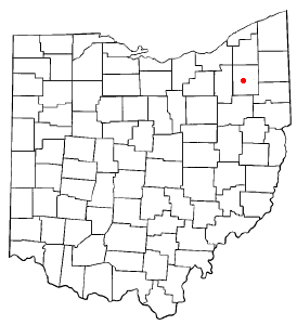
mapsize = 250px
map_caption = Location of Ravenna, Ohio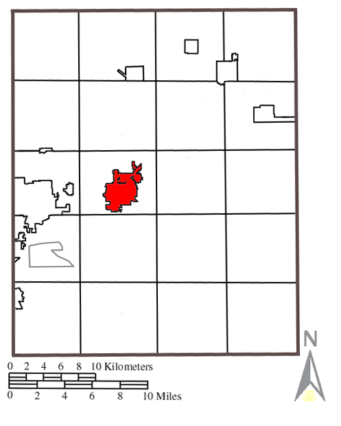
mapsize1 = 250px
map_caption1 = Location within Portage County.subdivision_type = Country
subdivision_name =United States
subdivision_type1 = State
subdivision_name1 =Ohio
subdivision_type2 = County
subdivision_name2 = Portagegovernment_footnotes =
government_type =
leader_title =
leader_name =
leader_title1 =
leader_name1 =
established_title =
established_date =unit_pref = Imperial
area_footnotes =area_magnitude =
area_total_km2 = 13.9
area_land_km2 = 13.9
area_water_km2 = 0.0
area_total_sq_mi = 5.4
area_land_sq_mi = 5.4
area_water_sq_mi = 0.0population_as_of = 2006 est.
population_footnotes =
population_total = 11,422
population_density_km2 = 849.1
population_density_sq_mi = 2199.2timezone = Eastern (EST)
utc_offset = -5
timezone_DST = EDT
utc_offset_DST = -4
elevation_footnotes = GR|3
elevation_m = 345
elevation_ft = 1132
latd = 41 |latm = 9 |lats = 31 |latNS = N
longd = 81 |longm = 14 |longs = 36 |longEW = Wpostal_code_type =
ZIP code
postal_code = 44266
area_code = 330, 234
blank_name = FIPS code
blank_info = 39-65592GR|2
blank1_name = GNIS feature ID
blank1_info = 1061586GR|3
website =
footnotes =Ravenna is a city in Portage County,
Ohio ,United States . It was formed from portions of Ravenna Township in theConnecticut Western Reserve . The population was 11,771 at the 2000 census and 11,422 at the 2006 estimate. [cite web |url= http://factfinder.census.gov/servlet/SAFFPopulation?_event=Search&_name=ravenna&_state=04000US39&_county=ravenna&_cityTown=ravenna&_zip=&_sse=on&_lang=en&pctxt=fph|title= Population Finder|accessdate=2008-04-29 |format= |work= www.census.gov] It is thecounty seat of Portage CountyGR|6. It is named for the city ofRavenna ,Italy .Ravenna is part of the Akron Metropolitan Statistical Area.
Geography
Ravenna is located at coor dms|41|9|31|N|81|14|36|W|city (41.158656, -81.243274)GR|1.
According to the
United States Census Bureau , the city has a total area of 5.4square mile s (13.9km² ), of which, 5.3 square miles (13.9 km²) of it is land and 0.19% is water.The following highways pass through Ravenna:
*OHShield|59|30 State Route 59
*OHShield|44|30 State Route 44
*OHShield|14|30 State Route 14
*OHShield|88|30 State Route 88Ravenna is located south of exit 38.
OHShield|5|30 State Route 5 passes Ravenna on the southeast but does not enter its city limits. Prior to 1969, SR 5 did pass through the city. That section is now known as SR 59.
Demographics
As of the
census GR|2 of 2000, there were 11,771 people, 4,980 households, and 2,997 families residing in the city. Thepopulation density was 2,199.2 people per square mile (849.5/km²). There were 5,313 housing units at an average density of 992.6/sq mi (383.4/km²). The racial makeup of the city was 93.03% White, 4.42% Black, 0.25% American Indian, 0.39% Asian, 0.02% Pacific Islander, 0.23% from other races, and 1.67% from two or more races. Hispanic or Latino of any race were 0.91% of the population.There were 4,980 households out of which 28.3% had children under the age of 18 living with them, 43.0% were married couples living together, 12.8% had a female householder with no husband present, and 39.8% were non-families. 33.5% of all households were made up of individuals and 13.5% had someone living alone who was 65 years of age or older. The average household size was 2.31 and the average family size was 2.95.
In the city the population was spread out with 23.7% under the age of 18, 9.2% from 18 to 24, 30.0% from 25 to 44, 20.8% from 45 to 64, and 16.2% who were 65 years of age or older. The median age was 36 years. For every 100 females there were 89.9 males. For every 100 females age 18 and over, there were 86.9 males.
The median income for a household in the city was $35,650, and the median income for a family was $46,090. Males had a median income of $33,574 versus $25,320 for females. The
per capita income for the city was $17,862. About 6.0% of families and 10.3% of the population were below thepoverty line , including 9.9% of those under age 18 and 11.1% of those age 65 or over.Education
Elementary and secondary education for students in Ravenna and Ravenna Township is provided by the
Ravenna School District , which includes: Ravenna High School, Brown Middle School, Carlin Elementary, Willyard Elementary, Tappan Elementary, West Park Elementary, and West Main Elementary. Just north of the city limits in Ravenna Township is the Maplewood Career Center, a vocational school which serves high school-aged students from nine of Portage County's eleven high schools, including Ravenna, and offers adult education programs as well.Higher education
Bohecker College, a small two-year professional school, is located in north Ravenna, near SR 14. Ravenna is located just east of the main campus of
Kent State University in neighboring Kent and just north of theNortheastern Ohio Universities Colleges of Medicine and Pharmacy in Rootstown. In addition, the city is in close proximity to bothHiram College in Hiram, theUniversity of Akron in Akron.Famous residents
*
Chris Bangle (automobile designer, b. 1958)
*David D. Busch (photographer, author, b. 1947)
*William Rufus Day , (U.S. Supreme Court justice, b. 1849, d. 1923)
*Timothy Hack (Pro BMX/Skate Boarder MTV's "Cribs" co-host, b. 1972)
*Calvin Hampton (Classical Organist, b. 1939 d. 1984)
*Al Hodge (actor, (Captain Video ), (The Green Hornet ) and director (The Lone Ranger ) b.1912, d. 1979)
*Maynard James Keenan (rock singer for Tool, A Perfect Circle, Puscifer, b. 1964)
*Don Nottingham (pro football player, b. 1949)
*Erastus B. Tyler , Union general in the American Civil War
*Brent Webb (world touring Mentalist/entertainer, b. 1975)
*Jeffrey Harold West (pro football kicker, b. 1953)Government
As of January 3, 2006 the mayor of Ravenna is Kevin Poland. Poland replaced long-time mayor Paul Jones who retired and moved to Florida to be with his family due to scandalous practices during his tenure as mayor. Ravenna Police Chief Randy McCoy initiated formal investigations by the county prosecutor after learning that the FBI had begun conducting a formal investigation of the former Mayor. The major focus of the city's investigation involved the Mayor's son, Paul Jones Jr., who was paid more than $274,900 over eight years for a questionable mowing contract. [Cite news
last = Armon
first = Rick
title = Former Ravenna mayor charged: Paul Jones now faces state case on evidence from federal probe that will send him to prison
format = Reprint
publisher =Akron Beacon Journal
date =2007-03-30 ] [Cite news
last = Piltz
first = Marci
title = Former Ravenna Mayor Paul Jones started federal sentence on May 9
url=http://www.recordpub.com/news/article/2008602
publisher =Record-Courier
access-date = 2007-05-24] [Cite news
title = Paul Jones sentenced to 16 months in prison
url=http://www.topix.net/content/kri/4286988636269590498719103570513772222461
access-date = 2007-05-24]In March, 2007, Jones was sentenced to sixteen months in a federal prison for various fraud charges. [cite web|url=http://www.ethics.ohio.gov/PressReleases/03232007.html|title=Former Mayor Paul Jones of Ravenna Sentenced to 16 Months in Jail for Mail and Tax Fraud Convictions|date=2007-03-23|accessdate=2008-07-22|publisher=
United States Department of Justice ]External links
* [http://www.ci.ravenna.oh.us/ Ravenna's official website]
* [http://www.reed.lib.oh.us/halloffame/index.html Raven Hall of Fame]
* [http://www.ravennafootball.org Official site of the Ravenna High School Football Program]
* [http://www.ravennayouthfootball.org Official site of the Ravenna Youth Football League]Notes
Wikimedia Foundation. 2010.