- Grover Hill, Ohio
Infobox Settlement
official_name = Grover Hill, Ohio
settlement_type = Village
nickname =
motto =
imagesize =
image_caption =
image_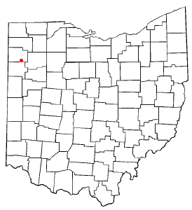
mapsize = 250x200px
map_caption = Location of Grover Hill, Ohio
mapsize1 =
map_caption1 =subdivision_type = Country
subdivision_name =United States
subdivision_type1 = State
subdivision_name1 =Ohio
subdivision_type2 = County
subdivision_name2 = Pauldinggovernment_footnotes =
government_type =
leader_title =
leader_name =
leader_title1 =
leader_name1 =
established_title =
established_date =unit_pref = Imperial
area_footnotes =area_magnitude =
area_total_km2 = 0.8
area_land_km2 = 0.8
area_water_km2 = 0.0
area_total_sq_mi = 0.3
area_land_sq_mi = 0.3
area_water_sq_mi = 0.0population_as_of = 2000
population_footnotes =
population_total = 412
population_density_km2 = 548.4
population_density_sq_mi = 1420.4timezone = Eastern (EST)
utc_offset = -5
timezone_DST = EDT
utc_offset_DST = -4
elevation_footnotes = GR|3
elevation_m = 220
elevation_ft = 722
latd = 41 |latm = 1 |lats = 7 |latNS = N
longd = 84 |longm = 28 |longs = 37 |longEW = Wpostal_code_type =
ZIP code
postal_code = 45849
area_code = 419
blank_name = FIPS code
blank_info = 39-32620GR|2
blank1_name = GNIS feature ID
blank1_info = 1064773GR|3
website =
footnotes =Grover Hill is a village in Paulding County,
Ohio ,United States . The population was 412 at the 2000 census. The village is named after PresidentGrover Cleveland .Geography
Grover Hill is located at coor dms|41|1|7|N|84|28|37|W|city (41.018721, -84.477041)GR|1.
According to the
United States Census Bureau , the village has a total area of 0.3square mile s (0.8km² ), all of it land.Demographics
As of the
census GR|2 of 2000, there were 412 people, 167 households, and 115 families residing in the village. Thepopulation density was 1,420.4 people per square mile (548.5/km²). There were 183 housing units at an average density of 630.9/sq mi (243.6/km²). The racial makeup of the village was 96.12% White, 0.49% African American, 0.24% Native American, 0.73% from other races, and 2.43% from two or more races. Hispanic or Latino of any race were 2.43% of the population.There were 167 households out of which 31.7% had children under the age of 18 living with them, 55.7% were married couples living together, 11.4% had a female householder with no husband present, and 31.1% were non-families. 28.7% of all households were made up of individuals and 12.6% had someone living alone who was 65 years of age or older. The average household size was 2.47 and the average family size was 2.97.
In the village the population was spread out with 26.0% under the age of 18, 7.8% from 18 to 24, 29.1% from 25 to 44, 21.8% from 45 to 64, and 15.3% who were 65 years of age or older. The median age was 37 years. For every 100 females there were 93.4 males. For every 100 females age 18 and over, there were 95.5 males.
The median income for a household in the village was $33,750, and the median income for a family was $41,667. Males had a median income of $31,563 versus $22,222 for females. The
per capita income for the village was $14,872. About 11.5% of families and 17.7% of the population were below thepoverty line , including 31.0% of those under age 18 and 8.8% of those age 65 or over.History
Grover Hill was a boom town, created as a stop on the railroad. 'The Depot' restaurant gives homage to the towns beginnings.
References
External links
Wikimedia Foundation. 2010.