Malbaie River

Malbaie River

There are two Malbaie Rivers in the province of Quebec in Canada.

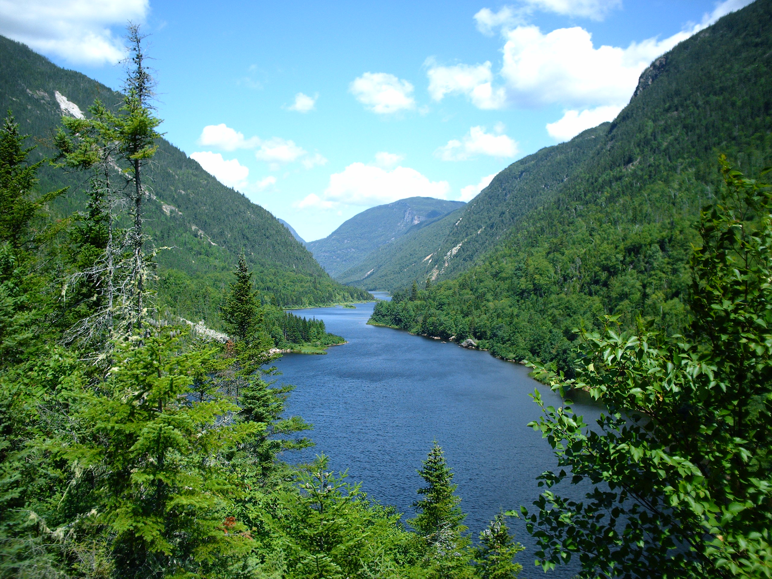
The Malbaie River in the Charlevoix region empties into the Saint Lawrence River at La Malbaie. Up until 1985, the river was used to transport logs downstream. The river flows through a steep valley known as Les Hautes Gorges. A forest of sugar maples and American elms which has remained largely undisturbed for hundreds of years is found in the gorge.

Le parc national des Hautes-Gorges-de-la-Rivière-Malbaie is home to Eastern Canada's tallest rock-faced cliffs. Designated a national park (of the province of Québec) in 2000, the 233-km² Hautes-Gorges is the centerpiece of the UNESCO Charlevoix biosphere reserve.

The Malbaie River in the Gaspé Peninsula empties into the Baie de la Malbaie on the Gulf of Saint Lawrence. A barachois has formed at the mouth of the river. The salt marshes found there are home to the Yellow Rail and Nelson's Sharp-tailed Sparrow. The river also provides spawning habitat for Atlantic Salmon. The Nature Conservancy of Canada has initiated a project to protect this area.


Wikimedia Foundation. 2010.

Игры ⚽ Поможем написать реферат

Look at other dictionaries:

  • La Malbaie —   Municipality   …   Wikipedia

  • La Malbaie, Quebec — La Malbaie is a municipality in the Charlevoix Est Regional County Municipality in the province of Quebec, Canada, situated on the north shore of the Saint Lawrence River, at the mouth of the Malbaie River.The name La Malbaie, from the French for …   Wikipedia

  • Rivière Malbaie — dans le parc national des Hautes Gorges de la Rivière Malbaie Caractéristiques Longueur 161 km  …   Wikipédia en Français

  • Hautes-Gorges-de-la-Rivière-Malbaie National Park — Infobox protected area|name=Parc national des Hautes Gorges de la Rivière Malbaie back color=#CDE5B2 iucn category=II label= locator x= locator y= location=Lac Pikauba (Québec), Canada nearest city=La Malbaie lat degrees=47 lat minutes=56 lat… …   Wikipedia

  • Charlevoix Railway — Charlevoix Railway, Chemin de fer Charlevoix Reporting mark CFC Locale Charlevoix Capitale Nationale regions of Quebec Dates of operation 10 August 1889 (1889 08 10)–present …   Wikipedia

  • Clermont, Capitale-Nationale, Quebec — Clermont   City   …   Wikipedia

  • Quebec — This article is about the Canadian province. For the province s capital city, see Quebec City. For other uses, see Quebec (disambiguation). Coordinates …   Wikipedia

  • List of rivers of Quebec — Here is a list of rivers in Quebec. =Hudson Bay watershed= Rivers flowing into James Bay and Hudson Bay, listed from south to north: *Harricana River **Turgeon River *Missisicabi River *Nottaway River **Waswanipi River **Bell River **Kitchigama… …   Wikipedia

  • Charlevoix — For other uses, see Charlevoix (disambiguation). The Charlevoix region, located in Quebec, includes parts of the north shore of the Saint Lawrence River and the Laurentian Mountains region of the Canadian Shield. This dramatic landscape includes… …   Wikipedia

  • Quebec Route 362 — Infobox road province=QC type=QC route=362 maint= established= decommissioned= length km=50 length round= length ref= direction a=West direction b=East terminus a= terminus b= previous type=QC previous route=361 next type=QC next route=363 cities …   Wikipedia

Share the article and excerpts

Direct link
Do a right-click on the link above
and select “Copy Link”