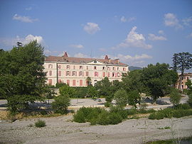
- Malijai
-
Malijai

Administration Country France Region Provence-Alpes-Côte d'Azur Department Alpes-de-Haute-Provence Arrondissement Digne-les-Bains Canton Les Mées Intercommunality Moyenne Durance Mayor Eliane Barreille
(2008–2014)Statistics Elevation 422–1,080 m (1,385–3,540 ft)
(avg. 428 m/1,404 ft)Land area1 26.56 km2 (10.25 sq mi) Population2 1,958 (2008) - Density 74 /km2 (190 /sq mi) INSEE/Postal code 04108/ 04350 1 French Land Register data, which excludes lakes, ponds, glaciers > 1 km² (0.386 sq mi or 247 acres) and river estuaries. 2 Population without double counting: residents of multiple communes (e.g., students and military personnel) only counted once. Coordinates: 44°02′48″N 6°01′52″E / 44.0466666667°N 6.03111111111°E
Malijai is a commune in the Alpes-de-Haute-Provence department in southeastern France.
Contents
Geography
The village lies on the right bank of the Bléone, which forms part of the commune's western border, then flows west through the northern part of the commune.
Population
Historical population of Malijai 1765 1793 1806 1821 1831 1836 1841 1846 1851 1856 460 464 470 466 529 506 514 554 578 565 1861 1866 1872 1876 1881 1886 1891 1896 1901 1906 537 551 503 605 512 488 497 472 467 511 1911 1921 1926 1931 1936 1946 1954 1962 1968 1975 447 421 457 535 558 592 576 841 988 1419 1982 1990 1999 2008 1578 1703 1628 1958 See also
References
Categories:- Communes of Alpes-de-Haute-Provence
- Alpes-de-Haute-Provence geography stubs
Wikimedia Foundation. 2010.


