- Majastres
-
Majastres


 Majastres
Administration Country France Region Provence-Alpes-Côte d'Azur Department Alpes-de-Haute-Provence Arrondissement Digne-les-Bains Canton Mézel Intercommunality Asse Mayor Gustave Pierrisnard
(2008–2014)Statistics Elevation 800–1,860 m (2,600–6,100 ft)
(avg. 1,143 m/3,750 ft)Land area1 29.85 km2 (11.53 sq mi) Population2 2 (2008) - Density 0 /km2 (0 /sq mi) INSEE/Postal code 04107/ 04270 1 French Land Register data, which excludes lakes, ponds, glaciers > 1 km² (0.386 sq mi or 247 acres) and river estuaries. 2 Population without double counting: residents of multiple communes (e.g., students and military personnel) only counted once. Coordinates: 43°54′51″N 6°17′23″E / 43.9141666667°N 6.28972222222°E
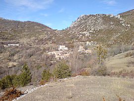
Majastres is a commune in the Alpes-de-Haute-Provence department in southeastern France.
Population
Historical population of Majastres 1765 1793 1800 1806 1821 1831 1836 1841 1846 1851 276 224 202 216 248 270 270 263 259 225 1856 1861 1866 1872 1876 1881 1886 1891 1896 1901 245 226 213 202 165 166 174 156 143 137 1906 1911 1921 1926 1931 1936 1946 1954 1962 1968 117 95 57 54 41 44 43 35 27 20 1975 1982 1990 1999 2008 14 12 10 8 2 See also
References
Categories:- Communes of Alpes-de-Haute-Provence
- Alpes-de-Haute-Provence geography stubs


Wikimedia Foundation. 2010.