- Byesville, Ohio
Infobox Settlement
official_name = Byesville, Ohio
settlement_type = Village
nickname =
motto =
imagesize =
image_caption =
image_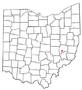
mapsize = 250x200px
map_caption = Location of Byesville, Ohio
mapsize1 =
map_caption1 =subdivision_type = Country
subdivision_name =United States
subdivision_type1 = State
subdivision_name1 =Ohio
subdivision_type2 = County
subdivision_name2 = Guernseygovernment_footnotes =
government_type =
leader_title =
leader_name =
leader_title1 =
leader_name1 =
established_title =
established_date =unit_pref = Imperial
area_footnotes =
area_magnitude =
area_total_km2 = 2.5
area_land_km2 = 2.5
area_water_km2 = 0.0
area_total_sq_mi = 1.0
area_land_sq_mi = 1.0
area_water_sq_mi = 0.0population_as_of = 2000
population_footnotes =
population_total = 2574
population_density_km2 = 1020.3
population_density_sq_mi = 2642.6timezone = Eastern (EST)
utc_offset = -5
timezone_DST = EDT
utc_offset_DST = -4
elevation_footnotes = GR|3
elevation_m = 249
elevation_ft = 817
latd = 39 |latm = 58 |lats = 8 |latNS = N
longd = 81 |longm = 32 |longs = 28 |longEW = Wpostal_code_type =
ZIP code
postal_code = 43723
area_code = 740
blank_name = FIPS code
blank_info = 39-10716GR|2
blank1_name = GNIS feature ID
blank1_info = 1056747GR|3
website =
footnotes =Byesville is a village in Guernsey County,
Ohio ,United States , along Wills Creek. The population was 2,574 as of the 2000 census.Geography
Byesville is located at coor dms|39|58|8|N|81|32|28|W|city (39.968985, -81.541087)GR|1.
According to the
United States Census Bureau , the village has a total area of 1.0square mile s (2.5km² ), all of it land.Economy
Plastech operated a manufacturing plant in Byesville, until late June 2008. Municipal officials are trying to find ways to market the site to find a new corporate tenant.
Demographics
As of the
census GR|2 of 2000, there were 2,574 people, 1,064 households, and 706 families residing in the village. Thepopulation density was 2,642.6 people per square mile (1,024.6/km²). There were 1,139 housing units at an average density of 1,169.4/sq mi (453.4/km²). The racial makeup of the village was 98.06% White, 0.19% African American, 0.43% Native American, 0.23% Asian, 0.04% Pacific Islander, and 1.05% from two or more races. Hispanic or Latino of any race were 0.66% of the population.There were 1,064 households out of which 33.0% had children under the age of 18 living with them, 46.3% were married couples living together, 15.7% had a female householder with no husband present, and 33.6% were non-families. 29.6% of all households were made up of individuals and 12.9% had someone living alone who was 65 years of age or older. The average household size was 2.42 and the average family size was 3.01.
In the village the population was spread out with 27.4% under the age of 18, 9.1% from 18 to 24, 26.8% from 25 to 44, 22.6% from 45 to 64, and 14.1% who were 65 years of age or older. The median age was 36 years. For every 100 females there were 85.7 males. For every 100 females age 18 and over, there were 84.0 males.
The median income for a household in the village was $28,136, and the median income for a family was $35,690. Males had a median income of $29,673 versus $18,346 for females. The
per capita income for the village was $13,270. About 10.9% of families and 15.2% of the population were below thepoverty line , including 14.7% of those under age 18 and 18.5% of those age 65 or over.References
External links
Wikimedia Foundation. 2010.