- Pytalovo
-
Coordinates: 57°04′N 27°54′E / 57.067°N 27.9°E
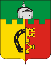
 Coat of arms of Pytalovo
Pytalovo (Russian: Пыта́лово; Latvian: Pitalova, Abrene) is a town and the administrative center of Pytalovsky District of Pskov Oblast, Russia. Population: 5,826 (2010 Census preliminary results);[1] 6,806 (2002 Census);[2] 7,166 (1989 Census).[3]
Pytalovo was part of independent Latvia as Abrene until Latvia was occupied and annexed by the Soviet Union. Latvia disputed Russian jurisdiction over the region until signing a border treaty with Russia in 2007.[4]
Contents
History
The village of Pytalovo by 1878 had a population of 57 and was a part of Ostrovsky Uyezd of Pskov Governorate. It grew into a town after becoming a railway station by a newly constructed railroad branch.
By the Latvian-Soviet Riga Peace Treaty of 1920, part of Ostrovsky Uyezd, including Pytalovo, was passed to Latvia and the town was known since then by its Latvian name Jaunlatgale (until 1938 when its official name was changed to Abrene). During the interwar period it was the administrative center of the Abrene district.
After World War II, the Soviet Union annexed Abrene together with the eastern part of the Abrene District from Latvian SSR to Pskov Oblast of the Russian SFSR. Most of the Latvian inhabitants left the town and the town was renamed back to Pytalovo.[citation needed] This change of jurisdiction has been a matter of Latvian-Russian disagreement since the dissolution of the Soviet Union. Pytalovo is the largest town in this disputed region.
In 2007 border treaty between Latvia and Russia was signed and ratified. Pytalovo was recognized as Russian territory.[citation needed]
Places of interest
Among places of interest in town Pytalovo there is a modernist style railroad station building built in the early 20th century, the wooden building of the functioning St. Nicholas Church built in 1931, the post office building (early 20th century), and the house of merchant Ilyin (built in the 1920s) located at 9 Pushkinskaya Street.
References
- ^ Федеральная служба государственной статистики (Federal State Statistics Service) (2011). "Предварительные итоги Всероссийской переписи населения 2010 года (Preliminary results of the 2010 All-Russian Population Census)" (in Russian). Всероссийская перепись населения 2010 года (All-Russia Population Census of 2010). Federal State Statistics Service. http://www.perepis-2010.ru/results_of_the_census/results-inform.php. Retrieved 2011-04-25.
- ^ Федеральная служба государственной статистики (Federal State Statistics Service) (2004-05-21). "Численность населения России, субъектов Российской Федерации в составе федеральных округов, районов, городских поселений, сельских населённых пунктов – районных центров и сельских населённых пунктов с населением 3 тысячи и более человек (Population of Russia, its federal districts, federal subjects, districts, urban localities, rural localities—administrative centers, and rural localities with population of over 3,000)" (in Russian). Всероссийская перепись населения 2002 года (All-Russia Population Census of 2002). Federal State Statistics Service. http://www.perepis2002.ru/ct/doc/1_TOM_01_04.xls. Retrieved 2010-03-23.
- ^ "Всесоюзная перепись населения 1989 г. Численность наличного населения союзных и автономных республик, автономных областей и округов, краёв, областей, районов, городских поселений и сёл-райцентров. (All Union Population Census of 1989. Present population of union and autonomous republics, autonomous oblasts and okrugs, krais, oblasts, districts, urban settlements, and villages serving as district administrative centers.)" (in Russian). Всесоюзная перепись населения 1989 года (All-Union Population Census of 1989). Demoscope Weekly (website of the Institute of Demographics of the State University—Higher School of Economics. 1989. http://demoscope.ru/weekly/ssp/rus89_reg.php. Retrieved 2010-03-23.
- ^ [1]
External links
- (Russian) Official website of Pytalovo
- Web site of Pskov region with pictures of and info on Pytalovo and surrounding area
- (Russian) Izvestya article about reaction of local inhabitants in 2005

Cities and towns in Pskov Oblast 
Administrative center: Pskov
Dno | Gdov | Nevel | Novorzhev | Novosokolniki | Opochka | Ostrov | Pechory | Porkhov | Pustoshka | Pytalovo | Sebezh | Velikiye Luki
Categories:- Cities and towns in Pskov Oblast
- Latvia–Russia relations
- History of Latvia
Wikimedia Foundation. 2010.