- Salineville, Ohio
Infobox Settlement
official_name = Salineville, Ohio
settlement_type = Village
nickname =
motto =
imagesize =
image_caption =
image_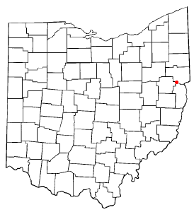
mapsize = 250x200px
map_caption = Location of Salineville, Ohio
mapsize1 =
map_caption1 =subdivision_type = Country
subdivision_name =United States
subdivision_type1 = State
subdivision_name1 =Ohio
subdivision_type2 = County
subdivision_name2 = Columbianagovernment_footnotes =
government_type =
leader_title =
leader_name =
leader_title1 =
leader_name1 =
established_title =
established_date =unit_pref = Imperial
area_footnotes =area_magnitude =
area_total_km2 = 5.8
area_land_km2 = 5.8
area_water_km2 = 0.0
area_total_sq_mi = 2.2
area_land_sq_mi = 2.2
area_water_sq_mi = 0.0population_as_of = 2000
population_footnotes =
population_total = 1397
population_density_km2 = 242.7
population_density_sq_mi = 628.6timezone = Eastern (EST)
utc_offset = -5
timezone_DST = EDT
utc_offset_DST = -4
elevation_footnotes = GR|3
elevation_m = 274
elevation_ft = 899
latd = 40 |latm = 37 |lats = 24 |latNS = N
longd = 80 |longm = 50 |longs = 3 |longEW = Wpostal_code_type =
ZIP code
postal_code = 43945
area_code = 330, 234
blank_name = FIPS code
blank_info = 39-70100GR|2
blank1_name = GNIS feature ID
blank1_info = 1065281GR|3
website =
footnotes =Salineville is a village in southwestern Columbiana County,
Ohio ,United States . The population was 1,397 at the 2000 census.The Civil War
Battle of Salineville , which endedMorgan's Raid and resulted in the capture of Confederate GeneralJohn Hunt Morgan , took place near Salineville in July 26, 1863.Geography
Salineville is located at coor dms|40|37|24|N|80|50|3|W|city (40.623461, -80.834182)GR|1.
According to the
United States Census Bureau , the village has a total area of 2.2square mile s (5.7km² ), all of it land.Demographics
As of the
census GR|2 of 2000, there were 1,397 people, 535 households, and 365 families residing in the village. Thepopulation density was 628.6 people per square mile (243.0/km²). There were 594 housing units at an average density of 267.3/sq mi (103.3/km²). The racial makeup of the village was 99.07% White, 0.36% Native American, 0.07% from other races, and 0.50% from two or more races. Hispanic or Latino of any race were 0.57% of the population.There were 535 households out of which 33.3% had children under the age of 18 living with them, 47.9% were married couples living together, 14.6% had a female householder with no husband present, and 31.6% were non-families. 26.7% of all households were made up of individuals and 13.8% had someone living alone who was 65 years of age or older. The average household size was 2.60 and the average family size was 3.14.
In the village the population was spread out with 29.2% under the age of 18, 9.3% from 18 to 24, 27.6% from 25 to 44, 22.2% from 45 to 64, and 11.7% who were 65 years of age or older. The median age was 33 years. For every 100 females there were 97.9 males. For every 100 females age 18 and over, there were 90.9 males.
The median income for a household in the village was $27,473, and the median income for a family was $30,167. Males had a median income of $28,864 versus $19,539 for females. The
per capita income for the village was $13,895. About 11.6% of families and 15.7% of the population were below thepoverty line , including 22.4% of those under age 18 and 16.5% of those age 65 or over.Notable natives
*Ben Feldman, record setting
insurance sales man.References
External links
Wikimedia Foundation. 2010.