- Powhatan Point, Ohio
Infobox Settlement
official_name = Powhatan Point, Ohio
settlement_type = Village
nickname =
motto =
imagesize =
image_caption =
image_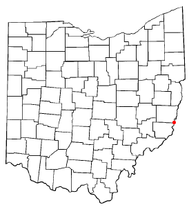
mapsize = 250px
map_caption = Location of Powhatan Point, Ohio
mapsize1 =
map_caption1 =subdivision_type = Country
subdivision_name =United States
subdivision_type1 = State
subdivision_name1 =Ohio
subdivision_type2 = County
subdivision_name2 = Belmontgovernment_footnotes =
government_type =
leader_title =
leader_name =
leader_title1 =
leader_name1 =
established_title =
established_date =unit_pref = Imperial
area_footnotes =area_magnitude =
area_total_km2 = 4.4
area_land_km2 = 4.0
area_water_km2 = 0.4
area_total_sq_mi = 1.7
area_land_sq_mi = 1.6
area_water_sq_mi = 0.1population_as_of = 2000
population_footnotes =
population_total = 1744
population_density_km2 = 432.3
population_density_sq_mi = 1119.7timezone = Eastern (EST)
utc_offset = -5
timezone_DST = EDT
utc_offset_DST = -4
elevation_footnotes = GR|3
elevation_m = 208
elevation_ft = 682
latd = 39 |latm = 51 |lats = 42 |latNS = N
longd = 80 |longm = 48 |longs = 21 |longEW = Wpostal_code_type =
ZIP code
postal_code = 43942
area_code = 740
blank_name = FIPS code
blank_info = 39-64542GR|2
blank1_name = GNIS feature ID
blank1_info = 1061570GR|3
website =
footnotes =Powhatan Point is one of several small villages in Belmont County,
Ohio ,United States , along theOhio River .While "Powhatan," likely memorializes Native-American Indian tribe of the same name, the "Point," in the town's name, refers to the confluence between the
Captina Creek and theOhio River . Powhatan Point is the closest town on the Ohio side ofCaptina Island in the Ohio River.Although the village's economy was once largely supported by the coal industry, most residents currently seek employment outside village limits in nearby towns and cities such as Moundsville and
Wheeling, West Virginia .Powhatan Point currently has a K-8 elementary school. After elementary graduation, the majority of students attend River High School (located in
Hannibal, Ohio ), an institution consolidated with other small Ohio-River villages.The population was 1,744 at the 2000 census. It is part of the
Wheeling, West Virginia Metropolitan Statistical Area.Geography
Powhatan Point is located at coor dms|39|51|42|N|80|48|21|W|city (39.861785, -80.805702)GR|1.
According to the
United States Census Bureau , the village has a total area of 1.7square mile s (4.4km² ), of which, 1.6 square miles (4.0 km²) of it is land and 0.2 square miles (0.4 km²) of it (8.77%) is water.Demographics
As of the
census GR|2 of 2000, there were 1,744 people, 760 households, and 515 families residing in the village. Thepopulation density was 1,119.7 people per square mile (431.6/km²). There were 830 housing units at an average density of 532.9/sq mi (205.4/km²). The racial makeup of the village was 98.11% White, 0.57% African American, 0.06% Native American, and 1.26% from two or more races. Hispanic or Latino of any race were 0.23% of the population.There were 760 households out of which 27.5% had children under the age of 18 living with them, 52.9% were married couples living together, 11.1% had a female householder with no husband present, and 32.2% were non-families. 28.2% of all households were made up of individuals and 14.9% had someone living alone who was 65 years of age or older. The average household size was 2.29 and the average family size was 2.78.
In the village the population was spread out with 21.3% under the age of 18, 8.5% from 18 to 24, 27.1% from 25 to 44, 25.6% from 45 to 64, and 17.5% who were 65 years of age or older. The median age was 41 years. For every 100 females there were 90.0 males. For every 100 females age 18 and over, there were 83.8 males.
The median income for a household in the village was $24,875, and the median income for a family was $32,546. Males had a median income of $32,039 versus $16,583 for females. The
per capita income for the village was $14,570. About 16.7% of families and 19.8% of the population were below thepoverty line , including 27.2% of those under age 18 and 16.2% of those age 65 or over.ee also
*
List of cities and towns along the Ohio River References
External links
* [http://www.mfpl.org/powhatan.asp Martins Ferry Public Library - Powhatan Point Branch]
Wikimedia Foundation. 2010.