- Perrysville, Ohio
Infobox Settlement
official_name = Perrysville, Ohio
settlement_type = Village
nickname =
motto =
imagesize =
image_caption =
image_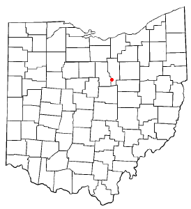
mapsize = 250x200px
map_caption = Location of Perrysville, Ohio
mapsize1 =
map_caption1 =subdivision_type = Country
subdivision_name =United States
subdivision_type1 = State
subdivision_name1 =Ohio
subdivision_type2 = County
subdivision_name2 = Ashlandgovernment_footnotes =
government_type =
leader_title =
leader_name =
leader_title1 =
leader_name1 =
established_title =
established_date =unit_pref = Imperial
area_footnotes =area_magnitude =
area_total_km2 = 2.0
area_land_km2 = 2.0
area_water_km2 = 0.0
area_total_sq_mi = 0.8
area_land_sq_mi = 0.8
area_water_sq_mi = 0.0population_as_of = 2000
population_footnotes =
population_total = 816
population_density_km2 = 406.2
population_density_sq_mi = 1052.1timezone = Eastern (EST)
utc_offset = -5
timezone_DST = EDT
utc_offset_DST = -4
elevation_footnotes = GR|3
elevation_m = 303
elevation_ft = 994
latd = 40 |latm = 39 |lats = 26 |latNS = N
longd = 82 |longm = 18 |longs = 41 |longEW = Wpostal_code_type =
ZIP code
postal_code = 44864
area_code = 419
blank_name = FIPS code
blank_info = 39-62190GR|2
blank1_name = GNIS feature ID
blank1_info = 1068213GR|3
website =
footnotes =Perrysville is a village in Ashland County,
Ohio ,United States . The population was 816 at the 2000 census.Geography
Perrysville is located at coor dms|40|39|26|N|82|18|41|W|city (40.657280, -82.311518)GR|1, along the Black Fork of the Mohican River. [
DeLorme (1991). "Ohio Atlas & Gazetteer". Yarmouth, Maine: DeLorme. ISBN 0-89933-233-1.] .According to the
United States Census Bureau , the village has a total area of 0.8square mile s (2.0km² ).0.8 square miles (2.0 km²) of it is land and none of the area is covered withwater .The Mohican River passes the southwestern edge of the village.
Demographics
As of the
census GR|2 of 2000, there were 816 people, 329 households, and 231 families residing in the village. Thepopulation density was 1,052.1 people per square mile (403.9/km²). There were 356 housing units at an average density of 459.0/sq mi (176.2/km²). The racial makeup of the village was 98.53% White, 0.49% African American, 0.12% Pacific Islander, 0.25% from other races, and 0.61% from two or more races. Hispanic or Latino of any race were 0.37% of the population.There were 329 households out of which 37.4% had children under the age of 18 living with them, 50.2% were married couples living together, 11.6% had a female householder with no husband present, and 29.5% were non-families. 26.4% of all households were made up of individuals and 13.4% had someone living alone who was 65 years of age or older. The average household size was 2.48 and the average family size was 2.97.
In the village the population was spread out with 29.4% under the age of 18, 9.8% from 18 to 24, 27.8% from 25 to 44, 19.7% from 45 to 64, and 13.2% who were 65 years of age or older. The median age was 33 years. For every 100 females there were 91.5 males. For every 100 females age 18 and over, there were 91.4 males.
The median income for a household in the village was $29,408, and the median income for a family was $35,781. Males had a median income of $27,031 versus $20,208 for females. The
per capita income for the village was $12,603. About 14.9% of families and 18.3% of the population were below thepoverty line , including 26.4% of those under age 18 and 8.1% of those age 65 or over.References
External links
* [http://www.villageofperrysville.net Village of Perrysville Community Website]
Wikimedia Foundation. 2010.