- Fort Shawnee, Ohio
Infobox Settlement
official_name = Fort Shawnee, Ohio
settlement_type = Village
nickname =
motto =
imagesize =
image_caption =
image_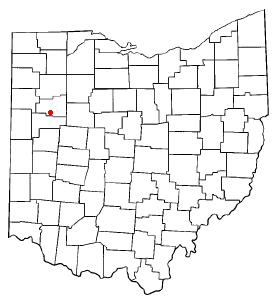
mapsize = 250x200px
map_caption = Location of Fort Shawnee, Ohio
mapsize1 =
map_caption1 =subdivision_type = Country
subdivision_name =United States
subdivision_type1 = State
subdivision_name1 =Ohio
subdivision_type2 = County
subdivision_name2 = Allengovernment_footnotes =
government_type =
leader_title =Mayor
leader_name = Dennis E. Shaffer
leader_title1 =
leader_name1 =
established_title =
established_date =unit_pref = Imperial
area_footnotes =
area_magnitude =
area_total_km2 = 18.7
area_land_km2 = 18.7
area_water_km2 = 0.0
area_total_sq_mi = 7.2
area_land_sq_mi = 7.2
area_water_sq_mi = 0.0population_as_of = 2000
population_footnotes =
population_total = 3855
population_density_km2 = 206.6
population_density_sq_mi = 535.0timezone = Eastern (EST)
utc_offset = -5
timezone_DST = EDT
utc_offset_DST = -4
elevation_footnotes = GR|3
elevation_m = 264
elevation_ft = 866
latd = 40 |latm = 40 |lats = 54 |latNS = N
longd = 84 |longm = 8 |longs = 21 |longEW = Wpostal_code_type =
postal_code =
area_code =
blank_name = FIPS code
blank_info = 39-27944GR|2
blank1_name = GNIS feature ID
blank1_info = 1040592GR|3
website = http://www.fortshawneeallencounty.com/
footnotes =Fort Shawnee is a village in Allen County,
Ohio ,United States with a population of 3,855 as of the 2000 U.S. census. It is included in theLima, Ohio Metropolitan Statistical Area . Fort Shawnee is adjacent to the city of Lima and the village of Cridersville in Auglaize CountyGeography
Fort Shawnee is located at coor dms|40|40|54|N|84|8|21|W|city (40.681750, -84.139297)GR|1.
According to the
United States Census Bureau , the village has a total area of 7.2 square miles (18.7 km²), all of it land.Demographics
As of the
census GR|2 of 2000, there were 3,855 people, 1,524 households, and 1,141 families residing in the village. Thepopulation density was 535.0 people per square mile (206.4/km²). There were 1,608 housing units at an average density of 223.2/sq mi (86.1/km²). The racial makeup of the village was 94.37% White, 3.06% African American, 0.08% Native American, 0.62% Asian, 0.03% Pacific Islander, 0.99% from other races, and 0.86% from two or more races. Hispanic or Latino of any race were 1.40% of the population.There were 1,524 households out of which 32.6% had children under the age of 18 living with them, 62.3% were married couples living together, 9.4% had a female householder with no husband present, and 25.1% were non-families. 21.3% of all households were made up of individuals and 7.7% had someone living alone who was 65 years of age or older. The average household size was 2.53 and the average family size was 2.92.
In the village the population was spread out with 24.9% under the age of 18, 7.7% from 18 to 24, 27.0% from 25 to 44, 26.8% from 45 to 64, and 13.6% who were 65 years of age or older. The median age was 39 years. For every 100 females there were 96.4 males. For every 100 females age 18 and over, there were 94.4 males.
The median income for a household in the village was $46,723, and the median income for a family was $52,072. Males had a median income of $41,908 versus $25,438 for females. The
per capita income for the village was $19,916. About 2.4% of families and 2.7% of the population were below thepoverty line , including 0.6% of those under age 18 and 4.7% of those age 65 or over.Government
The village is a charter municipality operating under a strong mayor system. The executive and ceremonial head of the Village is the Mayor, elected at large for a four year term. The Council consists of seven members, elected at large, on staggered terms.fact|date=November 2007
References
External links
* http://www.fortshawneeallencounty.com
Wikimedia Foundation. 2010.