- Cairo, Ohio
Infobox Settlement
official_name = Cairo, Ohio
settlement_type = Village
nickname =
motto =
imagesize =
image_caption =
image_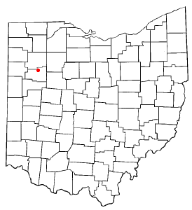
mapsize = 250x200px
map_caption = Location of Cairo, Ohio
mapsize1 =
map_caption1 =subdivision_type = Country
subdivision_name =United States
subdivision_type1 = State
subdivision_name1 =Ohio
subdivision_type2 = County
subdivision_name2 = Allengovernment_footnotes =
government_type =
leader_title =
leader_name =
leader_title1 =
leader_name1 =
established_title =
established_date =unit_pref = Imperial
area_footnotes =area_magnitude =
area_total_km2 = 0.6
area_land_km2 = 0.6
area_water_km2 = 0.0
area_total_sq_mi = 0.2
area_land_sq_mi = 0.2
area_water_sq_mi = 0.0population_as_of = 2000
population_footnotes =
population_total = 499
population_density_km2 = 796.9
population_density_sq_mi = 2064.0timezone = Eastern (EST)
utc_offset = -5
timezone_DST = EDT
utc_offset_DST = -4
elevation_footnotes = GR|3
elevation_m = 248
elevation_ft = 814
latd = 40 |latm = 49 |lats = 53 |latNS = N
longd = 84 |longm = 5 |longs = 4 |longEW = Wpostal_code_type =
ZIP code
postal_code = 45820
area_code = 419
blank_name = FIPS code
blank_info = 39-10884GR|2
blank1_name = GNIS feature ID
blank1_info = 1056752GR|3
website =
footnotes =Cairo (pronEng|ˈkeɪroʊ "kay-row") is a village in Allen County,
Ohio ,United States . The population was 499 at the 2000 census. It is included in the LimaMetropolitan Statistical Area . As indicated above, the village's name is pronounced differently from the English name for the Egyptian city having the same spelling: .Geography
Cairo is located at the intersection of what was the east-west
U.S. Route 30 (theLincoln Highway ) and the north-south State Route 65 ("Napoleon Road") in the middle of farming country. In the 1970s, Route 30 was upgraded and moved approximately one mile south of Cairo. Now, the east-west street in Cairo is Main Street. Cairo lies near the following towns:
*Lima, about six miles to the south
*Columbus Grove, about six miles to the north
*Gomer, about five miles to the west
*Beaverdam, about six miles to the eastThe elevation of the land area of Cairo (ranges from about 812' at the west end to 842' at the east end of the village above sea level) is benchmarked at 815' above sea level, generally flat and moderately wooded. The nearest stream with year-round flow is Rattlesnake Creek which flows from south of the village and passes just to the west of the village. Water flow in the village is generally from the south and east to the north and west.According to the
United States Census Bureau , the village has a total area of 0.2square mile s (0.6km² ), all of it land.Demographics
As of the
census GR|2 of 2000, there were 499 people, 181 households, and 148 families residing in the village. Thepopulation density was 2,064.0 people per square mile (802.8/km²). There were 184 housing units at an average density of 761.1/sq mi (296.0/km²). The racial makeup of the village was 98.60% White, 0.40% African American, 0.20% Asian, and 0.80% from two or more races. Hispanic or Latino of any race were 0.80% of the population.There were 181 households out of which 40.9% had children under the age of 18 living with them, 65.2% were married couples living together, 12.7% had a female householder with no husband present, and 18.2% were non-families. 15.5% of all households were made up of individuals and 7.2% had someone living alone who was 65 years of age or older. The average household size was 2.76 and the average family size was 3.08.
In the village the population was spread out with 30.7% under the age of 18, 6.8% from 18 to 24, 31.5% from 25 to 44, 21.4% from 45 to 64, and 9.6% who were 65 years of age or older. The median age was 34 years. For every 100 females there were 92.7 males. For every 100 females age 18 and over, there were 90.1 males.
The median income for a household in the village was $32,917, and the median income for a family was $39,375. Males had a median income of $34,250 versus $25,313 for females. The
per capita income for the village was $14,365. About 6.8% of families and 6.9% of the population were below thepoverty line , including 11.4% of those under age 18 and 3.8% of those age 65 or over.Points of interest
Cairo was formerly known as West Cairo.
Cairo is the hometown of
Robert Franklin Jones , attorney and United States Congressman from 1939 to 1947.Main Street in Cairo was a part of the coast to coast Lincoln Highway. At various times, there were Lincoln Highway markers and monuments along Main Street. The log building located at the Northeast corner of Main Street and Route 65 is known locally as the Lincoln Log Cabin.
The village and local farm children once attended elementary school in Cairo and had a choice of attending either Columbus Grove or Lima Central high schools. The village was formerly a part of the Cairo Local School District. However, after the consolidation of Cairo into
Bath Local School District in the 1970s the children attend the Bath elementary and secondary schools.The most distinctive physical feature of Cairo is a painted (white) concrete
grain elevator locally known as a "bean dryer" which is about 150' tall.There is a small war memorial listing the local residents who served in the armed forces during World War II. The memorial is located on the north side of Main Street about 250 feet west of the Baltimore & Ohio Railroad tracks.
The former
Baltimore & Ohio Railroad ("the B&O") passes through Cairo north-south about ½ mile east of and generally parallel to State Route 65. Formerly, theDetroit, Toledo and Ironton Railroad ("the DT&I") passed through Cairo paralleling the Baltimore & Ohio right of way but about 300 feet to the east. The DT&I right-of-way is still obvious but the DT&I track was removed in the 1970s.Cairo has two churches, Methodist and Congregational Christian.
The village has a single traffic control light located at the intersection of Main Street (Lincoln Highway) and Ohio Route 65.
Sports History
Baseball has long been a significant part of the village's recreational and social activities. In 1985 the Cairo little league team finished the season with a 14-0 record and were Tourney Champs defeating all other local teams.
References
External links
* [http://www.orgsites.com/oh/cairopolice Cairo Police Department]
Wikimedia Foundation. 2010.