- Wells Harbour
Geobox|Harbour
name = Wells Harbour
category =Harbour
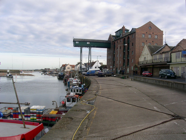
image_caption =The Harbour, Wells next the Sea.
official_name = Wells-next-the-sea Harbour
symbol =
country =England
state =Norfolk
region =East of England
district =North Norfolk
municipality =Wells-next-the-sea
location = North Sea,
elevation =
prominence =
length =
length_orientation =
width =
width_orientation =
height =
depth =
volume =
established =1400s
date =
management = The Harbour Commissioners
owner =Port Of Wells
public =
visitation = Open all year
visitation_date =Office Opening Hours
Monday to Friday 9am to 5pm,Saturday and Sunday 9am to Noon
One Hour less in the winter
access = Wells Leading Buoy
ascent =
ascent_date =
discovery =
discovery_date =
free =
free_type =
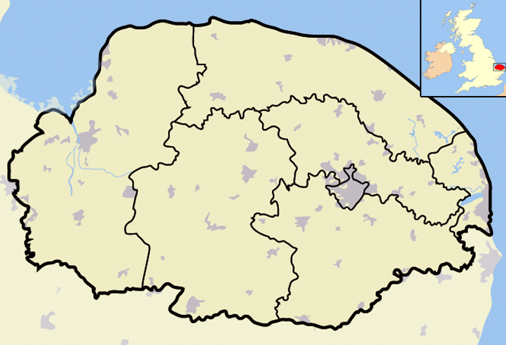
map_caption =Wells Harbour withinNorfolk
map_background =
map_locator =
map_locator_x =43
map_locator_y =4
commons =
statistics =
website = http://www.wellsharbour.co.uk/index.htm
footnotes =OS Grid Ref: TF9143Wells Harbour is located in the town of
Wells-next-the-Sea in the Englishcounty ofNorfolk ,England [ "OS Explorer Map 24” – Norfolk Coast Central. ISBN 0 319 21726 4] . Theharbour is 21 miles west ofCromer , 34.8 miles north ofNorwich and 123 miles north ofLondon . The harbour lies north of the A149 betweenKing’s Lynn andGreat Yarmouth . The nearest railway station is now at Sheringham for theBittern Line which runs betweenSheringham , Cromer and Norwich. The nearest airport isNorwich International Airport .Description
The Harbour is on the
North Norfolk Coast. It is used by a smallfishing fleet and by visiting commercial and fishing vessels, including vessels engaged in surveys, crew transfer or safety boat operations. The harbour also caters for a growing number of leisure craft which are both local boats and an increasing amount of visiting craft. Coastal trips to see the seals atBlakeney Point and chartered fishing and diving trips are also available in the high season. Berthed at the quay is the historic vessel "Albatros". The vessel is used for a variety of functions including charters, cruises and sometime just as a venue for entertaining.History
There has been a
port at Wells for over 600 years. The harbour is protected bysalt marsh es behind a sand bar. Because it is a natural safe haven from the unpredictableNorth Sea weather the Port of Wells was one ofEngland 's major harbours inTudor times and a thriving, centre forshipping and maritime industry in the nineteenth and early twentieth centuries. The stonequay side was constructed in the early 1900s as were many of the large building and tiny yards and dwellings still seen to this day on thequay side.Approaches
Approaches to Wells can be made from Blakeney Overfalls, South Race, The Woolpack or Burnham Flats. Details on Imray Chart C28: The East Coast -
Harwich to Wells-next-to Sea. A course should be made for Wells LeadingBuoy , keeping to the port side of the marker for the deepest water over the sand bar. Vessels arriving from the East should come close to thebuoy or pass it to port before turning for the harbour entrance rather than making directly for Buoys Number 1 and 2 in the channel. On arrival or prior to arrival at the leading Buoy it is advisable to contact theHarbourmaster for advice about the approaches. The Harbourmaster can be contacted on channel 12 (Wells Harbour). Depth at the entrance and at the quays is 3.04 metres to 3.66 at high water [Ports of the World, 32nd edition, Page 145 (1979) Benn publications ISBN 051049155 3] .Channel Navigation
The channel over the bar and into the harbour changes from time to time although the established buoyage system on the channel can usually be relied on to stay constant. A look out should be made for temporary pellet buoys and beacons to show changes in the channel. 175 degrees in from the leading buoy is a large conical buoy Number 1 flashing
green and the largered Number 2, can buoy flashing red on the bar itself are both visible in mostweather conditions. It is advisable to make good a course between these buoys until the smaller buoys of the channel become visible, after which it is better to favour thestarboard side because there is a considerable east going tidal stream across the harbour entrance from approximately two hours before every high water. From the starboard buoy No.9 known as the 'Knock', the channel bends away towards the South East into considerably quieter waters. The wide sweep to the eastward just past the lifeboat house must be made with the redbeacon s close to port as the channel is quite narrow at this point. On passing the green buoy named the 'Pool', turn to the South West and follow the buoys to the last red can buoy (Number 14) then arc back Easterly close to the marsh edge and follow the red beacons to the Quayside.Draft
During Spring tides Vessels drawing up to 10 feet (3 m) can use the harbour at high water and vessels of up to 1.5 metres draft can look at entry two hours either side of high water. On tides the Harbour may be entered by craft drawing up to 6 feet (1.75 m) at high water or at most one
hour before or after high water.Quayside Facilities
Off Beach Road there are easy accessible pontoons available for mooring. The pontoons provide electricity hook ups and fresh water points. Fresh water is also provided on the main quay. There is a diesel refuelling birth available on the tide. On the quayside there are bulk disposal bins for refuse. There is also a facility for the disposal of used engine oil at the east end of the Harbour. There are also toilet and shower facilities for the use of visiting crews along with a laundry. There is also a sewage pump-out point. The car parks are pay and display. Permits can be purchased for all these facilities from the harbour and information for pilotage and navigation in the area is also available.
torage Facilities
Wells has a purpose-built secure outdoor
compound with securitysurveillance which can be used year round as well as for storage in the winter. The facility can be found at the east end behind the sea wall close to theslipway . There is 15 metres of quayside which are used for craning and hard standing. The site is covered by security lighting and there are electricity and water hook up points.References
Wikimedia Foundation. 2010.