- Chimney Rock, North Carolina
-
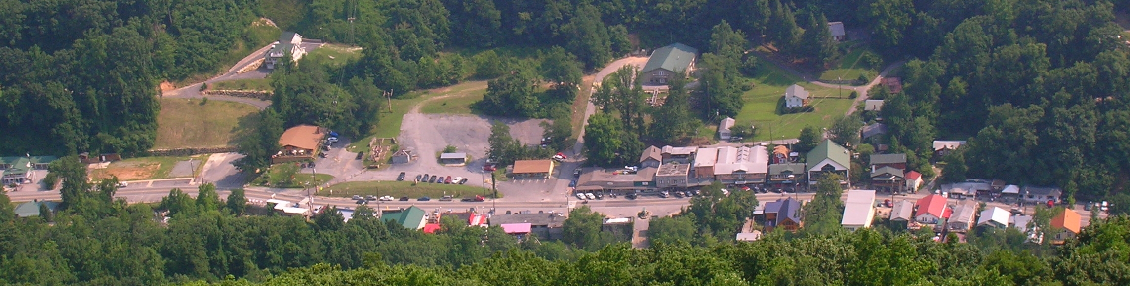
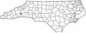
Chimney Rock, North Carolina — Village — The village of Chimney Rock Location of Chimney Rock, North Carolina
Coordinates: 35°26′27″N 82°15′10″W / 35.44083°N 82.25278°WCoordinates: 35°26′27″N 82°15′10″W / 35.44083°N 82.25278°W Country United States State North Carolina County Rutherford Area – Total 2.8 sq mi (7.2 km2) – Land 2.8 sq mi (7.2 km2) – Water 0.0 sq mi (0.0 km2) Elevation 1,096 ft (334 m) Population (2000) – Total 175 – Density 63.3/sq mi (24.4/km2) Time zone Eastern (EST) (UTC-5) – Summer (DST) EDT (UTC-4) ZIP code 28720 Area code(s) 828 FIPS code 37-12460[1] GNIS feature ID 1027392[2] Chimney Rock is a village in Rutherford County, North Carolina, United States. The population was 175 at the 2000 census. The village takes its name from a large granite outcropping located on a summit above the village itself in Chimney Rock State Park.
Contents
Geography
Chimney Rock is located at 35°26′27″N 82°15′10″W / 35.44083°N 82.25278°W (35.440706, -82.252642)[3].
According to the United States Census Bureau, the village has a total area of 2.8 square miles (7.3 km2), all of it land. The town shares a border with the town of Lake Lure.
Demographics
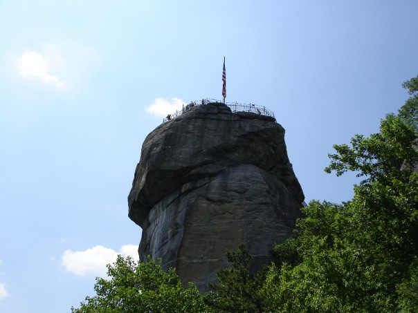
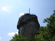 Chimney Rock, a 315-foot (96 m) granite monolith in Chimney Rock State Park near Chimney Rock, North Carolina
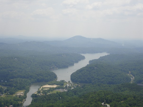
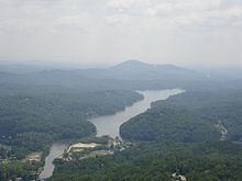 View from the top of Chimney Rock
As of the census[1] of 2000, there were 175 people, 74 households, and 50 families residing in the village. The population density was 63.3 people per square mile (24.4/km²). There were 200 housing units at an average density of 72.3 per square mile (27.9/km²). The racial makeup of the village was 94.86% White, 0.57% Native American, 2.29% from other races, and 2.29% from two or more races. Hispanic or Latino of any race were 4.00% of the population.
There were 74 households out of which 25.7% had children under the age of 18 living with them, 58.1% were married couples living together, 5.4% had a female householder with no husband present, and 31.1% were non-families. 21.6% of all households were made up of individuals and 8.1% had someone living alone who was 65 years of age or older. The average household size was 2.36 and the average family size was 2.80.
In the village the population was spread out with 21.7% under the age of 18, 6.3% from 18 to 24, 30.3% from 25 to 44, 25.7% from 45 to 64, and 16.0% who were 65 years of age or older. The median age was 39 years. For every 100 females there were 118.8 males. For every 100 females age 18 and over, there were 110.8 males.
The median income for a household in the village was $29,583, and the median income for a family was $29,583. Males had a median income of $28,250 versus $22,813 for females. The per capita income for the village was $17,142. About 15.8% of families and 14.7% of the population were below the poverty line, including 11.1% of those under the age of eighteen and 20.0% of those sixty five or over.
Trivia
The climax of Michael Mann's film version of James Fenimore Cooper's The Last of the Mohicans was filmed along one of the pathways across from Chimney Rock State Park.
Parts of the movie version of the Stephen King novel "Firestarter" were also filmed here.
References
- ^ a b "American FactFinder". United States Census Bureau. http://factfinder.census.gov. Retrieved 2008-01-31.
- ^ "US Board on Geographic Names". United States Geological Survey. 2007-10-25. http://geonames.usgs.gov. Retrieved 2008-01-31.
- ^ "US Gazetteer files: 2010, 2000, and 1990". United States Census Bureau. 2011-02-12. http://www.census.gov/geo/www/gazetteer/gazette.html. Retrieved 2011-04-23.
External links
Municipalities and communities of Rutherford County, North Carolina Towns Bostic | Ellenboro | Forest City | Lake Lure | Ruth | Rutherfordton | Spindale
Village Chimney Rock
Unincorporated
communityHenrietta | Hopewell
Categories:- Villages in North Carolina
- Populated places in Rutherford County, North Carolina

Wikimedia Foundation. 2010.