- Duluth International Airport
-
Duluth International Airport 
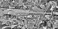
USGS aerial image - 17 May 1991 IATA: DLH – ICAO: KDLH – FAA LID: DLH Location of the Airport in Minnesota Summary Airport type Public Owner City of Duluth, Minn Serves Duluth, Minnesota Elevation AMSL 1,428 ft / 435 m Coordinates 46°50′32″N 092°11′37″W / 46.84222°N 92.19361°W Website Runways Direction Length Surface ft m 9/27 10,162 3,097 Concrete 3/21 5,718 1,743 Asphalt Statistics (2007) Aircraft operations 67,752 Based aircraft 86 Sources: airport web site,[1] FAA[2] - For the United States Air Force use of this facility, see Duluth Air National Guard Base
Duluth International Airport (IATA: DLH, ICAO: KDLH, FAA LID: DLH) is a city-owned, public-use airport located five nautical miles (9 km) northwest of the central business district of Duluth, a city in St. Louis County, Minnesota, United States.[2] It serves the Duluth-Superior area including Superior, Wisconsin. It is mostly used for general aviation but is also served by three commercial airlines.
The Minnesota Air National Guard's 148th Fighter Wing, equipped with F-16C Fighting Falcons, is based at Duluth Air National Guard Base.
Contents
History
The City of Duluth purchased the original property for the airport in 1929 from St. Louis County. The airport was constructed on 640 acres (2.6 km2) of land with two 2,650-foot (810 m) sod runways. Subsequently, in 1930, the airfield was dedicated as a public airport. The airport was called the Williamson-Johnson Municipal Airport until 1963 at which time it was renamed Duluth International Airport.
In 1942, the three existing runways were paved. Each runway was 4,000 feet (1,200 m) long, 150 feet (46 m) wide, and at nearly equal angles from each other, 30, 90, and 130 degrees. They were identified as runways 3-21, 9-27, and 13-31 respectively. The Corps of Engineers extended runway 9-27 and Runway 3-21 to 5,699 feet (1,737 m) in 1945. In 1951 the USAF extended Runway 9-27 to 9,000 feet (2,700 m) with a 1,000-foot (300 m) overrun and the control tower was built. Runway 9-27 was completely rebuilt in 1956 and further extended in 1966 to 10,152 feet (3,094 m) in length.
The original terminal building was built in 1954, south of Runway 9-27, on the west side of Runway 3-21 and served the airport for nearly 20 years. The terminal floor area was 14,200 square feet (1,320 m2) with 280 parking spaces.
In 1974, a new Terminal Building and U.S. Customs, International Arrivals Building, were completed east of Runway 13-31 and open for operation. Runway 13-31 was shortened to 2,578 feet (786 m) to accommodate construction of an addition to the International Arrivals building. This resulted in Runway 13-31 being closed as a runway due to obstructions. Runway 13-31 was subsequently re-striped in 1980, decreasing its width to 75 feet (23 m), for use as a taxiway only. In 1989, the new Terminal building and the adjacent structures were connected to form one enclosure. The original terminal building was then converted for use as offices for general aviation, the FAA, and the U.S. Weather Bureau.
Future
Future air service The Duluth Airport board is currently looking for possible carriers to serve Duluth International Airport. The most wanted new service is non-stop service to Chicago which took effect Dec. 17, 2009 by United Express. (American Airlines used to have Chicago O'Hare-Duluth service but had to stop this service because of flight restrictions at Chicago O'Hare Airport).
New terminal A new terminal is under construction to replace the old terminal at Duluth International Airport. The new terminal will be able to handle more people, flights, and airlines.
Facilities and aircraft
Duluth International Airport covers an area of 3,020 acres (1,220 ha) at an elevation of 1,428 feet (435 m) above mean sea level. It has two runways: 9/27 is 10,162 by 150 feet (3,097 x 46 m) with a concrete surface and 3/21 is 5,718 by 150 feet (1,743 x 46 m) with an asphalt surface.[2]
For the 12-month period ending June 30, 2007, the airport had 67,752 aircraft operations, an average of 185 per day: 76% general aviation, 10% military, 8% air taxi, and 6% scheduled commercial. At that time there were 86 aircraft based at this airport: 60% single-engine, 13% multi-engine, 1% helicopter and 26% military.[2]
Airlines and destinations
Airlines Destinations Allegiant Air Las Vegas, Orlando-Sanford, Phoenix/Mesa Delta Connection operated by Mesaba Airlines Seasonal: Detroit, Minneapolis/St. Paul Delta Connection operated by Pinnacle Airlines Detroit, Minneapolis/St. Paul Delta Connection operated by SkyWest Airlines Minneapolis/St. Paul United Express operated by SkyWest Airlines Chicago-O'Hare Cargo
Airlines Destinations Bemidji Airlines Minneapolis/St. Paul FedEx Feeder operated by CSA Air Rochester (MN) FedEx Feeder operated by Mountain Air Cargo Minneapolis/St. Paul See also
References
- ^ Duluth International Airport, official web site
- ^ a b c d FAA Airport Master Record for DLH (Form 5010 PDF). Federal Aviation Administration. Effective 8 April 2010.
External links
- Duluth International Airport official website
- Aerial image as of 10 May 1991 from USGS The National Map
- Duluth International AirportPDF (103 KB) at Minnesota DOT Airport Directory
- FAA Airport Diagram (PDF), effective 20 October 2011
- FAA Terminal Procedures for DLH, effective 20 October 2011
- Resources for this airport:
- AirNav airport information for KDLH
- ASN accident history for DLH
- FlightAware airport information and live flight tracker
- NOAA/NWS latest weather observations
- SkyVector aeronautical chart for KDLH
- FAA current DLH delay information
Categories:- Airports in Minnesota
- Transportation in Duluth, Minnesota
- Buildings and structures in Duluth, Minnesota
Wikimedia Foundation. 2010.

