- Con Dao
-
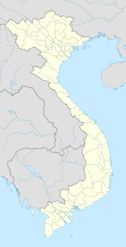
Coordinates: 8°41′35″N 106°36′34″E / 8.69306°N 106.60944°E
Con Dao
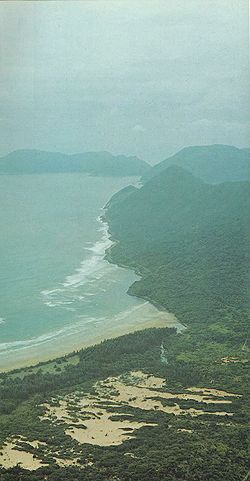
Huyện Côn Đảo— District — An aerial view of the main island Coordinates: 8°41′35″N 106°34′36″E / 8.69306°N 106.57667°E Country  Vietnam
Region South East Province Ba Ria-Vung Tau Province Time zone UTC + 7 (UTC+7) The Con Dao Islands (Vietnamese: Côn Đảo) are an archipelago of Ba Ria-Vung Tau province, in southeastern Vietnam, and a district of this province.
Contents
Description
Situated at about 185 km (115 mi) from Vung Tau and 230 km (143 mi) from Ho Chi Minh City, the group includes 16 mountainous islands and islets. The total land area reaches 75.15 km² and the local population is about 5,000.
The island group is served by Co Ong Airport.
History
On June 16, 1702, the English East India Company founded a settlement on the island of Pulo Condor (Poulo Condore) off the south coast of southern Vietnam, and on March 2, 1705, the garrison and settlement were destroyed.
The largest island is Côn Sơn Island (also known as Con Lon Island), famous for its prison built by the French colonial government.
Côn Đảo National Park
Many of the islands were given protected status in 1984. In 1984, they became a national park, Côn Đảo National Park, which was subsequently enlarged in 1998. Endangered species protected within the park include the hawksbill turtle, the green turtle and the dugong. Ecosystems represented in the park include seagrass meadow, mangrove and coral reefs.
Côn Đảo National Park is working with the World Wildlife Fund (WWF) Vietnam to further protection in the marine areas, with programs to establish a Marine Protected Area that protects coral reefs, seagrass beds and species, while also developing sustainable nature-based ecotourism. The island's management is strongly geared towards sustainable use, hoping to learn from previous experiences in Vietnam and the region to balance development with conservation.
External links
- Con Dao photos
- Con Dao guide and gallery
- Con Dao Island History and guide
- Visit Con Dao Facts and photos
 Districts of Southeast Vietnam (Dong Nam Bo)
Ho Chi Minh City Urban districts: Binh Tan · Binh Thanh · District 1 · District 2 · District 3 · District 4 · District 5 · District 6 · District 7 · District 8 · District 9 · District 10 · District 11 · District 12 · Go Vap · Phu Nhuan · Tan Binh · Tan Phu · Thu Duc
Districts: Binh Chanh · Can Gio · Cu Chi · Hoc Mon · Nha Be
Dong Nai province Bien Hoa · Cam My · Dinh Quan · Long Khanh · Long Thanh · Nhon Trach · Tan Phu · Thong Nhat · Trang Bom · Vinh Cuu · Xuan LocBinh Duong province Ba Ria–Vung Tau province Binh Phuoc province Tay Ninh province Binh Thuan province Categories:- Districts of Ba Ria-Vung Tau Province
- Islands of Vietnam
- Ba Ria-Vung Tau Province
- Former British colonies
- Archipelagoes of the Pacific Ocean
- States and territories established in 1702
- Former populated places in Vietnam
- Islands of the South China Sea
- Bà Rịa–Vũng Tàu Province geography stubs
Wikimedia Foundation. 2010.


