- Golden Triangle, New Jersey
Infobox Settlement
official_name = Golden Triangle, New Jersey
settlement_type = CDP
nickname =
motto =
imagesize =
image_caption =
image_
imagesize =
image_caption =
image_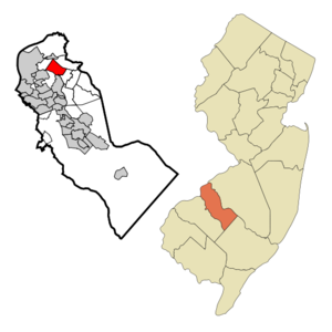
mapsize = 250x200px
map_caption = Map of Golden Triangle CDP in Camden County
mapsize1 =
map_caption1 =subdivision_type = Country
subdivision_name =United States
subdivision_type1 = State
subdivision_name1 =New Jersey
subdivision_type2 = County
subdivision_name2 = Camden
government_footnotes =
government_type =
leader_title =
leader_name =
leader_title1 =
leader_name1 =
established_title =
established_date =area_footnotes =
area_magnitude =
area_total_km2 = 7.6
area_land_km2 = 7.4
area_water_km2 = 0.2
area_total_sq_mi = 2.9
area_land_sq_mi = 2.9
area_water_sq_mi = 0.1population_as_of = 2000
population_footnotes =
population_total = 3511
population_density_km2 = 473.3
population_density_sq_mi = 1225.8timezone = Eastern (EST)
utc_offset = -5
timezone_DST = EDT
utc_offset_DST = -4
elevation_footnotes =
elevation_m = 8
elevation_ft = 26
latd = 39 |latm = 55 |lats = 40 |latNS = N
longd = 75 |longm = 2 |longs = 26 |longEW = Wpostal_code_type =
postal_code =
area_code =
blank_name = FIPS code
blank_info = 34-26902GR|2
blank1_name = GNIS feature ID
blank1_info = 1852610GR|3
website =
footnotes =Golden Triangle is a
census-designated place and unincorporated area located within Cherry Hill Township, in Camden County,New Jersey . As of theUnited States 2000 Census , the CDP population was 3,511.Golden Triangle is roughly bordered by Chapel Avenue, Cuthbert Boulevard, Haddonfield Road, and Route 70/Marlton Pike.
Geography
Golden Triangle is located at coor dms|39|55|40|N|75|2|26|W|city (39.927765, -75.040464)GR|1.
According to the
United States Census Bureau , the CDP has a total area of 7.6km² (3.0 mi²). 7.4 km² (2.9 mi²) of it is land and 0.2 km² (0.1 mi²) of it (2.71%) is water.Demographics
As of the
census GR|2 of 2000, there were 3,511 people, 1,358 households, and 862 families residing in the CDP. Thepopulation density was 474.0/km² (1,225.8/mi²). There were 1,457 housing units at an average density of 196.7/km² (508.7/mi²). The racial makeup of the CDP was 80.75% White, 9.40% African American, 0.14% Native American, 5.16% Asian, 2.08% from other races, and 2.48% from two or more races. Hispanic or Latino of any race were 5.50% of the population.There were 1,358 households out of which 24.0% had children under the age of 18 living with them, 47.2% were married couples living together, 11.5% had a female householder with no husband present, and 36.5% were non-families. 30.8% of all households were made up of individuals and 12.7% had someone living alone who was 65 years of age or older. The average household size was 2.43 and the average family size was 3.09.
In the CDP the population was spread out with 19.3% under the age of 18, 6.4% from 18 to 24, 31.2% from 25 to 44, 22.4% from 45 to 64, and 20.8% who were 65 years of age or older. The median age was 41 years. For every 100 females there were 96.3 males. For every 100 females age 18 and over, there were 92.2 males.
The median income for a household in the CDP was $46,266, and the median income for a family was $57,583. Males had a median income of $34,726 versus $31,563 for females. The
per capita income for the CDP was $22,423. About 4.6% of families and 7.7% of the population were below thepoverty line , including 6.6% of those under age 18 and 5.7% of those age 65 or over.References
External links
Wikimedia Foundation. 2010.