- Collorec
-
Collorec
Koloreg
 CollorecLocation within Brittany region
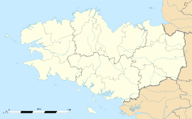 Collorec
Administration Country France Region Brittany Department Finistère Arrondissement Châteaulin Canton Châteauneuf-du-Faou Intercommunality Haute Cornouaille Mayor Marie Le Borgne
(2008–2014)Statistics Elevation 72–221 m (236–725 ft) Land area1 28.00 km2 (10.81 sq mi) Population2 667 (2008) - Density 24 /km2 (62 /sq mi) INSEE/Postal code 29036/ 29530 1 French Land Register data, which excludes lakes, ponds, glaciers > 1 km² (0.386 sq mi or 247 acres) and river estuaries. 2 Population without double counting: residents of multiple communes (e.g., students and military personnel) only counted once. Coordinates: 48°17′09″N 3°46′22″W / 48.2858°N 3.7728°W
Collorec (Breton: Koloreg) is a commune in the Finistère department of Brittany in north-western France.
Contents
Demographics
Inhabitants of Collorec are called in French Collorecois.
Historical populations Year Pop. ±% 1793 1,048 — 1800 1,198 +14.3% 1806 913 −23.8% 1821 871 −4.6% 1831 1,308 +50.2% 1836 1,328 +1.5% 1841 1,328 +0.0% 1846 1,352 +1.8% 1851 1,312 −3.0% 1856 1,234 −5.9% 1861 1,239 +0.4% 1866 1,325 +6.9% 1872 1,260 −4.9% 1876 1,339 +6.3% 1881 1,339 +0.0% 1886 1,439 +7.5% 1891 1,354 −5.9% 1896 1,578 +16.5% 1901 1,650 +4.6% 1906 1,801 +9.2% 1911 1,948 +8.2% 1921 1,880 −3.5% 1926 1,834 −2.4% 1931 1,661 −9.4% 1936 1,619 −2.5% 1946 1,554 −4.0% 1954 1,271 −18.2% 1962 1,148 −9.7% 1968 1,038 −9.6% 1975 891 −14.2% 1982 778 −12.7% 1990 692 −11.1% 1999 647 −6.5% 2008 667 +3.1% See also
References
- Mayors of Finistère Association (French);
External links
- Official website (French)
- French Ministry of Culture list for Collorec (French)
Categories:- Communes of Finistère
- Finistère geography stubs


Wikimedia Foundation. 2010.