- Dinglishna Hill
-
Dinglishna Hill 
Elevation [1] Prominence A[›] Translation Little Mountain (Dena'ina) Pronunciation IPA: [] Dgelishla or Dghelishla[needs IPA] Location Matanuska-Susitna Borough, Alaska, USA Range Alaska Range Coordinates 61°26′39″N 150°36′24″W / 61.44417°N 150.60667°WCoordinates: 61°26′39″N 150°36′24″W / 61.44417°N 150.60667°W[1] Topo map USGS Tyonek B-2 Geology Type Summit Climbing Easiest route Scramble Dinglishna Hill (English pronunciation: /dɪŋˈlɪʃnə/) is a hill located East of Mount Susitna, in the Matanuska-Susitna Valley of South Central Alaska. It is also the name of the Dinglishna Hills subdivision of the Matanuska-Susitna Borough, Alaska.
Contents
History
Tanaina Indian name reported in 1958 by USGS.[1]
Etymology
Dgelishla or Dghelishla in Dena'ina meaning "Little Mountain" is transliterated as "Dinglishna".
Description
Dinglishna Hill is on W bank of Alexander Creek, 28 miles (45 km) north west of Anchorage, Cook Inlet Low.[1]
Location
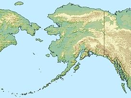
Dinglishna Hill is a hill located East of Mount Susitna, West of Alexander Creek and the big Susitna River, South-West of Susitna, and North of Alexander in the Matanuska-Susitna Valley of South Central Alaska.[1] It is also the name of the Dinglishna Hills subdivision of the Matanuska-Susitna Borough, Alaska.
Terrain
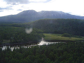
The elevation of Dinglishna Hill is 479 feet (146 m) above mean sea level.[1] The hill slopes down gradually until it reaches Alexander Creek near the confluence with the big Susitna River.
Vegetation
The hill and its surroundings are vegetated with birch, spruce and low lying shrubs. The soil in the area is well-drained.
Notes
^ A: Dinglishna Hill's prominence is approximately its 423 feet (129 m) summit elevation above mean sea level less Alexander Creek (at its base) 26 feet (7.9 m) elevation above mean sea level.[2] Some of the land around Dinglishna Hill is several feet higher than the water level, but not much.
References
- ^ a b c d e f "Dinglishna Hill". Geographic Names Information System, U.S. Geological Survey. 1981-03-31. http://geonames.usgs.gov/pls/gnispublic/f?p=gnispq:3:::NO::P3_FID:1401209. Retrieved 2009-05-04.
- ^ "Alexander Creek". Geographic Names Information System, U.S. Geological Survey. 1981-03-31. http://geonames.usgs.gov/pls/gnispublic/f?p=gnispq:3:::NO::P3_FID:1398098. Retrieved 2009-05-04.
General references
- "Dinglishna Hill area management plan" (PDF). Alaska Department of Natural Resources. http://www.dnr.state.ak.us/mlw/planning/areaplans/susitna/pdf/mt._susitna_unit_3.pdf.
- Kari, James; James A. Fall (2003). Shem Pete's Alaska: The Territory of the Upper Cook Inlet Dena'ina, 2nd ed., University of Alaska Press, 112. ISBN 1-889963-57-7.
External links
Categories:- Landforms of Matanuska-Susitna Borough, Alaska
- Hills of Alaska
Wikimedia Foundation. 2010.

