- Courtland, Mississippi
-
Courtland, Mississippi — Town — Location of Courtland, Mississippi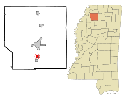
Coordinates: 34°14′21″N 89°56′34″W / 34.23917°N 89.94278°WCoordinates: 34°14′21″N 89°56′34″W / 34.23917°N 89.94278°W Country United States State Mississippi County Panola Area – Total 1.1 sq mi (2.9 km2) – Land 1.1 sq mi (2.9 km2) – Water 0.0 sq mi (0.0 km2) Elevation 253 ft (77 m) Population (2000) – Total 460 – Density 408.1/sq mi (157.6/km2) Time zone Central (CST) (UTC-6) – Summer (DST) CDT (UTC-5) ZIP code 38620 Area code(s) 662 FIPS code 28-15980 GNIS feature ID 0668883 Courtland is a town in Panola County, Mississippi, United States. The population was 460 at the 2000 census.
Contents
Geography
Courtland is located at 34°14′21″N 89°56′34″W / 34.23917°N 89.94278°W (34.239122, -89.942670)[1].
According to the United States Census Bureau, the town has a total area of 1.1 square miles (2.8 km2), all of it land.
Demographics
As of the census[2] of 2000, there were 460 people, 157 households, and 127 families residing in the town. The population density was 408.1 people per square mile (157.2/km²). There were 169 housing units at an average density of 150.0 per square mile (57.7/km²). The racial makeup of the town was 64.57% White and 35.43% African American. Hispanic or Latino of any race were 1.30% of the population.
There were 157 households out of which 43.3% had children under the age of 18 living with them, 59.9% were married couples living together, 19.1% had a female householder with no husband present, and 18.5% were non-families. 17.8% of all households were made up of individuals and 6.4% had someone living alone who was 65 years of age or older. The average household size was 2.93 and the average family size was 3.32.
In the town the population was spread out with 32.6% under the age of 18, 7.4% from 18 to 24, 30.9% from 25 to 44, 19.3% from 45 to 64, and 9.8% who were 65 years of age or older. The median age was 32 years. For every 100 females there were 100.0 males. For every 100 females age 18 and over, there were 86.7 males.
The median income for a household in the town was $35,729, and the median income for a family was $38,125. Males had a median income of $32,125 versus $19,375 for females. The per capita income for the town was $17,130. About 12.4% of families and 16.5% of the population were below the poverty line, including 17.4% of those under age 18 and 24.2% of those age 65 or over.
Education
The Town of Courtland is served by the South Panola School District.
References
- ^ "US Gazetteer files: 2010, 2000, and 1990". United States Census Bureau. 2011-02-12. http://www.census.gov/geo/www/gazetteer/gazette.html. Retrieved 2011-04-23.
- ^ "American FactFinder". United States Census Bureau. http://factfinder.census.gov. Retrieved 2008-01-31.
Municipalities and communities of Panola County, Mississippi City 
Towns Village Unincorporated
communitiesAskew | Curtis Station | Glenville | Locke Station‡ | Longtown | Pleasant Grove
Ghost town Tocowa
Footnotes ‡This populated place also has portions in an adjacent county or counties
Categories:- Populated places in Panola County, Mississippi
- Towns in Mississippi


Wikimedia Foundation. 2010.