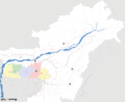
- Nongstoin
-
Nongstoin — city — Coordinates 25°31′N 91°16′E / 25.52°N 91.27°ECoordinates: 25°31′N 91°16′E / 25.52°N 91.27°E Country India State Meghalaya District(s) West Khasi Hills Population 22,003 (2001[update]) Time zone IST (UTC+05:30) Area
• 1,409 metres (4,623 ft)
Nongstoin is the headquarters of West Khasi Hills district in the state of Meghalaya in India.
Contents
Geography
Nongstoin is located at 25°31′N 91°16′E / 25.52°N 91.27°E.[1] It has an average elevation of 1409 metres (4622 feet).
The Langshiang Falls is located 24 kilometres (15 mi) from Nongstoin.[2]
Demographics
As of 2001[update] India census,[3] Nongstoin had a population of 22,003. Males constitute 50% of the population and females 50%. Nongstoin has an average literacy rate of 67%, higher than the national average of 59.5%: male literacy is 67%, and female literacy is 66%. In Nongstoin, 23% of the population is under 6 years of age.
Culture
In January 2006, Pope Benedict XVI erected a diocese in Nongstoin, covering the West Khasi Hills district. The Franciscan Missionary Brothers of the Catholic Church run a College and a School at Siejlieh, Nongstoin
References
- ^ Falling Rain Genomics, Inc - Nongstoin
- ^ "Langshiang Falls". india9. http://www.india9.com/i9show/-Meghalaya/Langshiang-Falls-44329.htm. Retrieved 2010-06-20.
- ^ "Census of India 2001: Data from the 2001 Census, including cities, villages and towns (Provisional)". Census Commission of India. Archived from the original on 2004-06-16. http://web.archive.org/web/20040616075334/http://www.censusindia.net/results/town.php?stad=A&state5=999. Retrieved 2008-11-01.
Municipalities of Meghalaya Categories:- Geography of Meghalaya
- West Khasi Hills district
- Cities and towns in West Khasi Hills district
- India geography stubs
- Meghalaya stubs
Wikimedia Foundation. 2010.


