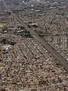
- Mount Eden, California
-
Mount Eden, also known as Eden Township, is a former city that has been incorporated into Hayward in Alameda County, California, United States of America. It lies at an elevation of 43 feet (13 m).
Mount Eden was founded in 1850 by a group of farmers from Mount Eden, Kentucky, drawn to California by the Gold Rush.[1] The party disbanded upon reaching the San Francisco Bay, but a few of them settled at a road crossing. They nailed a sign reading "Mt. Eden" to two trees, and the name stuck. A post office opened in 1860 and was in continuous operation until 1953.[1]
A town developed at the site, on the shores of the bay. Mount Eden developed shipping and salt-harvesting industries. The salt companies gradually consolidated; after the demise of the Oliver Salt Company in 1931, only the Leslie Salt Company remained. The shipping industry suffered from increasing competition from roads and railroads. Mount Eden experienced significant immigration from northern Germany and Denmark.
The historic center of Mount Eden, now a freeway interchange, was around what was then Telegraph Avenue, now Hesperian Boulevard, between Depot Road and Jackson Street. The town was incorporated into Hayward in the late 1950s, though the post office and town name continued to be used until 1984 when the U. S. Postal Service decommissioned the post office.
The name "Mount Eden" survives in the names of some local institutions: Mount Eden High School, Eden Area Regional Occupation Program[2], Mount Eden Cemetery[3], and Eden Congregational Church.
References
See also
Hayward, California Landmarks Hayward City Hall · The Tower at Hayward City Center · Alex Giualini Plaza · Hayward Hall of Justice · Eden Congregational Church · Green Shutter HotelParks Hayward Area Recreation and Park District · Don Castro Regional Recreation Area · Dry Creek Pioneer Regional Park · Garin Regional Park · Hayward Regional Shoreline · Hayward Shoreline Interpretive Center · Kennedy Park · Japanese GardensEducation Transportation San Mateo – Hayward Bridge · Mission Boulevard · Hayward Executive Airport · Hayward Amtrak station · Hayward BART Station · South Hayward BART station · AC TransitBusiness History 1868 Hayward earthquake · Harry Rowell Rodeo Ranch · Hunt Brothers Cannery · Meek Mansion · Mervyns · Ukraina Honcharenko · William Dutton HaywardCoordinates: 37°38′10″N 122°06′00″W / 37.63611°N 122.1°W
Categories:- Neighborhoods in California
- Populated places in Alameda County, California
- Hayward, California
- Populated places established in 1850
- Alameda County, California geography stubs
Wikimedia Foundation. 2010.

