- Montréal/Mascouche Airport
-
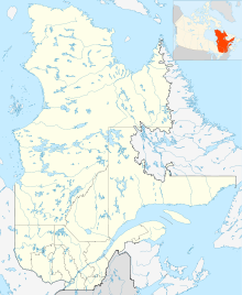
Montréal/Mascouche Airport IATA: none – ICAO: none – TC LID: CSK3 Summary Airport type Public Operator Corporation de l'aéroport de Mascouche Location Mascouche, Quebec Elevation AMSL 75 ft / 23 m Coordinates 45°43′07″N 073°35′53″W / 45.71861°N 73.59806°WCoordinates: 45°43′07″N 073°35′53″W / 45.71861°N 73.59806°W Map Location in Quebec Runways Direction Length Surface ft m 11/29 3,000 914 Asphalt Source: Canada Flight Supplement[1] Montréal/Mascouche Airport, (TC LID: CSK3), is a small, general aviation airport located 1.5 NM (2.8 km; 1.7 mi) southeast of Mascouche and approximately 20 km (12 mi) northeast of Montreal, Quebec, Canada. It is reached by Autoroute 640 at exit 44. The runway is parallel to Autoroute 640.
The mandatory frequency for this airport is 122.35 MHz.
The Mascouche airport is the largest "regional airport" in the province of Quebec, in terms of air traffic.[citation needed] It is located close to the Legardeur regional hospital and could be used for medical evacuations in the future. The airport regroups 30 buildings, 15 related SMEs (including Cargair Inc.) and sustains 75 full-time jobs. More than a hundred small planes are stationed there year-round.
There has been talks of closing down (or to privatize) the airport during the last decade, for various reasons: the land lots are well-located and are zoned industrial, the city is unwilling to invest in the airport, and the airport couldn't get funds from the government to build a control tower and to expand the runway's length. To counter the closure of the airport, users have founded a group (Mascouche Airport Owners and Pilots Association MAOPA). With more than 125 members, this dynamic group fights hard to keep the airport open, organizing many activities to stimulate the interest of the population about the airport.
See also
References
- ^ Canada Flight Supplement. Effective 0901Z 20 October 2011 to 0901Z 15 December 2011
External links
Airports in Canada By name A–B · C–D · E–G · H–K · L–M · N–Q · R–S · T–ZBy location indicator CA · CB · CC · CD · CE · CF · CG · CH · CI · CJ · CK · CL · CM · CN · CO · CP · CR · CS · CT · CV · CW · CY · CZBy province/territory National Airports System Calgary · Charlottetown · Edmonton · Fredericton · Gander · Halifax · Iqaluit · Kelowna · London · Moncton · Montréal-Mirabel · Montréal-Trudeau · Ottawa · Prince George · Québec · Regina · Saint John · St. John's · Saskatoon · Thunder Bay · Toronto · Vancouver · Victoria · Whitehorse · Winnipeg · YellowknifeRelated List of airports by ICAO code: C · List of defunct airports in Canada · List of heliports in Canada · List of international airports in Canada · National Airports System · Operation Yellow RibbonCategories:- Airports in Quebec
- Transportation in Montreal
- Transportation in Lanaudière
- Quebec airport stubs
Wikimedia Foundation. 2010.

