- Brownville, Nebraska
Infobox Settlement
official_name = Brownville, Nebraska
settlement_type = Village
nickname =
motto =
imagesize =
image_caption =
image_
imagesize =
image_caption =
image_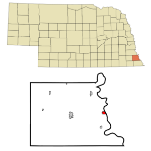
mapsize = 250px
map_caption = Location of Brownville, Nebraska
mapsize1 =
map_caption1 =subdivision_type = Country
subdivision_name =United States
subdivision_type1 = State
subdivision_name1 =Nebraska
subdivision_type2 = County
subdivision_name2 = Nemaha
government_footnotes =
government_type =
leader_title =
leader_name =
leader_title1 =
leader_name1 =
established_title =
established_date =unit_pref = Imperial
area_footnotes =area_magnitude =
area_total_km2 = 1.6
area_land_km2 = 1.6
area_water_km2 = 0.0
area_total_sq_mi = 0.6
area_land_sq_mi = 0.6
area_water_sq_mi = 0.0population_as_of = 2000
population_footnotes =
population_total = 146
population_density_km2 = 90.3
population_density_sq_mi = 233.9timezone = Central (CST)
utc_offset = -6
timezone_DST = CDT
utc_offset_DST = -5
elevation_footnotes =
elevation_m = 292
elevation_ft = 958
latd = 40 |latm = 23 |lats = 49 |latNS = N
longd = 95 |longm = 39 |longs = 34 |longEW = Wpostal_code_type =
ZIP code
postal_code = 68321
area_code = 402
blank_name = FIPS code
blank_info = 31-06750GR|2
blank1_name = GNIS feature ID
blank1_info = 0827698GR|3
website =
footnotes =Brownville is a village in Nemaha County,
Nebraska ,United States . The population was 146 at the 2000 census.History
Established in 1854 and incorporated in 1856, Brownville quickly became the largest town in what was then the
Nebraska Territory . It became an importantport on theMissouri River and grew to a population of 1,309 by 1880.The rise of the
railroad was ultimately Brownville's undoing. The railroads siphoned traffic away from the Missouri River'ssteamboat s. Brownville's attempt to secure a railroad of its own was severely botched and led to immensetax increases to pay the bonds for the failed venture. This drove most of the population away and led to the county seat being transferred to Auburn in 1885. [http://www.yourcountryneighbor.com/YCN/BHS150.pdf]Today, owing to its place in Nebraska history, Brownville is primarily a tourist attraction, with several old
house s having been opened for tours or converted tomuseum s.Art galleries and wineries in and near Brownville have also helped to make the town an increasingly attractive getaway for residents of the region's larger cities. TheBrownville Bridge over the Missouri River is on theNational Register of Historic Places .The
Cooper Nuclear Station is south of the city.In 1992-1993, the
Governor Furnas Arboretum was planted.Geography
Brownville is located at coor dms|40|23|49|N|95|39|34|W|city (40.397048, -95.659306)GR|1.
According to the
United States Census Bureau , the village has a total area of 0.6square mile s (1.6km² ), all of it land.Demographics
As of the
census GR|2 of 2000, there were 146 people, 74 households, and 40 families residing in the village. Thepopulation density was 233.9 people per square mile (90.9/km²). There were 106 housing units at an average density of 169.8/sq mi (66.0/km²). The racial makeup of the village was 99.32% White, and 0.68% from two or more races.There were 74 households out of which 20.3% had children under the age of 18 living with them, 44.6% were married couples living together, 5.4% had a female householder with no husband present, and 44.6% were non-families. 40.5% of all households were made up of individuals and 17.6% had someone living alone who was 65 years of age or older. The average household size was 1.97 and the average family size was 2.63.
In the village the population was spread out with 18.5% under the age of 18, 5.5% from 18 to 24, 19.2% from 25 to 44, 34.2% from 45 to 64, and 22.6% who were 65 years of age or older. The median age was 51 years. For every 100 females there were 117.9 males. For every 100 females age 18 and over, there were 108.8 males.
The median income for a household in the village was $34,375, and the median income for a family was $51,000. Males had a median income of $35,750 versus $28,438 for females. The
per capita income for the village was $20,928. There were 11.5% of families and 15.9% of the population living below thepoverty line , including 15.2% of under eighteens and 17.9% of those over 64.Business and industry
Brownville is home to one of Nebraska's two nuclear powerplants,
Cooper Nuclear Station , which is owned & operated by the Nebraska Public Power DistrictNotable people from Brownville
*
Thomas Tipton , one of the first two United States Senators from Nebraska, moved to Brownville in 1859 [ [http://bioguide.congress.gov/scripts/biodisplay.pl?index=T000286 Congressional biography] ] .
*Eugene Allen Gilmore -Governor-General of the Philippines in 1927.Cultural references
*
Willa Cather 's 1897 short story "A Resurrection " is set in Brownville, and it includes a description of the town.References
External links
* [http://www.brownville-ne.com/ Official website]
* [http://www.brownvillemills-ne.com/village/ Comprehensive website]
Wikimedia Foundation. 2010.