- North Park (Colorado basin)
-
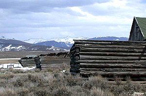 Log structure near Rand, Colorado, at the southern end of North Park. The view is southwards towards Willow Creek Pass.
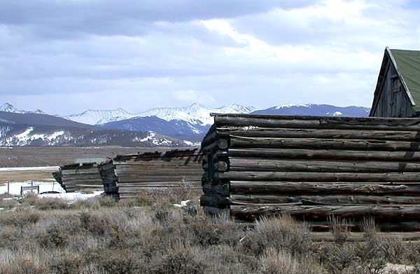
North Park is a high, sparsely populated basin (approximately 8800 ft in elevation) in the Rocky Mountains in north central Colorado in the United States. It encompasses a wide valley in Jackson County rimmed by mountain ranges at the headwaters of the North Platte River and several smaller tributaries, including the Michigan River, Illinois River, and Canadian River. The valley receives its name from being the northernmost of the three large mountain valleys (or parks) in Colorado on the western side of the Front Range. The others are Middle Park and South Park respectively.
The basin opens out northward into Wyoming, in the direction of flow of the North Platte. On the east side, it is rimmed by the Medicine Bow Mountains, the Never Summer Mountains and Rabbit Ears Range to the south, and the Park Range to the west. The continental divide rims the Park along the south and west. The primary economic activities in the valley are cattle ranching and timber harvesting, although the latter has declined substantially in recent decades. The largest community in the valley is Walden, the Jackson County seat, that sits near the middle of the valley near the confluence of the Michigan and Illinois rivers. Smaller communities in the valley include the unincorporated hamlets of Gould and Rand.
The valley is crossed east-west by State Highway 14, which enters from the east over Cameron Pass, providing a link to the Poudre Canyon and Fort Collins. Highway 14 enters from the west over Muddy Pass which provides access to Steamboat Springs, and to Middle Park in the valley of the Colorado River. It is crossed north-south by State Highway 125, which enters from the north (from Wyoming) along the course of the North Platte. It enters from the south over Willow Creek Pass, providing access to the upper end of Middle Park near Granby. The valley along the Illinois River is the location of the Arapaho National Wildlife Refuge.
Geology and mineral resources
The valley floor is underlain by Paleozoic and Mesozoic sedimentary rocks that form a structural basin. The stratigraphy is similar to that in adjacent basins such as the Green River Basin to the west and the Denver Basin to the east.
Petroleum has long been produced from anticinal traps of the Muddy Sandstone (Cretaceous) at North McCallum and South McCallum oil fields. In 2007, North Park produced 96 thousand barrels of oil and 1.3 billion cubic feet (BCF) of natural gas from 153 wells.[1] In 2008 EOG Resources announced great success in drilling and completing horizontal oil wells in the Cretaceous Niobrara Formation.[2]
References
- ^ Colorado Oil and Gas Conservation Commission Retrieved 8 December 2008.
- ^ "EOG expands North Park horizontal program," Rocky Mountain Oil Journal, 27 June 2008, p.4.
External links
Categories:- Geologic provinces of Colorado
- Valleys of Colorado
- Geography of Jackson County, Colorado
Wikimedia Foundation. 2010.