- Doniphan, Nebraska
-
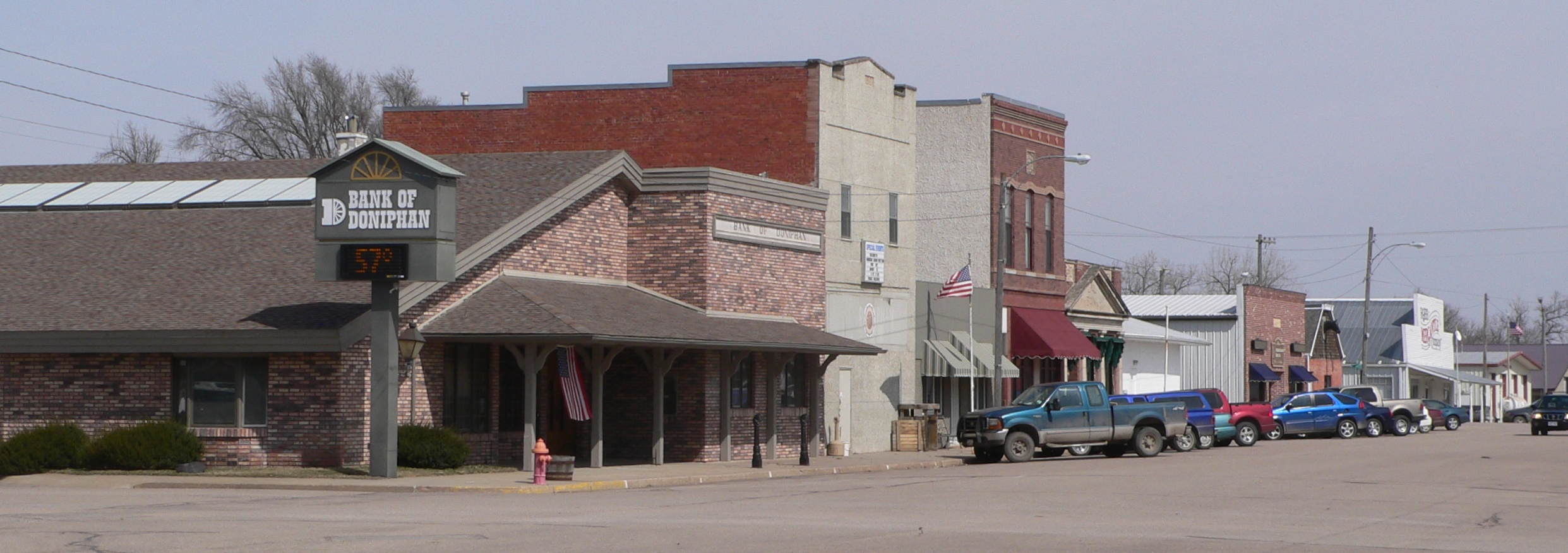
Doniphan, Nebraska — Village — Downtown Doniphan: West Main Street, seen from the southwest Location of Doniphan, Nebraska
Coordinates: 40°46′25″N 98°22′17″W / 40.77361°N 98.37139°WCoordinates: 40°46′25″N 98°22′17″W / 40.77361°N 98.37139°W Country United States State Nebraska County Hall Area – Total 0.5 sq mi (1.2 km2) – Land 0.5 sq mi (1.2 km2) – Water 0.0 sq mi (0.0 km2) Elevation 1,942 ft (592 m) Population (2000) – Total 763 – Density 1,654.6/sq mi (638.8/km2) Time zone Central (CST) (UTC-6) – Summer (DST) CDT (UTC-5) ZIP code 68832 Area code(s) 402 FIPS code 31-13365[1] GNIS feature ID 0828756[2] Doniphan is a village in Hall County, Nebraska, United States. The population was 763 at the 2000 census. It is part of the Grand Island, Nebraska Micropolitan Statistical Area. The town of Doniphan was platted by local pioneer William J. Burger in 1879 as a midway point between Hastings and Grand Island on the St. Joseph and Grand Island Railroad. It was named for Col. John Doniphan of Saint Joseph, Missouri, an attorney for the railroad.
Contents
Geography
Doniphan is located at 40°46′25″N 98°22′17″W / 40.77361°N 98.37139°W (40.773548, -98.371513)[3].
According to the United States Census Bureau, the village has a total area of 0.5 square miles (1.3 km2), all of it land.
Demographics
As of the census[1] of 2000, there were 763 people, 288 households, and 213 families residing in the village. The population density was 1,654.6 people per square mile (640.4/km²). There were 300 housing units at an average density of 650.6 per square mile (251.8/km²). The racial makeup of the village was 98.43% White, 0.39% Native American, 0.26% from other races, and 0.92% from two or more races. Hispanic or Latino of any race were 2.36% of the population.
There were 288 households out of which 41.7% had children under the age of 18 living with them, 55.2% were married couples living together, 15.3% had a female householder with no husband present, and 26.0% were non-families. 24.0% of all households were made up of individuals and 8.7% had someone living alone who was 65 years of age or older. The average household size was 2.58 and the average family size was 3.01.
In the village the population was spread out with 30.7% under the age of 18, 8.1% from 18 to 24, 29.2% from 25 to 44, 19.1% from 45 to 64, and 12.8% who were 65 years of age or older. The median age was 35 years. For every 100 females there were 85.2 males. For every 100 females age 18 and over, there were 77.5 males.
The median income for a household in the village was $36,985, and the median income for a family was $42,917. Males had a median income of $30,588 versus $19,904 for females. The per capita income for the village was $15,641. About 9.9% of families and 10.2% of the population were below the poverty line, including 12.1% of those under age 18 and 8.4% of those age 65 or over.
Economy
Agriculture is the heart of the region. It is supported by century old family farms, and businesses that service those farms. Many of the local residents work within in the town, and some travel to Grand Island and/or Hastings, Nebraska.
The Village contains several businesses, White Farms Trucking, Ag Services, Pioneer, and Bosselmans. The continued economic growth from these businesses provides tax revenues which support improvements to the roads, school, and beautification of the local buildings.
Others within Doniphan work for the local post office, the Doniphan-Trumbull school, several Doniphan Banks, and NPPD.
Due to the robustness of the agriculture sector, the region faces a lower than average unemployment rate compared to the National average.
References
- ^ a b "American FactFinder". United States Census Bureau. http://factfinder.census.gov. Retrieved 2008-01-31.
- ^ "US Board on Geographic Names". United States Geological Survey. 2007-10-25. http://geonames.usgs.gov. Retrieved 2008-01-31.
- ^ "US Gazetteer files: 2010, 2000, and 1990". United States Census Bureau. 2011-02-12. http://www.census.gov/geo/www/gazetteer/gazette.html. Retrieved 2011-04-23.
External links
Municipalities and communities of Hall County, Nebraska Cities 
Villages Categories:- Populated places in Hall County, Nebraska
- Villages in Nebraska
- Grand Island micropolitan area

Wikimedia Foundation. 2010.