- Newchurch, Monmouthshire
-
Coordinates: 51°40′29″N 2°47′22″W / 51.67460°N 2.78958°W
Newchurch Welsh: Yr Eglwys Newydd ar y Cefn 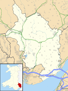
 Newchurch
Newchurch shown within MonmouthshireOS grid reference ST454976 Principal area Monmouthshire Ceremonial county Gwent Country Wales Sovereign state United Kingdom Post town CHEPSTOW Postcode district NP16 Dialling code 01291 Police Gwent Fire South Wales Ambulance Welsh EU Parliament Wales UK Parliament Monmouth List of places: UK • Wales • Monmouthshire Newchurch (Welsh: Yr Eglwys Newydd ar y Cefn, meaning "new church on the ridge") is an extensive rural parish and small hamlet in Monmouthshire, south east Wales, United Kingdom. It is located 6 miles south east of Usk and 6 miles north west of Chepstow, between the B4235 and B4293 roads.
Contents
History and amenities
Before the Norman conquest, the area was heavily forested as part of Wentwood. There is a Neolithic dolmen or burial chamber at Gaer-llwyd, 1 mile south west of the village close to the B4235.
In the early 12th century the Newchurch area was known as Plataland and was given by the Marcher lord of Striguil, or Chepstow, to Tintern Abbey. The monks cleared much of the land for farming, but in 1302 exchanged it with Roger Bigod, Earl of Norfolk, for land at Woolaston in what is now Gloucestershire.[1] The parish still contains much of Wentwood and also, to the east, Chepstow Park Wood south of Devauden.
Bigod built a church for the tenants of his land, which became known as Newchurch. The parish church is dedicated to St. Peter. It has some 14th century features but was largely rebuilt around 1865.[2]
The modern hamlet consists of little more than the church, three houses and a farm.
Cas Troggy
Cas (or Castell) Troggy is a small ruined fortified hunting lodge or manor house built by Roger Bigod around 1303. It is located within Newchurch parish, beside the Troggy (or Castrogi) Brook and the old road between Chepstow and Usk, on the northern slopes of Wentwood at Pen y cae-mawr. It was probably abandoned shortly after Bigod's death in 1306.[3][4] The 16th century antiquarian William Camden incorrectly referred to the ruins as Striguil, a mistake repeated on some later maps.
References
- ^ The Cistercian Way
- ^ John Newman, The Buildings of Wales: Gwent/Monmouthshire, 2000, ISBN 0-14-071053-1
- ^ Cas Troggy at The Gatehouse
- ^ Castell Troggy at CastleWales
External links
- Kelly's Directory of Monmouthshire from 1901
- St. Peter's church, Newchurch
- Genuki information on Newchurch, Mon.
- Geograph photos of the Newchurch area
Categories:- Villages in Monmouthshire
- Gwent geography stubs

Wikimedia Foundation. 2010.