- Cabool, Missouri
Infobox Settlement
official_name = Cabool, Missouri
settlement_type =City
nickname =
motto =
imagesize =
image_caption =
image_
imagesize =
image_caption =
image_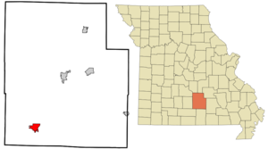
mapsize = 250px
map_caption = Location of Cabool, Missouri
mapsize1 =
map_caption1 =subdivision_type = Country
subdivision_name =United States
subdivision_type1 = State
subdivision_name1 =Missouri
subdivision_type2 = County
subdivision_name2 = Texas
government_footnotes =
government_type =
leader_title =
leader_name =
leader_title1 =
leader_name1 =
established_title =
established_date =unit_pref = Imperial
area_footnotes =area_magnitude =
area_total_km2 = 9.7
area_land_km2 = 9.6
area_water_km2 = 0.1
area_total_sq_mi = 3.8
area_land_sq_mi = 3.7
area_water_sq_mi = 0.0population_as_of = 2000
population_footnotes =
population_total = 2168
population_density_km2 = 225.4
population_density_sq_mi = 583.7timezone = Central (CST)
utc_offset = -6
timezone_DST = CDT
utc_offset_DST = -5
elevation_footnotes =
elevation_m = 391
elevation_ft = 1283
latd = 37 |latm = 7 |lats = 34 |latNS = N
longd = 92 |longm = 6 |longs = 13 |longEW = Wpostal_code_type =
postal_code =
area_code =
blank_name = FIPS code
blank_info = 29-10288GR|2
blank1_name = GNIS feature ID
blank1_info = 0749152GR|3
website =
footnotes =Cabool is a city in Texas County,
Missouri ,United States . The population was 2,168 at the 2000 census.Geography
Cabool is located at coor dms|37|7|34|N|92|6|13|W|city (37.126097, -92.103479)GR|1.
According to the
United States Census Bureau , the city has a total area of 3.8square mile s (9.7km² ), of which, 3.7 square miles (9.6 km²) of it is land and 0.04 square miles (0.1 km²) of it (1.07%) is water.Origin of name
The city was named after
Kabul ,Afghanistan , using an older English spelling of the name, in 1882. The British had just pulled out of Kabul at the end of theSecond Anglo-Afghan War in1881 . As local legend goes, one of the construction engineers who built the railroad through Cabool also worked on railroad construction in Afghanistan and thought this area of southern Texas County looked similar to the region of Kabul, Afghanistan. Prior to being called Cabool, the community was known as Cedar Bluff.Old Legends claim that Cabool was named after the Indian chief that lived there.
Demographics
As of the
census GR|2 of 2000, there were 2,168 people, 883 households, and 544 families residing in the city. Thepopulation density was 583.7 people per square mile (225.6/km²). There were 1,013 housing units at an average density of 272.7/sq mi (105.4/km²). The racial makeup of the city was 95.85% White, 0.23% African American, 0.83% Native American, 0.83% Asian, 0.09% Pacific Islander, 0.23% from other races, and 1.94% from two or more races. Hispanic or Latino of any race were 1.01% of the population.There were 883 households out of which 31.9% had children under the age of 18 living with them, 45.0% were married couples living together, 14.2% had a female householder with no husband present, and 38.3% were non-families. 34.5% of all households were made up of individuals and 19.9% had someone living alone who was 65 years of age or older. The average household size was 2.29 and the average family size was 2.94.
In the city the population was spread out with 27.2% under the age of 18, 6.5% from 18 to 24, 23.7% from 25 to 44, 18.8% from 45 to 64, and 23.9% who were 65 years of age or older. The median age was 40 years. For every 100 females there were 81.9 males. For every 100 females age 18 and over, there were 71.3 males.
The median income for a household in the city was $21,887, and the median income for a family was $29,154. Males had a median income of $26,625 versus $16,500 for females. The
per capita income for the city was $13,069. About 45.0% of families and 22.4% of the population were below thepoverty line , including 28.5% of those under age 18 and 18.8% of those age 65 or over.Historically, Texas County has consistently voted Democratic in elections, however, the southern end of the county has more competitive elections with nearly equal vote distribution between Democrats and Republicans.
In 2000, Cabool was the largest city in the largest geographic county (Texas County) in Missouri. The school district is the home of the "Bulldogs". Cabool High School is a historic native rock structure with the oldest buildings being constructed in 1932. At least one of the buildings on the high school campus was a project of the federal Works Projects Administration (WPA). Current Mayor is Edwin Hardy.
References
External links
Cabool R-IV School District & Cabool Current Weather [http://www.CaboolSafeSchools.org]
* [http://www.cityofcabool.com/ City of Cabool, Missouri]
Wikimedia Foundation. 2010.