- Dights Falls
-
Coordinates: 37°47′50″S 145°00′03″E / 37.79722°S 145.00083°E
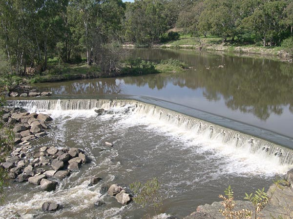
 Dights Falls on the Yarra River, Abbotsford.
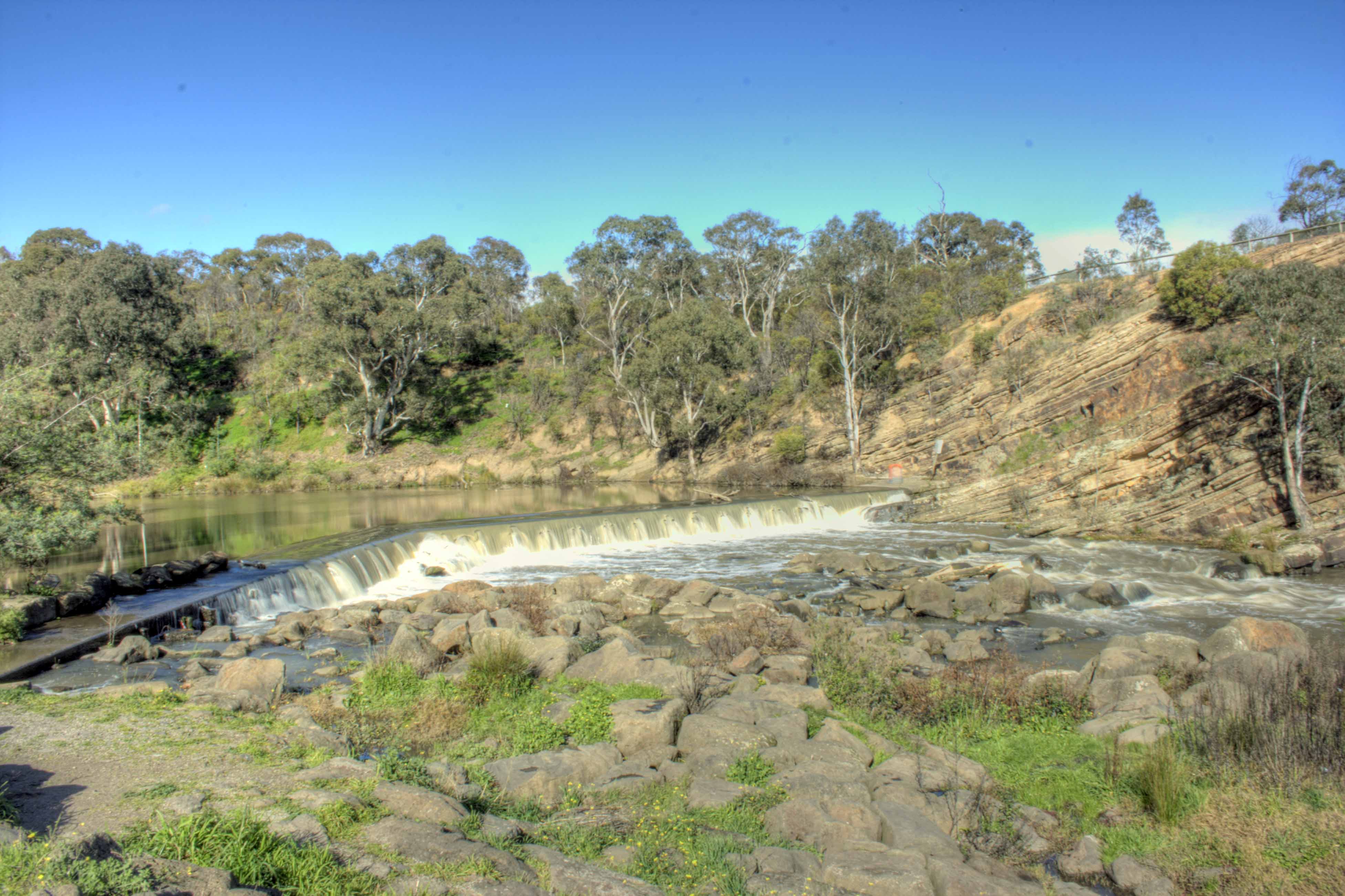
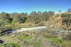 Dights Falls on the Yarra River showing the silurian sandstone hillside
Dights Falls (
 /ˈdaɪts/) is located in Melbourne, Victoria just downstream of the junction of the Yarra River with Merri Creek. At this point the river narrows and is constricted between 800,000 year old volcanic, basaltic lava flow and a much older steep, silurian, sedimentary spur. The north side also contains abundant graptolite fossils in sedimentary sandstone.[1][2]
Magpies occupy the area, and it is said that the Collingwood Football Club's use of the magpie mascot was inspired by the magpies at Dight's Falls.[3]
Prior to European settlement, the area was occupied by the indigenous Wurundjeri tribe of the Kulin nation. The rock falls would have provided the Aboriginal people with a natural river crossing and place to trap migrating fish. It was also a meeting place for many clans where they would trade, settle disputes and exchange brides.
In January 1803, Charles Grimes, the deputy surveyor-general of New South Wales, was sent to Port Phillip to survey the area.[4] Sailing on the schooner Cumberland, under the command of Acting Lieutenant Charles Robbins, the party entered Port Phillip on 20 January 1803. Grimes explored the Yarra by boat for several miles until he reached Dights Falls on 8 February.
On a ridge above the falls, 250 metres to the east, is an historic marker commemorating the "first white men to discover the river Yarra reaching Yarra Falls on 8th February, 1803. Also to make the first crossing near here with the cattle by the first overlanders John Gardiner, Joseph Hawdon and Captain John Hepburn in December 1836".
In the 1840s, an artificial weir was built on the natural bar of basalt boulders to provide water to the "Ceres" flour mill, one of the first in Victoria. Situated by the Yarra River in Collingwood is the industrial relic known locally as "Dight's Mill", one of Melbourne's oldest and most significant industrial sites. In the early 1840's John Dight established Melbourne's first water-powered flour mill on the site. In 1888 'Yarra Falls Roller Mills' built a water-turbine powered mill, which was the largest and most sophisticated of the thirty two water powered mills built in Victoria before 1900.[5]
The area can be readily accessed from the Yarra River Trail.
The rapid has been used many times for the Victorian Canoe Slalom Championships and has been used regularly for training by Australian Olympian Warwick Draper.
The falls are a major obstacle to fish migration up the Yarra River. A fish ladder was installed in 1993, but subsequent research found it "is not functioning adequately and will require modifications to improve its efficiency and effectiveness".[6] Melbourne Water have undertaken works from the end of 2010 to replace the weir and construct a new fishway to address this issue.[7]
External links
References
- ^ Merri Creek Geological Sites: Site 1 Studley Park/Dights Falls, Kew - Melbourne Formation, http://mcmc.org.au/index.php?option=com_content&view=article&id=150&Itemid=246, retrieved 2011-03-29
- ^ Yarra Bend Park - Geology, Park Notes, Parks Victoria, November 2007, http://www.parkweb.vic.gov.au/resources05/05_0497.pdf, retrieved 2011-03-31
- ^ Main, Jim (2008), Aussie Rules: For Dummies (Australia: Wiley): p. 181
- ^ Fleming, James (2002), Currey, John, ed., A journal of Grimes' survey : the Cumberland in Port Phillip January-February 1803, Malvern, Victoria: Banks Society Publications, pp. 43, ISBN 0949586102
- ^ "Dights Mill Site, Victorian Heritage Register (VHR) Number H1522, Heritage Overlay HO48,HO488". Victorian Heritage Database. Heritage Victoria. http://vhd.heritage.vic.gov.au/vhd/heritagevic#detail_places;2.
- ^ Zampatti, Brenton; Koster, Wayne; Crook, David (2003), Assessment of the Rock-Ramp Fishways at Dights Falls, Lower Yarra River, Melbourne, Freshwater Ecology Section, Arthur Rylah Institute for Environmental Research, ISBN 1741066077
- ^ Dights Falls Weir and Fishway Project, Melbourne Water, http://www.melbournewater.com.au/content/current_projects/rivers_creeks_and_wetlands/dights_falls_weir_and_fishway_project/dights_falls_weir_and_fishway_project.asp, retrieved 2011-07-29
Categories:- Geography of Melbourne
- Yarra River
- Victorian Heritage Register
Wikimedia Foundation. 2010.