- Maitland, Missouri
-
Maitland, Missouri — City — Location of Maitland, Missouri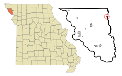
Coordinates: 40°12′5″N 95°4′32″W / 40.20139°N 95.07556°WCoordinates: 40°12′5″N 95°4′32″W / 40.20139°N 95.07556°W Country United States State Missouri County Holt Area – Total 0.3 sq mi (0.8 km2) – Land 0.3 sq mi (0.8 km2) – Water 0.0 sq mi (0.0 km2) Elevation 945 ft (288 m) Population (2000) – Total 342 – Density 1,179.7/sq mi (455.5/km2) Time zone Central (CST) (UTC-6) – Summer (DST) CDT (UTC-5) ZIP code 64466 Area code(s) 660 FIPS code 29-45596[1] GNIS feature ID 0730138[2] Maitland is a city in Holt County, Missouri, United States. The population was 342 at the 2000 census which at one point billed itself as the "Bluegrass Mecca" -- home to the largest bluegrass farm in the world.[3]
Contents
History
The town is named for John Skirving Maitland who was a surveyor for the Nodaway Valley Railroad (the construction company for the Kansas City, St. Joseph and Council Bluffs Railroad) that arrived in Maitland in 1880 when its superintendent John Fisk Barnard bought the land for the town from John S. and Delila Swope. The railroad would eventually be taken over by the Burlington Northern Railroad before eventually being abandoned.[4]
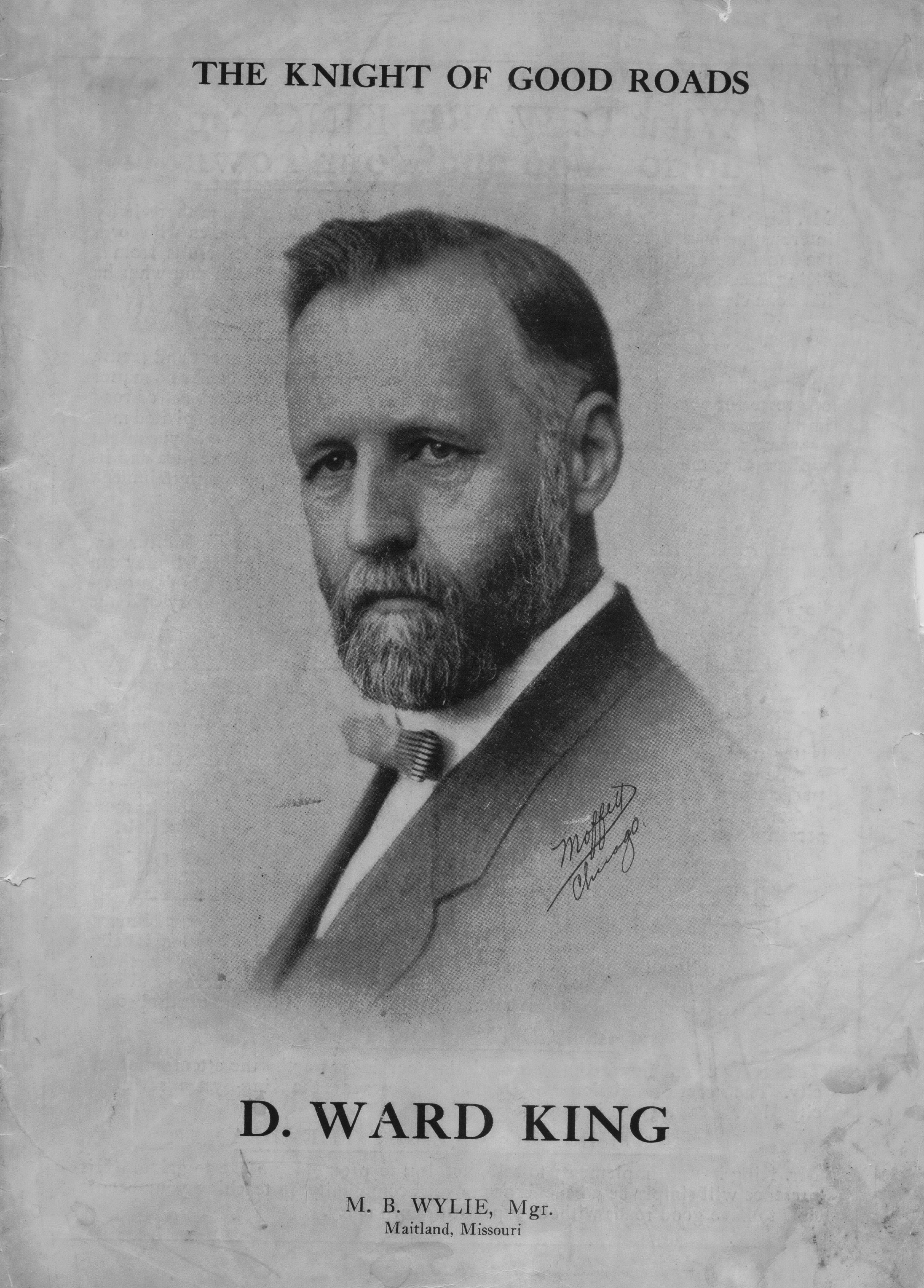
 David Ward King, Inventor of the King Road Drag
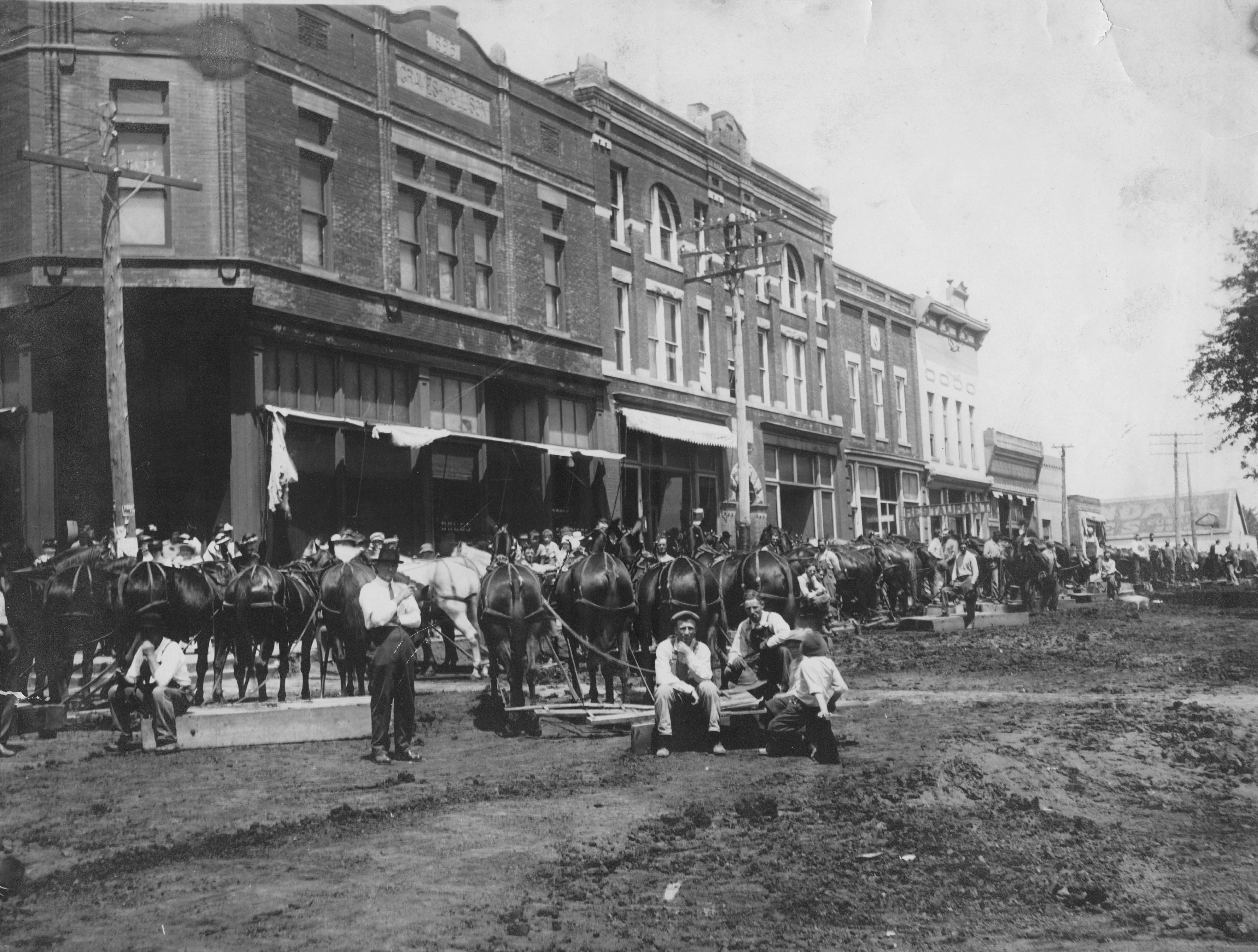
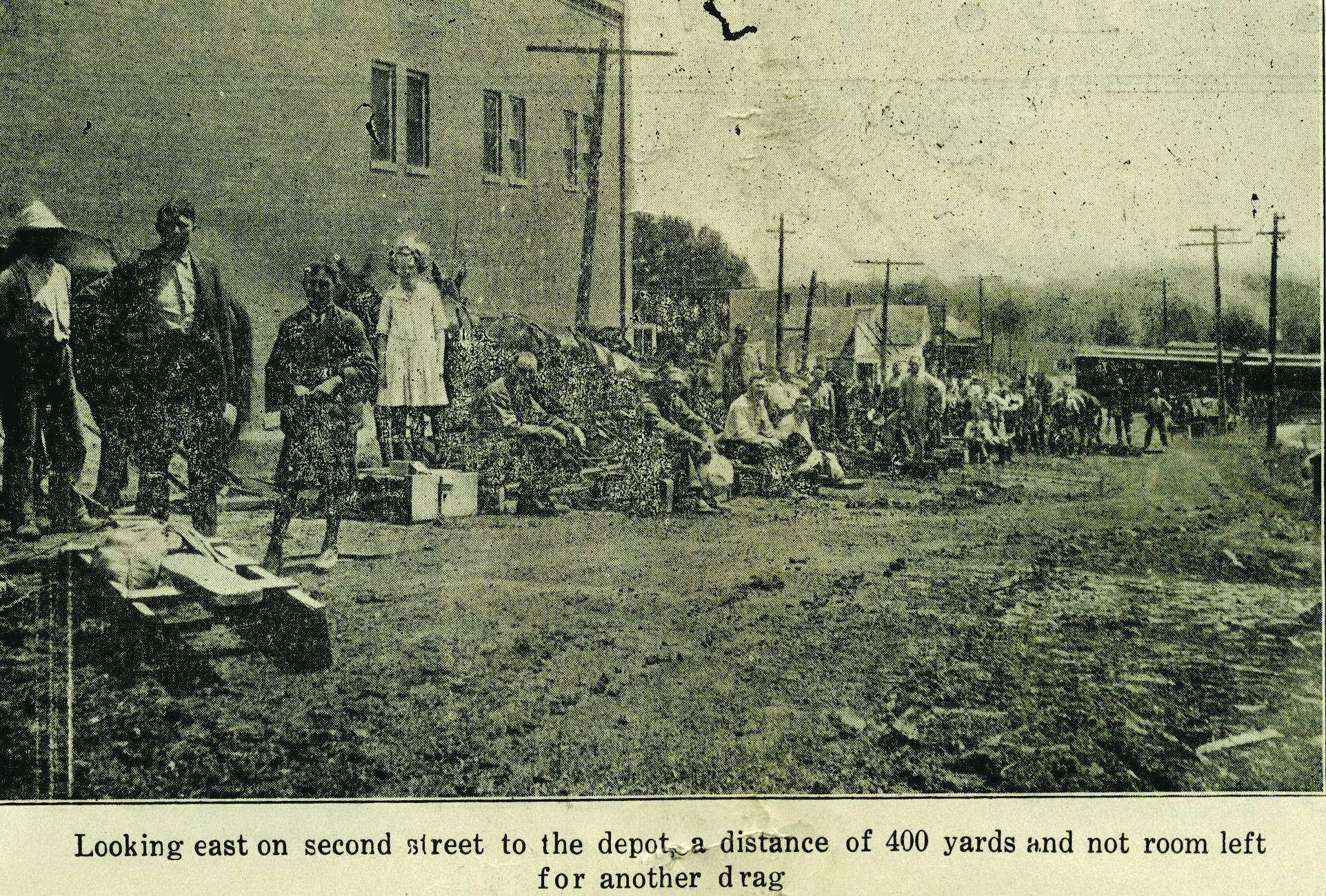
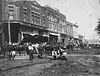 Road Dragging the Dirt Streets of Maitland in 1910
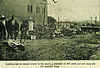 Drag Day in Maitland
The town is a farming community. One of the neighbor farmers was David Ward King, inventor and promoter of the King road drag -- an invention that essentially was two logs lashed together and dragged behind horse or mule teams that was an effective and inexpensive method to grade dirt roads. It was the horse drawn forerunner of the modern road grader. The invention came at the time Henry Ford started to mass produce automobiles. Before its invention, wet country roads became muck and were often nearly impassable. The use of the King Road Drag kept rural roads solid, even when wet, which made them passable all the time. These improved rural roads made possible both the advent of the automobile and rural mail delivery.[5]
In the first half of the 20th Century, Maitland claimed to have the largest bluegrass seed producing farm in the world. John Q. Weller was to claim that the 10,000,000 pounds (4,500,000 kg) of seed produced on his farm was more than the harvested seed output of the entire state of Kentucky.[6] In some years, Weller would get permission to pile up bumper crops of seed on the city streets. During the harvest time in late June/early July, the town hosted a Bluegrass festival.
Bluegrass seed production in the late 1950s/early 1960s moved to farming communities in Idaho, Oregon, and Washington. The Festival has been discontinued.
Geography
Maitland is located at 40°12′5″N 95°4′32″W / 40.20139°N 95.07556°W (40.201256, -95.075533)[7].
According to the United States Census Bureau, the city has a total area of 0.3 square miles (0.78 km2), all of it land.
Demographics
As of the census[1] of 2000, there were 342 people, 143 households, and 90 families residing in the city. The population density was 1,179.7 people per square mile (455.3/km²). There were 173 housing units at an average density of 596.7 per square mile (230.3/km²). The racial makeup of the city was 100.00% White. Hispanic or Latino of any race were 0.29% of the population.
There were 143 households out of which 32.2% had children under the age of 18 living with them, 48.3% were married couples living together, 8.4% had a female householder with no husband present, and 36.4% were non-families. 32.9% of all households were made up of individuals and 18.2% had someone living alone who was 65 years of age or older. The average household size was 2.39 and the average family size was 3.08.
In the city the population was spread out with 27.8% under the age of 18, 7.9% from 18 to 24, 24.3% from 25 to 44, 24.3% from 45 to 64, and 15.8% who were 65 years of age or older. The median age was 38 years. For every 100 females there were 112.4 males. For every 100 females age 18 and over, there were 102.5 males.
The median income for a household in the city was $31,250, and the median income for a family was $39,500. Males had a median income of $30,250 versus $18,750 for females. The per capita income for the city was $13,743. About 6.0% of families and 10.9% of the population were below the poverty line, including 13.3% of those under age 18 and 8.3% of those age 65 or over.
References
- ^ a b "American FactFinder". United States Census Bureau. http://factfinder.census.gov. Retrieved 2008-01-31.
- ^ "US Board on Geographic Names". United States Geological Survey. 2007-10-25. http://geonames.usgs.gov. Retrieved 2008-01-31.
- ^ Maitlandmo.com history
- ^ "Blue Grass Mecca", Biographical sketches from Maitland Centennial, 1980
- ^ Malcolm Gladwell, The New Yorker, December 6, 1999, Don't believe the Internet hype: the real E-commerce revolution happened off-line. Historic Importance of King Road Drag
- ^ Daily Capital News - Jefferson City, Missouri - July 10, 1937
- ^ "US Gazetteer files: 2010, 2000, and 1990". United States Census Bureau. 2011-02-12. http://www.census.gov/geo/www/gazetteer/gazette.html. Retrieved 2011-04-23.
External links
- Historic maps of Maitland in the Sanborn Maps of Missouri Collection at the University of Missouri
Municipalities and communities of Holt County, Missouri Cities Craig | Forest City | Maitland | Mound City | Oregon

Villages Unincorporated
communitiesCategories:- Cities in Holt County, Missouri


Wikimedia Foundation. 2010.