- Norborne, Missouri
-
Norborne, Missouri — City — Location of Norborne, Missouri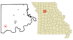
Coordinates: 39°18′8″N 93°40′34″W / 39.30222°N 93.67611°WCoordinates: 39°18′8″N 93°40′34″W / 39.30222°N 93.67611°W Country United States State Missouri County Carroll Area – Total 0.6 sq mi (1.6 km2) – Land 0.6 sq mi (1.6 km2) – Water 0.0 sq mi (0.0 km2) Elevation 689 ft (210 m) Population (2000) – Total 805 – Density 1,285.0/sq mi (496.1/km2) Time zone Central (CST) (UTC-6) – Summer (DST) CDT (UTC-5) ZIP code 64668 Area code(s) 660 FIPS code 29-52760[1] GNIS feature ID 0723412[2] Norborne is a city in Carroll County, Missouri, United States. The population was 805 at the 2000 census.
Norborne was founded in 1868 by Norborne B. Coates, a civil engineer for the railroad. The town has numerous small businesses, but is mostly an agricultural community. Norborne is the self-proclaimed Soybean Capital of the World and holds the Soybean Festival every year during the weekend of the second Saturday in August. The Festival begins on Thursday evening and concludes on Saturday night.
The traditional Soy Bean Festival will not be held in 2011 due to flooding.
In June 2009, Norborne, Missouri got hit by straight-line winds in excess of 74 mph (miles per hour) which severely damaged buildings, homes and property.[1][2]
Contents
Geography
Norborne is located at 39°18′8″N 93°40′34″W / 39.30222°N 93.67611°W (39.302268, -93.676040)[3].
According to the United States Census Bureau, the city has a total area of 0.6 square miles (1.6 km2), all of it land.
Demographics
As of the census[1] of 2000, there were 805 people, 358 households, and 220 families residing in the city. The population density was 1,285.0 people per square mile (493.4/km²). There were 404 housing units at an average density of 644.9 per square mile (247.6/km²). The racial makeup of the city was 95.16% White, 3.60% African American and 1.24% Native American. Hispanic or Latino of any race were 0.99% of the population.
There were 358 households out of which 28.2% had children under the age of 18 living with them, 50.0% were married couples living together, 6.4% had a female householder with no husband present, and 38.3% were non-families. 34.6% of all households were made up of individuals and 20.4% had someone living alone who was 65 years of age or older. The average household size was 2.25 and the average family size was 2.93.
In the city the population was spread out with 25.0% under the age of 18, 7.7% from 18 to 24, 24.2% from 25 to 44, 22.4% from 45 to 64, and 20.7% who were 65 years of age or older. The median age was 40 years. For every 100 females there were 90.3 males. For every 100 females age 18 and over, there were 81.9 males.
The median income for a household in the city was $25,208, and the median income for a family was $31,488. Males had a median income of $24,821 versus $18,393 for females. The per capita income for the city was $14,526. About 11.1% of families and 15.8% of the population were below the poverty line, including 21.1% of those under age 18 and 15.2% of those age 65 or over.
Notable natives
- Harold L. Wright Vice president, F. W. Woolworth Co.
- Bob Walkenhorst, singer, songwriter and former member of The Rainmakers
- Max Lane Former NFL offensive lineman, New England Patriots
Norborne's History
Norborne, Missouri was started as a railroad town. The first railroad to play an important part in the history of the area was the North Missouri Railroad. In 1862 the North Missouri Railroad was consolidated with the St. Louis, Kansas City and Northern Railroad. In 1879, another consolidation took place with the Wabash Railroad. The Santa Fe Railroad started its expansion east to Chicago, Illinois in 1874 and completed the route in 1878, forming the double tracks in Norborne. (Running from Carrollton, Missouri in the east to Hardin, Missouri in the west.)
Norborne B. Coates was born in Randolph County, Missouri, the son of Captain Thomas Coates, one of the earliest pioneer families of the Randolph County area. In 1868, Mr. Coates secured the position of land agent and surveyor for the North Missouri Railroad. He was also a notary public (with his signature on many old abstracts in Norborne). He came to the area in 1867 to contact owners of land and start negotiations for a right-of-way for the railroad. He surveyed land owned by John and Catherine Deitrich, purchased the railroad rights, then used his shrewd business talents to help plat a town on the site. Hence the name, NORBORNE. The town was incorporated in 1874 and reorganized under a new state law in 1878 to become a city of the fourth class. Norborne celebrated its centennial in 1968.
Education
School mascot is the Pirates.
References
- ^ a b "American FactFinder". United States Census Bureau. http://factfinder.census.gov. Retrieved 2008-01-31.
- ^ "US Board on Geographic Names". United States Geological Survey. 2007-10-25. http://geonames.usgs.gov. Retrieved 2008-01-31.
- ^ "US Gazetteer files: 2010, 2000, and 1990". United States Census Bureau. 2011-02-12. http://www.census.gov/geo/www/gazetteer/gazette.html. Retrieved 2011-04-23.
More references
External links
- Historic maps of Norborne in the Sanborn Maps of Missouri Collection at the University of Missouri
Municipalities and communities of Carroll County, Missouri Cities Bogard | Bosworth | Carrollton | De Witt | Hale | Norborne

Village Townships Carrollton | Cherry Valley | Combs | De Witt | Egypt | Eugene | Fairfield | Hill | Hurricane | Leslie | Moss Creek | Prairie | Ridge | Rockford | Stokes Mound | Sugartree | Trotter | Van Horn | Wakenda | Washington
Unincorporated
communityCategories:- Cities in Carroll County, Missouri
- Populated places established in 1868


Wikimedia Foundation. 2010.