- Mayersville, Mississippi
-
Mayersville, Mississippi — Town — Location of Mayersville, Mississippi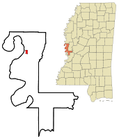
Coordinates: 32°54′4″N 91°3′2″W / 32.90111°N 91.05056°WCoordinates: 32°54′4″N 91°3′2″W / 32.90111°N 91.05056°W Country United States State Mississippi County Issaquena Area – Total 1.1 sq mi (2.9 km2) – Land 1.1 sq mi (2.9 km2) – Water 0.0 sq mi (0.0 km2) Elevation 105 ft (32 m) Population (2000) – Total 795 – Density 710.7/sq mi (274.4/km2) Time zone Central (CST) (UTC-6) – Summer (DST) CDT (UTC-5) ZIP code 39113 Area code(s) 662 FIPS code 28-46000 GNIS feature ID 0673260 Mayersville is a town in Issaquena County, Mississippi, United States. The population was 795 at the 2000 census. The town was named for David Mayer, on whose plantation the town was built. It is the county seat of Issaquena County[1]. One of its more famous natives is Unita Blackwell, Mississippi's first black female mayor, who was elected in 1977. She became president of the U.S. National Conference of Black Mayors.
Contents
Geography
Mayersville is located at 32°54′4″N 91°3′2″W / 32.90111°N 91.05056°W (32.901179, -91.050585)[2].
According to the United States Census Bureau, the town has a total area of 1.1 square miles (2.8 km2), none of which is covered by water.
Demographics
As of the census[3] of 2000, there were 795 people, 190 households, and 126 families residing in the town. The population density was 710.7 people per square mile (274.1/km²). There were 212 housing units at an average density of 189.5 per square mile (73.1/km²). The racial makeup of the town was 11.95% White, 88.05% Black or African American, and 0.13% Hispanic or Latino.
There were 190 households out of which 40.5% had children under the age of 18 living with them, 26.3% were married couples living together, 31.1% had a female householder with no husband present, and 33.2% were non-families. 31.1% of all households were made up of individuals and 13.7% had someone living alone who was 65 years of age or older. The average household size was 2.80 and the average family size was 3.53.
In the town the population was spread out with 26.4% under the age of 18, 16.0% from 18 to 24, 36.9% from 25 to 44, 13.7% from 45 to 64, and 7.0% who were 65 years of age or older. The median age was 29 years. For every 100 females there were 165.9 males. For every 100 females age 18 and over, there were 228.7 males.
The median income for a household in the town was $10,962, and the median income for a family was $15,208. Males had a median income of $20,917 versus $15,875 for females. The per capita income for the town was $7,287. About 41.6% of families and 49.9% of the population were below the poverty line, including 62.6% of those under age 18 and 51.4% of those age 65 or over.
Education
The town of Mayersville is served by the South Delta School District.
References
- ^ "Find a County". National Association of Counties. http://www.naco.org/Counties/Pages/FindACounty.aspx. Retrieved 2011-06-07.
- ^ "US Gazetteer files: 2010, 2000, and 1990". United States Census Bureau. 2011-02-12. http://www.census.gov/geo/www/gazetteer/gazette.html. Retrieved 2011-04-23.
- ^ "American FactFinder". United States Census Bureau. http://factfinder.census.gov. Retrieved 2008-01-31.
Municipalities and communities of Issaquena County, Mississippi County seat: MayersvilleCities Mayersville
Unincorporated
communitiesFitler | Grace | Valley Park
Categories:- Populated places in Issaquena County, Mississippi
- Mississippi populated places on the Mississippi River
- Towns in Mississippi
- County seats in Mississippi
- Populated places in Mississippi with African American majority populations


Wikimedia Foundation. 2010.