- New Houlka, Mississippi
-
New Houlka, Mississippi — Town — Nickname(s): H-Town Location of New Houlka, Mississippi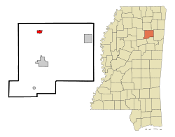
Coordinates: 34°2′11″N 89°1′12″W / 34.03639°N 89.02°WCoordinates: 34°2′11″N 89°1′12″W / 34.03639°N 89.02°W Country United States State Mississippi County Chickasaw Area – Total 1.2 sq mi (3.2 km2) – Land 1.2 sq mi (3.2 km2) – Water 0.0 sq mi (0.0 km2) Population (2000) – Total 710 – Density 581.7/sq mi (224.6/km2) Time zone Central (CST) (UTC-6) – Summer (DST) CDT (UTC-5) FIPS code 28-51420 New Houlka is a town in Chickasaw County, Mississippi, United States, which includes the older settlement of "old Houlka", the oldest white settlement in the county, established in 1812 at the intersection of the Natchez Trace and Gaines Trace, approximately one mile from the Chickasaw Indian Agency. The population was 710 at the 2000 census.
Contents
Geography
New Houlka is located at 34°02′11″N 89°01′12″W / 34.036422°N 89.020100°W.[1]
According to the United States Census Bureau, the town has a total area of 1.2 square miles (3.2 km²), all of it land.
Demographics
As of the census[2] of 2000, there were 710 people, 285 households, and 186 families residing in the town. The population density was 581.7 people per square mile (224.7/km²). There were 319 housing units at an average density of 261.3 per square mile (101.0/km²). The racial makeup of the town was 74.23% White, 24.79% African American, 0.56% from other races, and 0.42% from two or more races. Hispanic or Latino of any race were 1.97% of the population.
There were 285 households out of which 34.4% had children under the age of 18 living with them, 43.5% were married couples living together, 18.6% had a female householder with no husband present, and 34.7% were non-families. 31.9% of all households were made up of individuals and 17.5% had someone living alone who was 65 years of age or older. The average household size was 2.49 and the average family size was 3.16.
In the town the population was spread out with 29.4% under the age of 18, 7.9% from 18 to 24, 28.9% from 25 to 44, 19.3% from 45 to 64, and 14.5% who were 65 years of age or older. The median age was 34 years. For every 100 females there were 88.8 males. For every 100 females age 18 and over, there were 80.9 males.
The median income for a household in the town was $20,417, and the median income for a family was $28,958. Males had a median income of $22,353 versus $18,542 for females. The per capita income for the town was $10,812. About 20.0% of families and 24.7% of the population were below the poverty line, including 29.7% of those under age 18 and 26.4% of those age 65 or over.
Education
The Town of New Houlka is served by the Chickasaw County School District. It is the location of the Houlka Attendance Center, the only school in the district. The old Houlka High School building is still extant.
References
- ^ "US Gazetteer files: 2010, 2000, and 1990". United States Census Bureau. 2011-02-12. http://www.census.gov/geo/www/gazetteer/gazette.html. Retrieved 2011-04-23.
- ^ "American FactFinder". United States Census Bureau. http://factfinder.census.gov. Retrieved 2008-01-31.
Municipalities and communities of Chickasaw County, Mississippi Cities 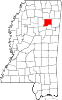
Towns New Houlka
Villages Unincorporated
communitiesCategories:- Populated places in Chickasaw County, Mississippi
- Towns in Mississippi


Wikimedia Foundation. 2010.