Mendocino Pass

Mendocino Pass
Mendocino Pass
Elevation c. 5,006 ft (1,524 m)
Traversed by US Forest Highway 7
Location
Location Glenn County, California, USA
Range Northern Coast Ranges
Coordinates 39°47′39″N 122°56′06″W / 39.79417°N 122.935°W / 39.79417; -122.935Coordinates: 39°47′39″N 122°56′06″W / 39.79417°N 122.935°W / 39.79417; -122.935
Topo map USGS Mendocino Pass

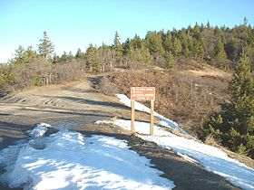
Mendocino Pass is a mountain pass located in the Northern Coast Ranges in California. The pass, in the extreme northwest corner of Glenn County, is at an elevation of about 5,006 feet (1,526 m) and at the gap, two dirt roads intersect.[1][2] One of them is US Forest Highway 7, a dirt road connecting two disjointed sections of State Route 162.[3] The pass and dirt roads are closed in winter due to heavy snowfall.[1][4]

References


Wikimedia Foundation. 2010.

Игры ⚽ Поможем написать реферат

Look at other dictionaries:

  • Mendocino Headlands State Park — is a California State Park in Mendocino, California. It consists of 347 acres (1.4 km2) of undeveloped seaside bluffs and islets surrounding the town of Mendocino, two beaches (Big River Beach and Portuguese Beach), and the much larger Big… …   Wikipedia

  • Mendocino Woodlands State Park — U.S. National Register of Historic Places U.S. National Historic Landmark …   Wikipedia

  • Mendocino National Forest — IUCN Category VI (Managed Resource Protected Area) Rattlesnake Creek …   Wikipedia

  • Mendocino County GMO Ban — Mendocino County, California was the first jurisdiction in the United States to ban the cultivation, production or distribution of genetically modified organisms (GMOs).[1] The ordinance, entitled Measure H, was passed by referendum on March 2,… …   Wikipedia

  • Mendocino Range — The Mendocino Range is one of several coastal mountain ranges which compose the Pacific Coast Range. This massive range of coastal mountains was formed during a period of coastal orogeny, millions of years ago. The Mendocino Range is a component… …   Wikipedia

  • California State Route 162 — Infobox road state=CA type=SR route=162 section=462 maint=Caltrans length mi= length round= length ref=fact established= direction a=West terminus a=jct|state=CA|US|101 at Longvale junction=jct|state=CA|FH|7|nolink1=yes near Covelo… …   Wikipedia

  • Anthony Peak (California) — Infobox Mountain Name = Anthony Peak Photo = Caption = Elevation = 6,954 ft (2,120 m) Prominence = 1,514 ft (462 m) Location = Mendocino County, California, USA Range = Central Northern California Coast Range Coordinates =… …   Wikipedia

  • List of peaks named Baldy — There are a number of peaks named Baldy: Contents 1 Canada 2 United States 2.1 Peaks named Baldy 2.2 Peaks named Baldy Mountain …   Wikipedia

  • Black Butte (Glenn County, California) — Infobox Mountain Name = Black Butte Photo = Caption = Elevation = 7,448 ft (2,270 m) Prominence = 2,436 ft (742 m) Location = Glenn County, California, USA Range = Central Northern California Coast Range Coordinates =… …   Wikipedia

  • U.S. Route 101 in California — This article is about the section of U.S. Route 101 in California. For the entire length of the highway, see U.S. Route 101. U.S. Route 101 …   Wikipedia

Share the article and excerpts

Direct link
Do a right-click on the link above
and select “Copy Link”