- Devilsmother
-
Devilsmother Magairlí an Deamhain 
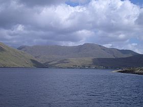
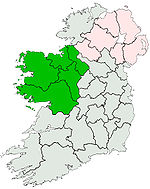
Elevation 645 m (2,116 ft) Prominence 280 m (919 ft) Listing Hewitt, Marilyn Location Location border of County Galway and Mayo, Republic of Ireland Range Connemara Coordinates Latitude: 53.600399 Longitude: -9.638164 Topo map OSi Discovery 37 OSI/OSNI grid L915624 Devilsmother (Irish: Magairlí an Deamhain meaning "demon’s testicles"), also known as Binn Gharbh (meaning "rough peak"),[1] is a small (645 m) mountain in Connemara, Ireland. It is just off the edge of the Maumturks chain and overlooks the Western Way long distance path.
Coordinates: 53°36′01″N 9°38′23″W / 53.60039°N 9.63967°W
References
- ^ "Devilsmother". Mountain Views. http://mountainviews.ie/mv/index.php?mtnindex=202. Retrieved 6 March 2009.
Mountains and hills of Connacht List of mountains in Ireland Achill Island 
Dartry Mountains Benbulbin • TruskmoreMaumturks Nephin Range Ox Mountains KnockalongyPartry Mountains Devilsmother • MaumtrasnaSheeffry Range Twelve Bens Others Categories:- Untranslated Irish place names
- Mountains and hills of County Galway
- Mountains and hills of County Mayo
- Hewitts of Ireland
- Marilyns of Ireland
- County Galway geography stubs
- County Mayo geography stubs
Wikimedia Foundation. 2010.
