- Croaghaun
-
Croaghaun 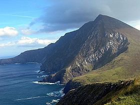
Elevation 688 m (2,257 ft) [1] Prominence 688 m (2,257 ft) Parent peak None Listing Marilyn, Hewitt Translation little stack (Irish) Location Location Mayo,  Ireland
Range Achill Island OSI/OSNI grid F553060 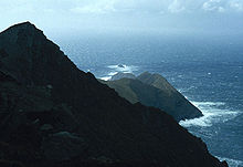 Cliffs of Croaghaun, looking towards Achill Head
 Not to be confused with Croghan Hill.
(For Croaghaun in the Blackstairs Mountains see Blackstairs Mountains)
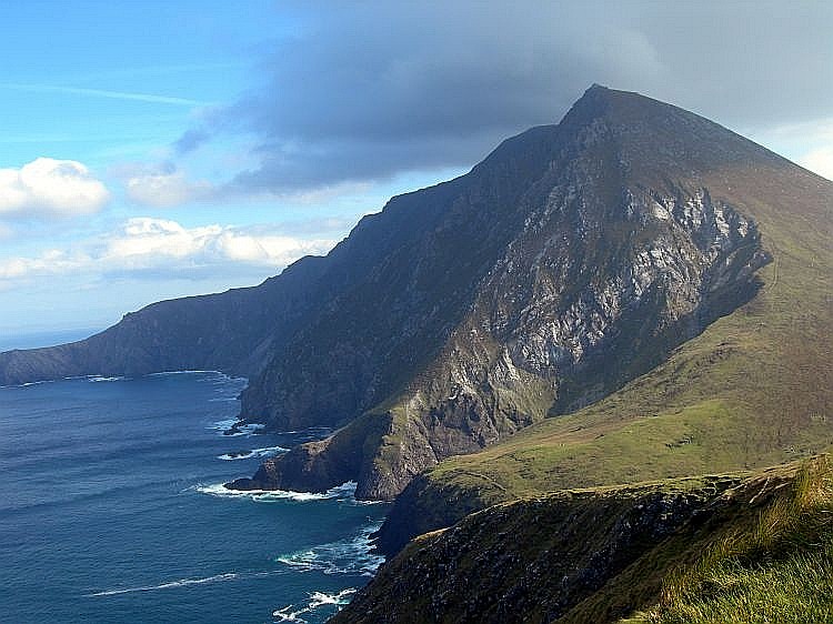
Croaghaun (Irish: Cruachán) is a mountain in County Mayo, Ireland. At 688 metres (2,257 ft), it has the highest cliffs in Ireland and the second highest sea cliffs in Europe (after Hornelen, Norway).[citation needed]
Croaghaun is the most westerly peak of Achill Island, and its highest mountain. Its cliffs lie on the northern slope of the mountain. The cliffs at Croaghaun can only be seen by hiking around or to the summit of the mountain, or from the sea. They are part of a sequence of sheer rock faces which start south of Keem Bay and loop around the uninhabited northwest of the island, by Achill Head and Saddle Head, and east to Slievemore, occasionally dropping vertically into the waters of the Atlantic Ocean. The views from the top of the cliffs are breathtaking, and the unusual corries and unique rock types make this location desirable to hikers. The cliffs are not reachable by car and visitors must either park at Keem beach and trek from there; park at the supply lake on the way to Keem bay; or go by boat.
The Croaghaun cliffs are home to two families of peregrine falcons (RTÉ, 2008). September and October are the best time to see the fastest creatures on earth here, as they teach their young to fly. Metamorphic, quartz laden gems may be observed, along with Mediterranean heathers and the waters of the Atlantic. It is common to see shoals of bottle-nosed dolphins, and basking sharks, once a source of revenue for Achill Island (BBC, 2009). Porpoises are found in large numbers. Killer whales, humpbacks, and other whales have been sighted. [2]
References
- "Croaghaun". Peakbagger.com. http://www.peakbagger.com/peak.aspx?pid=8976.
- "Croaghaun". MountainViews.ie.
Coordinates: 53°58′52″N 10°12′14″W / 53.981°N 10.204°W
Mountains and hills of Connacht List of mountains in Ireland Achill Island Croaghaun • Slievemore
Dartry Mountains Benbulbin • TruskmoreMaumturks Nephin Range Ox Mountains KnockalongyPartry Mountains Sheeffry Range Twelve Bens Benbaun • Bencorr • ErrisbegOthers Categories:- Achill Island
- Mountains and hills of County Mayo
- Special Areas of Conservation in the Republic of Ireland
- County Mayo geography stubs

Wikimedia Foundation. 2010.