- Okabena, Minnesota
-
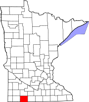
Okabena, Minnesota — City — Location of Okabena, Minnesota
Coordinates: 43°44′24″N 95°18′57″W / 43.74°N 95.31583°W Country United States State Minnesota County Jackson Government – Type Mayor – Council – Mayor Kevin Nelson Area – Total 0.2 sq mi (0.5 km2) – Land 0.2 sq mi (0.5 km2) – Water 0.0 sq mi (0.0 km2) Elevation 1,421 ft (433 m) Population (2010)[1] – Total 188 – Density 893.3/sq mi (344.9/km2) Time zone Central (CST) (UTC-6) – Summer (DST) CDT (UTC-5) ZIP code 56161 Area code(s) 507 FIPS code 27-48184[2] GNIS feature ID 0657662[3] Okabena is a town in Jackson County, Minnesota, United States. The population was 188 at the 2010 census.[1] The community's name is a Dakota term meaning "the nesting place of herons."[4]
Contents
History
Most of the original settlers were driven out in 1862 due to the Dakota War, but settlers began returning after the Civil War.
On May 19, 1933, the Okabena Bank was robbed by Bonnie and Clyde. After leaving the bank, they were shot at many times, but escaped on a country road with approximately $2500.[5][6][7]
Geography
According to the United States Census Bureau, the city has a total area of 0.2 square miles (0.52 km2), all of it land.
The community is located on County Roads 9 and 20 west of South Heron Lake.
Demographics
As of the census[2] of 2000, there were 185 people, 76 households, and 49 families residing in the city. The population density was 893.3 people per square mile (340.1/km²). There were 87 housing units at an average density of 420.1 per square mile (160.0/km²). The racial makeup of the city was 100.00% White. Hispanic or Latino of any race were 6.49% of the population.
There were 76 households out of which 28.9% had children under the age of 18 living with them, 52.6% were married couples living together, 7.9% had a female householder with no husband present, and 35.5% were non-families. 32.9% of all households were made up of individuals and 19.7% had someone living alone who was 65 years of age or older. The average household size was 2.43 and the average family size was 3.08.
In the city the population was spread out with 29.2% under the age of 18, 7.6% from 18 to 24, 25.9% from 25 to 44, 15.1% from 45 to 64, and 22.2% who were 65 years of age or older. The median age was 35 years. For every 100 females there were 101.1 males. For every 100 females age 18 and over, there were 98.5 males.
The median income for a household in the city was $32,188, and the median income for a family was $35,500. Males had a median income of $28,438 versus $19,375 for females. The per capita income for the city was $14,332. None of the families and 1.5% of the population were living below the poverty line.
Politics
Okabena is located in Minnesota's 1st congressional district, represented by Mankato educator Tim Walz, a Democrat. At the state level, Okabena is located in Senate District 22, represented by Republican Doug Magnus, and in House District 22B, represented by Republican Rod Hamilton.
References
- ^ a b "2010 Census Redistricting Data (Public Law 94-171) Summary File". American FactFinder. United States Census Bureau. http://factfinder2.census.gov/faces/tableservices/jsf/pages/productview.xhtml?pid=DEC_10_PL_GCTPL2.ST13&prodType=table. Retrieved 27 April 2011.
- ^ a b "American FactFinder". United States Census Bureau. http://factfinder.census.gov. Retrieved 2008-01-31.
- ^ "US Board on Geographic Names". United States Geological Survey. 2007-10-25. http://geonames.usgs.gov. Retrieved 2008-01-31.
- ^ "Minnesota Place Names - Township and Village Information". Minnesota Historical Society. http://mnplaces.mnhs.org/upham/city.cfm?PlaceNameID=2254&BookCodeID=6&County=32&SendingPage=Results.cfm. Retrieved 30 April 2011.
- ^ Ramsey, Winston G., ed. (2003). On The Trail of Bonnie and Clyde. London: After The Battle Books. ISBN 1870067517.
- ^ "On the Trail of Bonnie and Clyde Then and Now"
- ^ "My Life with Bonnie and Clyde" by Blanche Caldwell Barrow, Esther L. Weiser
External links
Municipalities and communities of Jackson County, Minnesota Cities Alpha | Heron Lake | Jackson | Lakefield | Okabena | Wilder
Townships Alba | Belmont | Christiania | Delafield | Des Moines | Enterprise | Ewington | Heron Lake | Hunter | Kimball La Crosse | Middletown | Minneota | Petersburg | Rost | Round Lake | Sioux Valley | Weimer | West Heron Lake | Wisconsin
Unincorporated
communitiesCoordinates: 43°44′22″N 95°18′57″W / 43.73944°N 95.31583°W
Categories:- Populated places in Jackson County, Minnesota
- Cities in Minnesota


Wikimedia Foundation. 2010.