- Mount Egerton, Victoria
-
Mount Egerton
Victoria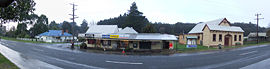
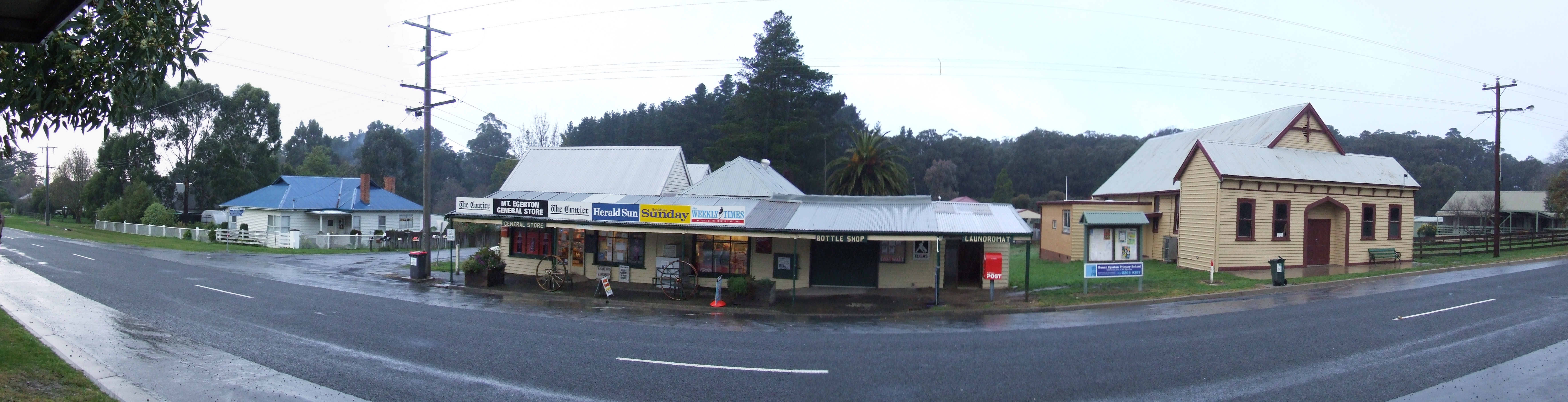
Mount Egerton General Store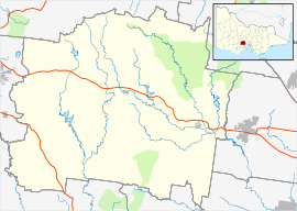
 Mount Egerton
Population: 215[1] Postcode: 3352 Location: LGA: Shire of Moorabool State District: Ballarat East Federal Division: Ballarat Mount Egerton is a town in Victoria, Australia. The town is located in the Shire of Moorabool Local Government Area, 97 kilometres (60 mi) north west of the state capital, Melbourne. At the 2006 census, Mount Egerton had a population of 215.[1]
European settlement began in Mount Egerton in 1853 with the discovery of gold at All Nations Gully.[2] The Post Office opened on 1 February 1856 and closed in 1993. [3]
The Mount Egerton General Store was redeveloped into a fish and chip shop, Bottle O and laundromat in 1996, with the old bank being removed to make way. The shop closed in May 2010, and the premises are now used as a private residence.
Mount Egerton also has a primary school. This opened on November 6th, 1877 and has a history of more than 130 years.[4]
The home ground of Ballan United Soccer Club and the Moorabool Panthers Soccer Club is formally known as the Mt Egerton Recreation Reserve.
References
- ^ a b Australian Bureau of Statistics (25 October 2007). "Mount Egerton (L) (Urban Centre/Locality)". 2006 Census QuickStats. http://www.censusdata.abs.gov.au/ABSNavigation/prenav/LocationSearch?collection=Census&period=2006&areacode=UCL235580&producttype=QuickStats&breadcrumb=PL&action=401. Retrieved 2007-10-28.
- ^ "Welcome to MtEgerton.com". MtEgerton.com. http://www.mtegerton.com/. Retrieved 2007-10-28.
- ^ Premier Postal History. "Post Office List". https://www.premierpostal.com/cgi-bin/wsProd.sh/Viewpocdwrapper.p?SortBy=VIC&country=. Retrieved 2008-04-11
- ^ "Mt Egerton Primary School". MtEgerton.com. http://www.mtegerton.com/cb_pages/resource_school.php. Retrieved 2010-10-07.
Coordinates: 37°37′S 144°06′E / 37.617°S 144.1°E
Towns in the Shire of Moorabool Bacchus Marsh • Ballan • Balliang • Balliang East • Barkstead • Barrys Reef • Beremboke • Blackwood • Blakeville • Bolwarrah • Bullarook • Bullarto South • Bunding • Bungal • Bungaree • Buninyong • Cargerie • Clarendon • Claretown • Clarkes Hill • Coimadai • Colbrook • Dales Creek • Darley • Dunnstown • Durham Lead • Elaine • Fiskville • Glenmore • Glen Park • Gordon • Greendale • Grenville • Hopetoun Park • Ingliston • Korobeit • Korweinguboora • Lal Lal • Leigh Creek • Lerderderg • Long Forest Maddingley • Millbrook • Meredith • Merrimu • Mollongghip • Morrisons • Mount Doran • Mount Egerton • Mount Wallace • Myrniong • Navigators Parwan • Pentland Hills • Pootilla • Rowsley • Scotsburn • Spargo Creek • Springbank • Trentham • Wallace • Warrenheip • Watten Flat • Yendon
Categories:- Towns in Victoria (Australia)
- Victoria (Australia) geography stubs

Wikimedia Foundation. 2010.