- Mount Edgecumbe (Alaska)
-
For other mountains named Edgecumbe, see Mount Edgecumbe (disambiguation).
Mount Edgecumbe 
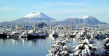
Mount Edgecumbe in December 2004.Elevation 3,201 ft (976 m) Prominence 3,201 ft (976 m) Location Location Kruzof Island, Sitka City and Borough, Alaska, USA Coordinates 57°03′05″N 135°45′31″W / 57.05139°N 135.75861°WCoordinates: 57°03′05″N 135°45′31″W / 57.05139°N 135.75861°W Topo map USGS Sitka A-6 Geology Type Dacite stratovolcano Age of rock < 600,000 yr Last eruption 2220 BC ±100 years Climbing First ascent 1803 by Urey Lisianski Easiest route Hike  A view toward Mount Edgecumbe
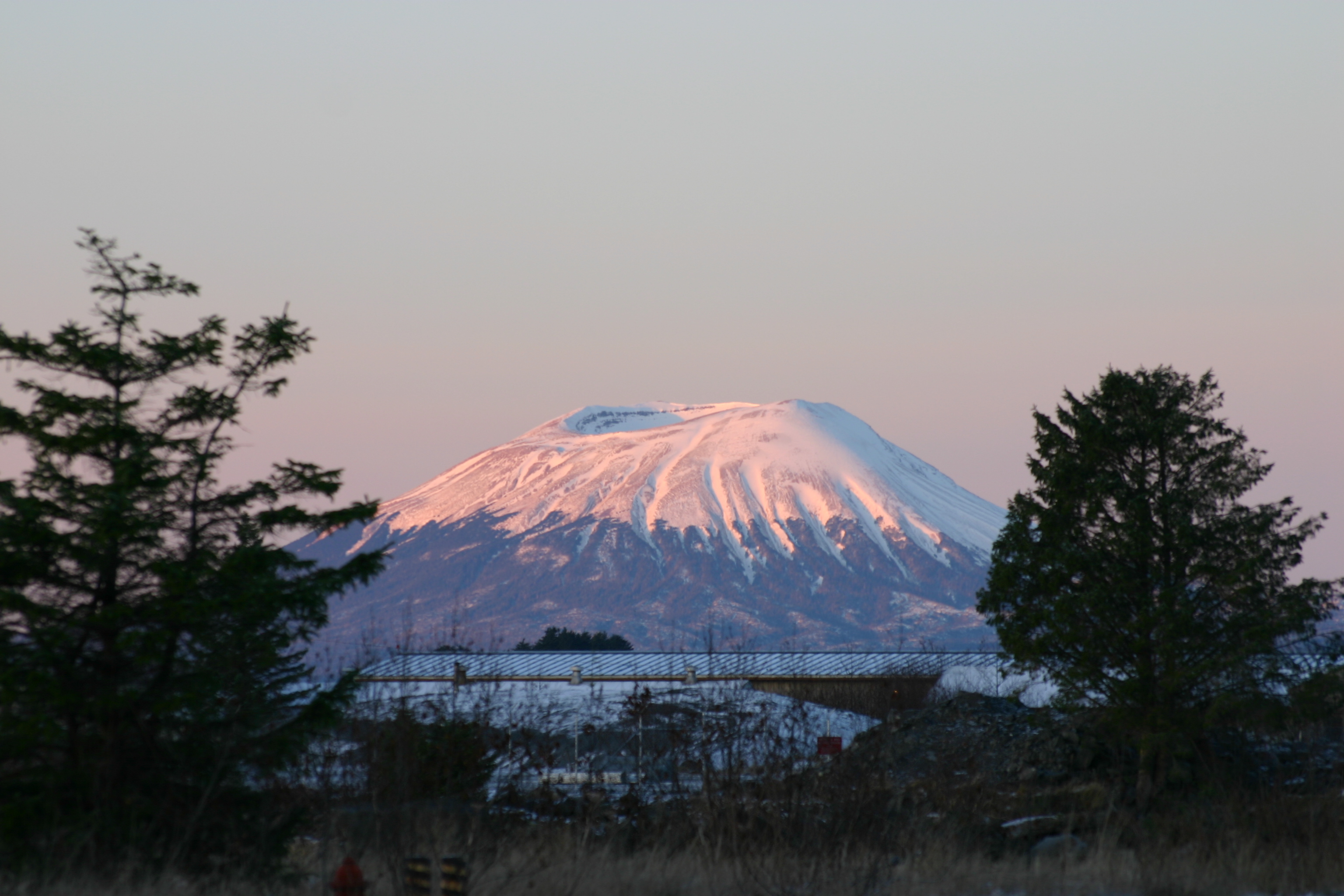
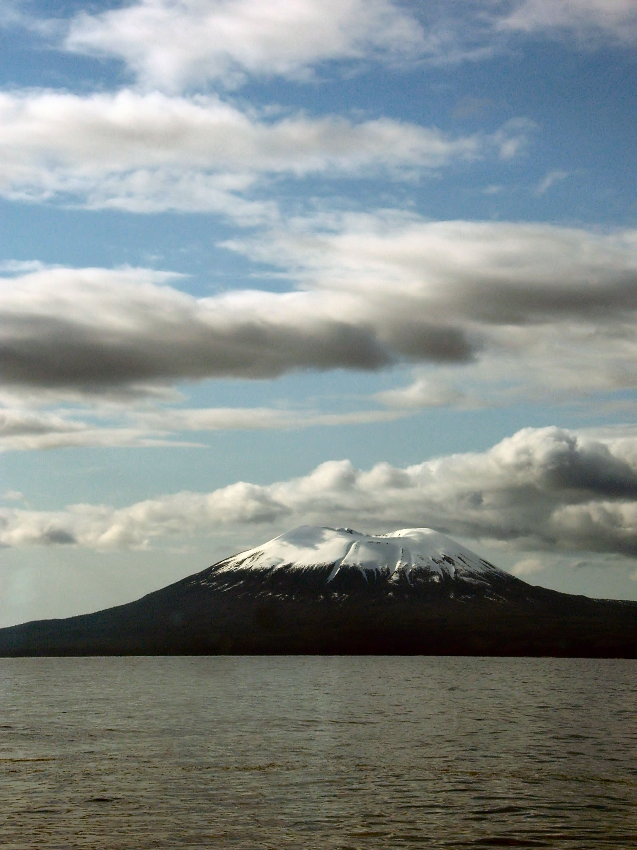
 A snow-capped Mount Edgecumbe, with its companion Crater Ridge, as viewed from nearby Baranof Island.
Mount Edgecumbe is the current name of a dormant volcano located at the southern end of Kruzof Island, Alaska, of which it is the highest point. In the Tlingit language it is called L’ux.[1] Mt. Edgecumbe is a local landmark and a tourist attraction.
Naming
Mount Edgecumbe was named by British Captain James Cook in 1778 after a hill overlooking Plymouth Harbor, England, or possibly for George, Earl of Edgcumbe.[2] It had previously been named Montaña de San Jacinto (to La Pérouse "Mount Saint Hyacinth") in 1775 by Spanish explorer Juan de la Bodega to honor the saint whose day it was.[3]
Ascent
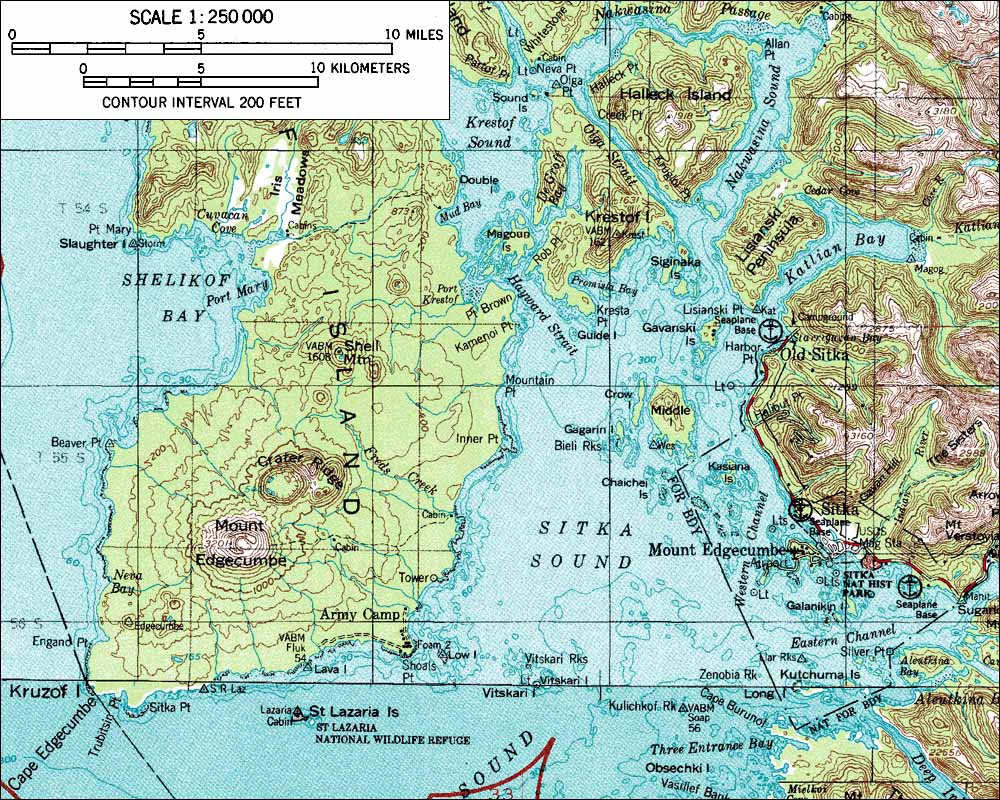
Mount Edgecumbe can be easily ascended in a day hike. Although finding marine transportation from the nearby town of Sitka to Kruzof Island is often the biggest obstacle, once hikers reach the island and the Mt. Edgecumbe's trailhead of Fred's Creek, the trip to the base of volcano is relatively flat while passing through open expanses of muskeg. There is a three-sided shelter at about mile 3.5, halfway to the mountain and a small campsite right before the final ascent . At about mile six, the climb begins. Soon tree line is achieved and a series of posts guide hikers through the scree if there is bad weather. The top is barren and often windy.
The trail and original cabin were constructed by the Civilian Conservation Corps.
Eruptions
False eruption
On April 1, 1974, a local prankster named Porky Bickar flew in and ignited 100 old tires in the crater, convincing nearby residents of Sitka, Alaska that the volcano was erupting.[5][6]
See also
References
- ^ Joseph, Charlie; Brady, I.; Makinen, E.; David, R.; Davis, V.; Johnson, A.; Lord, N. (2001). "Sheet’kwaan Aani Aya". Sitka Tribe of Alaska. http://www.sitkatribe.org/placenames/. Retrieved 27 October 2009.
- ^ Wagner, Henry (1937). The Cartography of the Northwest Coast of America to the Year 1800. Berkeley: University of California Press. pp. 385.
- ^ Orth, Donald J. (1967). Dictionary of Alaska Place Names, Geological Survey, Professional Paper 567. Washington: United States Government Printing Office.
- ^ "Mount Edgecumbe". Global Volcanism Program, Smithsonian Institution. http://www.volcano.si.edu/world/volcano.cfm?vnum=1105-04-.
- ^ Boese, Alex. "April 1, 1974". Museum of Hoaxes. http://www.museumofhoaxes.com/af_1974.html. Retrieved 2007-06-25.
- ^ Cushing, Ed. "Photo of Mount Edgecumbe eruption April Fool's prank". Sitka Alaska Information and Resources. http://www.sitka.com/Porky/porky2.htm. Retrieved 2009-03-13.
External links
Categories:- Mountains of Alaska
- Volcanoes of Alaska
- Dormant volcanoes
- Stratovolcanoes
- Landforms of Sitka City and Borough, Alaska
- Civilian Conservation Corps in Alaska

Wikimedia Foundation. 2010.