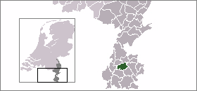
- Nuth
-
Nuth
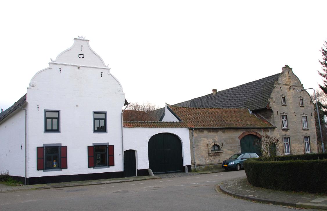
Nut— Municipality — Arensgenhout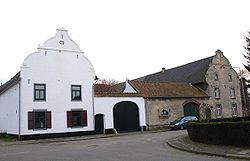

Flag
Coat of arms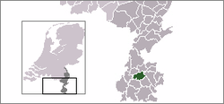
Coordinates: 50°55′N 5°53′E / 50.917°N 5.883°E Country Netherlands Province Limburg Area(2006) - Total 33.17 km2 (12.8 sq mi) - Land 33.15 km2 (12.8 sq mi) - Water 0.03 km2 (0 sq mi) Population (1 January 2007) - Total 15,844 - Density 478/km2 (1,238/sq mi) Source: CBS, Statline. Time zone CET (UTC+1) - Summer (DST) CEST (UTC+2) Nuth (
 pronunciation (help·info)) (Limburgish: Nut) is a municipality and a village in the Dutch province of Limburg, situated in the southern Netherlands.
The village Nuth has 5,548 inhabitants, and is with that the largest village of the municipality. The town hall of the municipality Nuth is also situated in the village Nuth. The other villages in the municipality are Hulsberg with 4,300 inhabitants, Schimmert with 3,339, Wijnandsrade with 1,812 and Vaesrade with 1,027 inhabitants (data: 1-1-2005). The other population centres belong to one of the following villages.
Contents
Population centres
Aalbeek, Arensgenhout, Grijzegrubben, Helle, Hellebroek, Hulsberg, Laar, Schimmert, Swier, Terstraten, Vaesrade, Wijnandsrade.
Transportation
- Railway station: Nuth
Some facts about Nuth
-The patron Saint of Nuth is St. Bavo, after which the parish is named.
-The municipality expands all the way from Hoensbroek to Meerssen.
-From 2004 Nuth boasted a one Michelin star restaurant, In de'n Dillegaard, and Nuth made the international press when the restaurant owner returned the coveted star in 2009 over concerns of being too elitist.[1]
External links
Villages Hamlets Aalbeek - Arensgenhout - Op de Bies - Brand - Brommelen - Grijzegrubben - Haasdal - Helle - Hellebroek - Hommert - Hunnecum - Kamp - Kathagen - Kleingenhout - Kruis - Laar - Leeuw - Nierhoven - Oensel - Reuken - Swier - Terstraten - Tervoorst - VinkList of cities, towns and villages in Dutch Limburg Beek · Beesel · Bergen · Brunssum · Echt-Susteren · Eijsden-Margraten · Gennep · Gulpen-Wittem · Heerlen · Horst aan de Maas · Kerkrade · Landgraaf · Leudal · Maasgouw · Maastricht · Meerssen · Mook en Middelaar · Nederweert · Nuth · Onderbanken · Peel en Maas · Roerdalen · Roermond · Schinnen · Simpelveld · Sittard-Geleen · Stein · Vaals · Valkenburg aan de Geul · Venlo · Venray · Voerendaal · Weert
See also: Netherlands · Provinces · Municipalities · map Coordinates: 50°55′N 5°53′E / 50.917°N 5.883°E
Categories:- Municipalities of Dutch Limburg
- Populated places in Dutch Limburg
- Dutch Limburg geography stubs


Wikimedia Foundation. 2010.