Schinnen

Schinnen

Infobox Settlement
official_name = Schinnen
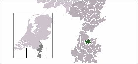

mapsize = 280px
subdivision_type = Country
subdivision_name = Netherlands
subdivision_type1 = Province
subdivision_name1 = Limburg
area_footnotes = (2006)
area_total_km2 = 24.13
area_land_km2 = 24.08
area_water_km2 = 0.05
population_as_of = 1 January, 2007
population_note = Source: CBS, [http://statline.cbs.nl/ Statline] .
settlement_type = Municipality
population_total = 13456
population_density_km2 = 559
timezone = CET
utc_offset = +1
timezone_DST = CEST
utc_offset_DST = +2

Schinnen (Pronunciation|157 Schinnen.ogg) is a municipality and a town in the southeastern part of the Netherlands. The U.S. Army has a post, United States Army Garrison Schinnen, in Schinnen.

Cities and towns

*Amstenrade
*Doenrade
*Oirsbeek
*Puth
*Schinnen
*Sweikhuizen

External links

* [http://www.schinnen.nl Official website] (in Dutch)
* [http://www.usagschinnen.eur.army.mil/sites/local/default.asp US Army Schinnen]


Wikimedia Foundation. 2010.

Игры ⚽ Нужен реферат?

Look at other dictionaries:

  • Schinnen — Héraldique …   Wikipédia en Français

  • Schinnen — (Pityriasis furfuracea capillitii), lose Schüppchen auf der Kopfhaut, aus dem eingetrockneten Talg der Talgdrüsen der Kopfhaut bestehend (s. Haarkrankheiten). Auch soviel wie Kleienflechte (s. d.) …   Meyers Großes Konversations-Lexikon

  • Schinnen — Schinnen, s. Schuppen …   Kleines Konversations-Lexikon

  • Schinnen — ↑ schinden …   Das Herkunftswörterbuch

  • Schinnen — Gemeinde Schinnen Flagge Wappen Provinz Limburg Bürgermeister …   Deutsch Wikipedia

  • Schinnen — Original name in latin Schinnen Name in other language State code NL Continent/City Europe/Amsterdam longitude 50.94333 latitude 5.88889 altitude 78 Population 2970 Date 2009 01 02 …   Cities with a population over 1000 database

  • Schinnen — Sp Schinenas Ap Schinnen L Nyderlandai …   Pasaulio vietovardžiai. Internetinė duomenų bazė

  • Gemeente Schinnen — Admin ASC 2 Code Orig. name Gemeente Schinnen Country and Admin Code NL.05.0962 NL …   World countries Adminstrative division ASC I-II

  • Amstenrade — 50°56′18″N 5°55′20″E / 50.93833, 5.92222 …   Wikipédia en Français

  • Oirsbeek — 50°56′56″N 5°54′32″E / 50.94889, 5.90889 …   Wikipédia en Français

Share the article and excerpts

Direct link
Do a right-click on the link above
and select “Copy Link”