- Sittard-Geleen
Infobox Settlement
official_name = Sittard-Geleen
mapsize = 280px
subdivision_type = Country
subdivision_name =Netherlands
subdivision_type1 = Province
subdivision_name1 = Limburg
area_footnotes = (2006)
area_total_km2 = 80.62
area_land_km2 = 79.09
area_water_km2 = 1.54
population_as_of =1 January ,2007
population_note = Source: CBS, [http://statline.cbs.nl/ Statline] .
settlement_type = Municipality
population_total = 96275
population_density_km2 = 1217
timezone = CET
utc_offset = +1
timezone_DST = CEST
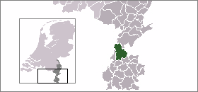
utc_offset_DST = +2Sittard-Geleen (Pronunciation|160 Sittard-Geleen.ogg) is a
municipality in the southeasternNetherlands . It was formed in 2001 from the former municipalitiesSittard ,Geleen and Born.The combined municipality has approximately 96,000 inhabitants (2007) and is thus the second most populated municipality in Limburg (after Maastricht with 125,000 inhabitants). Since the 2006 municipal elections, the city has been governed by a coalition of PvdA ("Labour"), GroenLinks ("Green") and the local party GOB.
To the west, Sittard-Geleen borders on
Belgium , while to the east, it borders onGermany .Population centres
Born,
Broeksittard ,Buchten ,Einighausen ,Geleen ,Graetheide ,Grevenbicht ,Guttecoven ,Holtum ,Limbricht ,Munstergeleen ,Windraak ,Obbicht ,Papenhoven ,Schipperskerk andSittard .External links
* [http://www.sittard-geleen.nl Official website]
* [http://www.webcamsittard.nl For a 24/7 view on the Markt in Sittard]

Wikimedia Foundation. 2010.