- Greilickville, Michigan
Infobox Settlement
official_name = Greilickville, Michigan
settlement_type = CDP
nickname =
motto =
imagesize =
image_caption =
image_
imagesize =
image_caption =
image_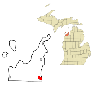
mapsize = 250px
map_caption = Location of Greilickville, Michigan
mapsize1 =
map_caption1 =subdivision_type = Country
subdivision_name =United States
subdivision_type1 = State
subdivision_name1 =Michigan
subdivision_type2 = County
subdivision_name2 = Leelanaugovernment_footnotes =
government_type =
leader_title =
leader_name =
leader_title1 =
leader_name1 =
established_title =
established_date =unit_pref = Imperial
area_footnotes =
area_magnitude =
area_total_km2 = 17.8
area_land_km2 = 11.7
area_water_km2 = 6.2
area_total_sq_mi = 6.9
area_land_sq_mi = 4.5
area_water_sq_mi = 2.4population_as_of = 2000
population_footnotes =
population_total = 1415
population_density_km2 = 121.4
population_density_sq_mi = 314.4timezone = Eastern (EST)
utc_offset = -5
timezone_DST = EDT
utc_offset_DST = -4
elevation_footnotes =
elevation_m = 178
elevation_ft = 584
latd = 44 |latm = 47 |lats = 43 |latNS = N
longd = 85 |longm = 38 |longs = 53 |longEW = Wpostal_code_type =
postal_code =
area_code =
blank_name = FIPS code
blank_info = 26-35300GR|2
blank1_name = GNIS feature ID
blank1_info = 0627411GR|3
website =
footnotes =Greilickville is an
unincorporated community in Leelanau County in theU.S. state ofMichigan . It is aCensus-designated place (CDP) used for statistical purposes and has no legal standing as amunicipality . The population was 1,415 at the 2000 census.The area is on
Grand Traverse Bay just north of Traverse City and is a part of that city's urban area. The Traverse City Harbor is located in Greilickville. The CDP includes a larger area extending further inland than the settlement concentrated on the waterfront.The area was first known as "Norristown", after Seth and Albert Norris who opened a
gristmill there in about 1853. In the mid-1850s,Bohemia n natives Godfrey Greilick and his sons built a small, water-poweredsawmill . Greilick's original name was Gottlieb Greulich and he escaped in 1842 furtively his hometownChrastava , because he owed there much money. The Greilick brothers built a steam-powered mill in a few years. Until its destruction by fire in about 1907, the mill was one of the most important on Grand Traverse Bay, cutting eight and one-half million feet of hardwood lumber in 1883. Other industries in the nineteenth century included a brickyard, brewery, and tannery. When theManistee and Northeastern Railroad entered town in 1892, the station was called "Greilicks" and the surrounding community also took this name. In 1961, when Greilickville's population was about 900, a special election was held in sections 28 and 33 of Elmwood Township, including Greilickville, to deceide a proposal regarding making those areas a home-rule village called Elmwood. The proposal was defeated by a vote of 238 to 88.Geography
According to the
United States Census Bureau , the community has a total area of 6.9square mile s (17.8km² ), of which, 4.5 square miles (11.7 km²) of it is land and 2.4 square miles (6.2 km²) of it (34.59%) is water.Demographics
As of the
census GR|2 of 2000, there were 1,415 people, 624 households, and 431 families residing in the community. Thepopulation density was 314.4 per square mile (121.4/km²). There were 677 housing units at an average density of 150.4/sq mi (58.1/km²). The racial makeup of the community was 97.95% White, 0.64% African American, 0.35% Native American, 0.07% Asian, 0.21% from other races, and 0.78% from two or more races. Hispanic or Latino of any race were 0.57% of the population.There were 624 households out of which 21.5% had children under the age of 18 living with them, 59.5% were married couples living together, 7.2% had a female householder with no husband present, and 30.8% were non-families. 25.3% of all households were made up of individuals and 12.8% had someone living alone who was 65 years of age or older. The average household size was 2.27 and the average family size was 2.67.
In the community the population was spread out with 18.2% under the age of 18, 4.8% from 18 to 24, 21.3% from 25 to 44, 31.0% from 45 to 64, and 24.7% who were 65 years of age or older. The median age was 48 years. For every 100 females there were 90.2 males. For every 100 females age 18 and over, there were 87.8 males.
The median income for a household in the community was $48,269, and the median income for a family was $51,250. Males had a median income of $45,938 versus $27,938 for females. The
per capita income for the community was $30,822. None of the families and 1.2% of the population were living below thepoverty line , including no under eighteens and 1.8% of those over 64.References
External links
* [http://www.michmarkers.com/startup.asp?startpage=L0214.htm Michigan Historical Marker]
Wikimedia Foundation. 2010.