- Nimule
-
Nimule Location in South Sudan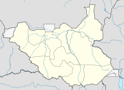
 Nimule
Coordinates: 03°36′00″N 32°03′36″E / 3.6°N 32.06°ECoordinates: 03°36′00″N 32°03′36″E / 3.6°N 32.06°E Country  South Sudan
State Eastern Equatoria Elevation 2,461 ft (750 m) Population (2006 Estimate) – Total 45,000 Nimule is a town in South Sudan, immediately north of the International border with Uganda.
Contents
Location
Nimule is located in Magwi County, Eastern Equatoria State, South Sudan, adjacent to the border with the Republic of Uganda. This location lies approximately 190 kilometres (120 mi), by road, southeast of Juba, the capital of South Sudan and the largest city in that country.[1] The coordinates of Nimule are:3° 36' 0.00"N, 32° 3' 36.00"E (Latitude:3.6000; Longitude:32.0600).
Population
The population of Nimule was estimated at about 45,000 in 2006. The current population is not publicly known.[2]
Transport
In 2007, there were new proposals for a rail link between Uganda and South Sudan passing through Nimule. The nearest towns in Uganda are Bibia and Atiak. Nimule is also served by Nimule Airport, which receives regular service from South Sudan's indigenous airline, Southern Sudan Airlines.[3]
Accidents
On 7 October 2006, a heavy truck with Ugandan registration UAD 720U from Uganda, carrying cement caused several spans on one of the two carriageways of the bridge to collapse into the river.[4] On Friday 17 June 2011, two Ugandan buses, one traveling to Juba, South Sudan to Nimule and the other traveling in the opposite direction, collided head-on, in Pajili Village, about 40 kilometres (25 mi), north of Nimule, killing at least twenty-eight (28) people and injuring at least sixty-five (65) others.[5] A joint investigation by the South Sudanese and Ugandan authorities, cited (a) Overloading (b) Speeding and (c) Driver fatigue as factors in the collision.[6]
Points of interest
The following points of interest are located in or near Nimule:
- The offces of Nimule Town Council
- Merin Hospital Nimule - A private, non-profit hospital, owned and operated by Merin, an NGO
- Nimule Airport - A public, civilian and military airport
- The International border between South Sudan and the Republic of Uganda
- The Gulu-Juba Highway - As of July 2011[update], the 320 kilometres (200 mi) highway is murram. Arrangements to convert the highway to bitumen surface are underway in both countries[7]
- Nimule National Park - The national park is located just outside of town, to the north and to the east.
- A branch of Equity Bank (South Sudan)[8]
External links
Maps
See also
- List of road accidents
- List of bridge failures
- Railway stations in Uganda
- Railway stations in Sudan
- Transport in Uganda
- Transport in Sudan
- Nimule Airport
- Eastern Equatoria
References
- ^ Map Showing Juba And Nimule With Distance Marker
- ^ Nimule Has Rapidly Growing Population
- ^ About Southern Sudan Airlines
- ^ Ugandan Truck Breaks Bridge In Nimule
- ^ Two Buses Collide In Nimule, Killing Dozens
- ^ Human Error Caused Bus Collision
- ^ The Tarmacking of the Gulu-Juba Highway Begins In 2011
- ^ Equity Bank Expands In South Sudan
Counties 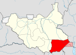
Principal towns Airports Torit · Kapoeta · NimuleRivers Mountains Communities Categories:- Populated places in South Sudan
- South Sudan–Uganda border crossings
- Eastern Equatoria


Wikimedia Foundation. 2010.