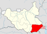
- Narus River, Kapoeta
-
The Narus River originates in the east of the Didinga Hills in Eastern Equatoria State, South Sudan. It flows eastward and discharges into the swampy area northeast of Narus. The river floods during the rainy season, but ceases to flow at other times. Gold has reportedly been panned in the river bed, probably washed down from the Didinga Hills.[1] During the rainy season, the river virtually cuts the town of Narus in two as the riverbed fills and sometimes floods. The small market area is also cut into two halfs, one on each side of the riverbed.[2]
References
- ^ "Geologic Survey of Kapoeta County: Report on the Reconnaissance Fieldwork in Kapoeta County". University of Missouri. July 2002. http://cafnr.missouri.edu/iap/sudan/doc/geo-survey.pdf. Retrieved 2011-07-22.
- ^ Lief Doerring et al. (June 2003). "Southern Sudan MICROENTERPRISE MARKET SURVEY". USAID. http://pdf.usaid.gov/pdf_docs/PNACT633.pdf. Retrieved 2011-07-22.
Counties 
Principal towns Airports Torit · Kapoeta · NimuleRivers Mountains Communities Categories:- Geography of Eastern Equatoria
- South Sudan geography stubs
Wikimedia Foundation. 2010.
