- Kinyeti
-
Kinyeti 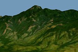
Elevation 3,187 m (10,456 ft) Prominence 2,120 m (6,955 ft) Listing Country high point
UltraLocation Location in South Sudan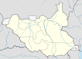
 Kinyeti
Location  South Sudan
Range Imatong Mountains Coordinates 3°56′51″N 32°54′32″E / 3.9475°N 32.90889°ECoordinates: 3°56′51″N 32°54′32″E / 3.9475°N 32.90889°E Mount Kinyeti is the highest peak in South Sudan. Located in the Imatong Mountains in Ikotos county of Eastern Equatoria state, near the Ugandan border, Kinyeti has an elevation of 3,187 metres (10,456 ft) above sea level.[1]. The group of high mountains that contain Kinyeti, extending to the border with Uganda, are sometimes called the Lomariti or Lolobai mountains.[2]
The lower parts of the mountain were covered with lush forest.[3] These are the most northern forests of the East African montane forest ecoregion.[4] The summit is rocky, with montane grassland and scattered, low ericaceous scrubs, low subshrub and herbs in rock crevices.[5] One of the first Europeans to visit the mountain was the botanist Thomas Ford Chipp, who discovered Coreopsis Chippii near the summit.[6]
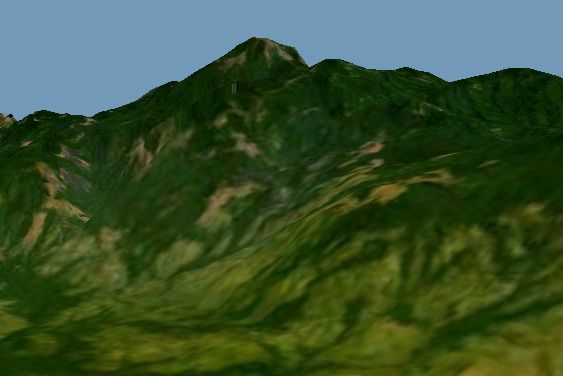
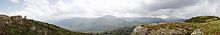 Panoramic image from the top of the mount
- ^ "Mount Kinyeti". Encyclopedia Britannica. http://www.britannica.com/EBchecked/topic/318949/Mount-Kinyeti. Retrieved 2011-07-06.
- ^ Kaj Vollesen (1998). Flora of the Sudan-Uganda border area east of the Nile, Part 1. Kgl. Danske Videnskabernes Selskab. p. 9. ISBN 8773042978. http://books.google.ca/books?id=PUa_cBHMB0IC&pg=PA9.
- ^ Paul Clammer (2005). "Sudan: the Bradt travel guide". Bradt Travel Guides. p. 5. ISBN 1841621145. http://books.google.ca/books?id=lvVao2vWnxUC&pg=PA5.
- ^ "East African montane forests (AT0108)". World Wildlife. http://www.worldwildlife.org/wildworld/profiles/terrestrial/at/at0108_full.html. Retrieved 2011-07-06.
- ^ Kaj Vollesen (2005). Flora of the Sudan-Uganda border area east of the Nile: Catalogue of vascular plants, 2nd part, vegetation and phytogeography, Part 2. Kgl. Danske Videnskabernes Selskab. ISBN 8773043184. http://books.google.ca/books?id=lD5sE7bjhskC&pg=PA406.
- ^ Earl Edward Sherff (20 October 1936). "Revision of the Genus Coreopsis". Field Museum of Natural History, Chicago. http://libsysdigi.library.uiuc.edu/OCA/Books2009-05/revisionofgenusfisher/revisionofgenusfisher.pdf.
Counties 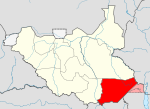
Principal towns Airports Torit · Kapoeta · NimuleRivers Mountains Communities Categories:- Mountains of South Sudan
- Geography of Eastern Equatoria
- South Sudan geography stubs


Wikimedia Foundation. 2010.