- Brownlee Park, Michigan
Infobox Settlement
official_name = Brownlee Park, Michigan
settlement_type = CDP
nickname =
motto =
imagesize =
image_caption =
image_
imagesize =
image_caption =
image_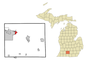
mapsize = 250px
map_caption = Location of Brownlee Park, Michigan
mapsize1 =
map_caption1 =subdivision_type = Country
subdivision_name =United States
subdivision_type1 = State
subdivision_name1 =Michigan
subdivision_type2 = County
subdivision_name2 = Calhoungovernment_footnotes =
government_type =
leader_title =
leader_name =
leader_title1 =
leader_name1 =
established_title =
established_date =unit_pref = Imperial
area_footnotes =area_magnitude =
area_total_km2 = 5.2
area_land_km2 = 5.2
area_water_km2 = 0.0
area_total_sq_mi = 2.0
area_land_sq_mi = 2.0
area_water_sq_mi = 0.0population_as_of = 2000
population_footnotes =
population_total = 2588
population_density_km2 = 501.0
population_density_sq_mi = 1297.7timezone = Eastern (EST)
utc_offset = -5
timezone_DST = EDT
utc_offset_DST = -4
elevation_footnotes =
elevation_m = 268
elevation_ft = 879
latd = 42 |latm = 19 |lats = 24 |latNS = N
longd = 85 |longm = 8 |longs = 23 |longEW = Wpostal_code_type =
postal_code =
area_code =
blank_name = FIPS code
blank_info = 26-11200GR|2
blank1_name = GNIS feature ID
blank1_info = 0622106GR|3
website =
footnotes =Brownlee Park is an
unincorporated community in Calhoun County,Michigan ,United States . It is aCensus-designated place (CDP) used for statistical purposes and is part of the Battle Creek,Michigan Metropolitan Statistical Area . The population was 2,588 at the 2000 census. The CDP is immediately east of the city of Battle Creek,Michigan and is considered to be a part of the city's urban area.The CDP includes both Brownlee Park and the adjacent
unincorporated community of Greenfield Park:
*Brownlee Park is within Emmett Charter Township, mostly east of Raymond Road and north of Michigan Avenue, at coord|42|19|08|N|85|08|33|W|. TheFIPS place code is 11200.
*Greenfield Park is mostly within Pennfield Charter Township, just north of Verona Road, centered on coord|42|20|06|N|85|08|14|W|. TheFIPS place code is 34880.Geography
According to the
United States Census Bureau , the CDP has a total area of 2.0square mile s (5.2km² ), of which, 2.0 square miles (5.2 km²) of it is land and 0.50% is water.Demographics
As of the
census GR|2 of 2000, there were 2,588 people, 1,027 households, and 659 families residing in the CDP. Thepopulation density was 1,297.7 per square mile (502.1/km²). There were 1,194 housing units at an average density of 598.7/sq mi (231.7/km²). The racial makeup of the CDP was 91.11% White, 2.70% Black or African American, 1.00% Native American, 0.66% Asian, 0.08% Pacific Islander, 1.51% from other races, and 2.94% from two or more races. Hispanic or Latino of any race were 4.21% of the population.There were 1,027 households out of which 32.3% had children under the age of 18 living with them, 39.5% were married couples living together, 19.8% had a female householder with no husband present, and 35.8% were non-families. 29.0% of all households were made up of individuals and 10.1% had someone living alone who was 65 years of age or older. The average household size was 2.50 and the average family size was 3.05.
In the CDP the population was spread out with 27.7% under the age of 18, 9.4% from 18 to 24, 31.4% from 25 to 44, 20.9% from 45 to 64, and 10.5% who were 65 years of age or older. The median age was 34 years. For every 100 females there were 90.4 males. For every 100 females age 18 and over, there were 87.7 males.
The median income for a household in the CDP was $26,694, and the median income for a family was $32,644. Males had a median income of $27,400 versus $20,813 for females. The
per capita income for the CDP was $17,026. About 16.0% of families and 19.0% of the population were below thepoverty line , including 30.3% of those under age 18 and 9.7% of those age 65 or over.References
Wikimedia Foundation. 2010.